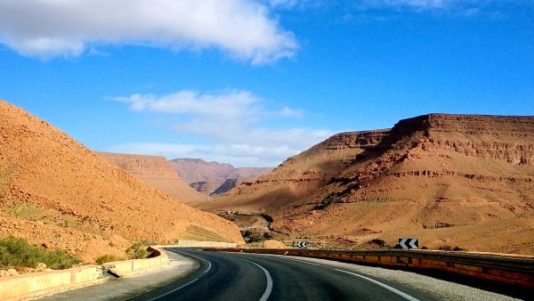
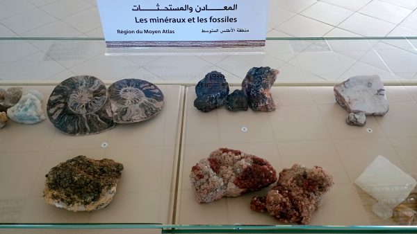
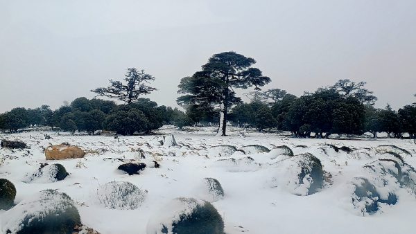
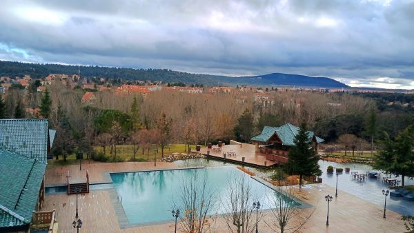
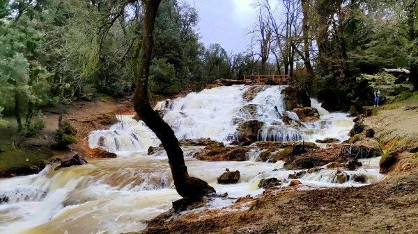
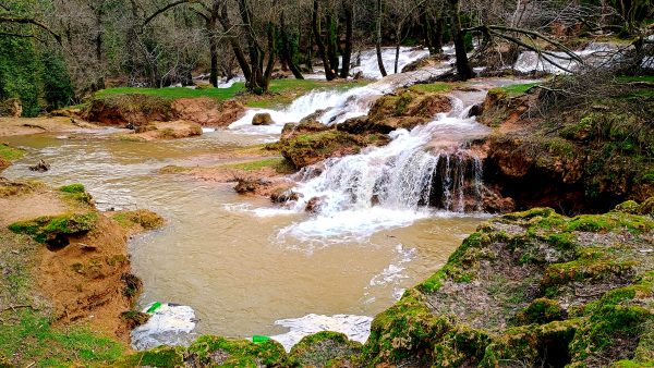
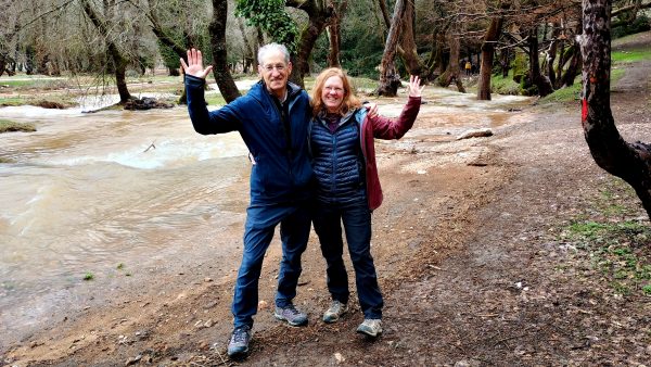
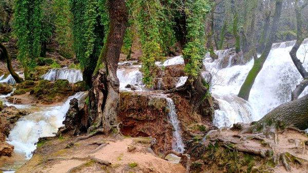
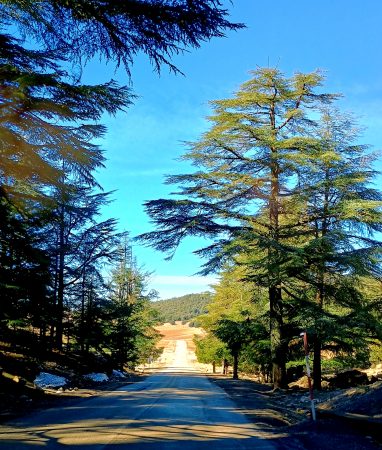
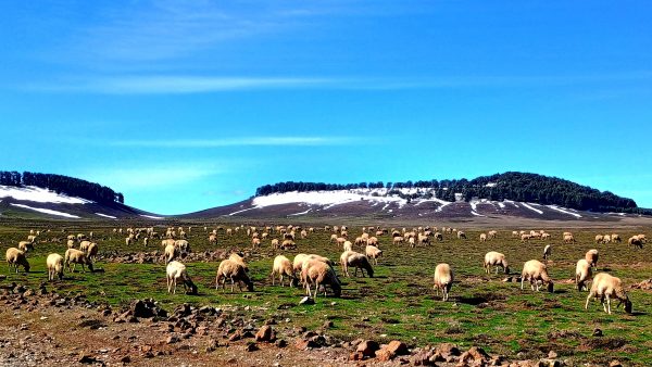
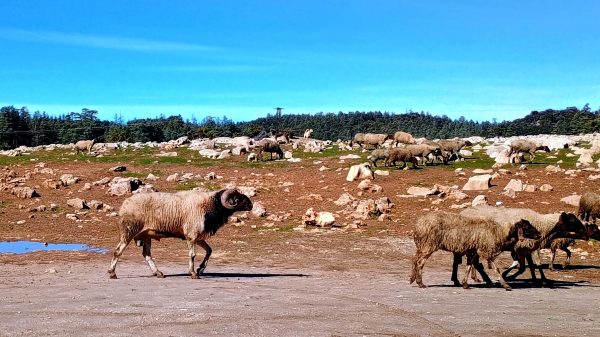
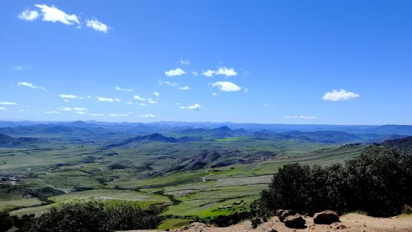
We leave the Sahara behind and head north through the breathtaking Ziz Gorge towards Fes. It brought to mind the canyons of the southwest USA.This southern area is very rich with fossils – we felt like we were driving through the Tucson Gem and Mineral show.And then there is snow in the Middle Atlas Mountains! Imagine in the past 7 hours we went from the Sahara, thru Morocco’s Grand Canyon and apple orchards, to the snow covered forest — what a diverse landscape.We had a rainy day in Ifrane but enjoyed a Resort lifestyle. This is dubbed the Switzerland of Morocco.Ifrane National Park with overflowing waterfalls — beautiful Cascades des ViergesThe waterfalls are all quite breathtaking.Next to the river, we met some locals and swap photo ops.Wow. The power of water! This side of the mountains seems to get a lot of moisture.Nearby towards Azrou, we head through Cedre Gouraud Forest NP. The cedar trees are very majestic.There were a lot of sheep — more than we have seen anywhere else — near Azrou & Cedre Gouraud Forest NP.Of course there is the proud papa Ram strutting with his flock.Outside Azrou, we were on the rim looking over mountains, valleys and fertile fields. We are definitively experiencing a more lush Morocco.
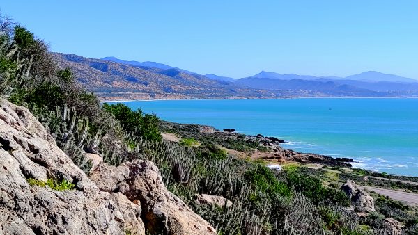
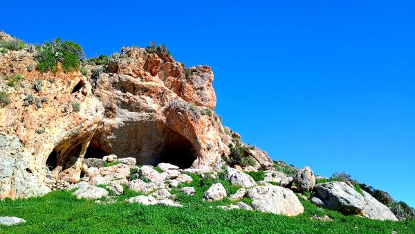
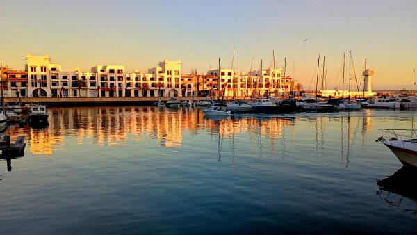
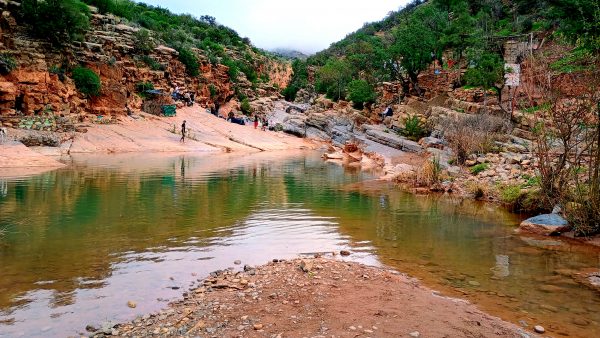
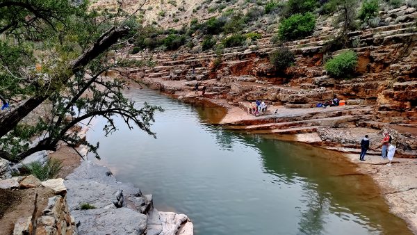
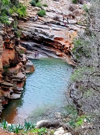
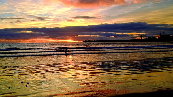
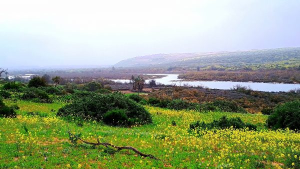
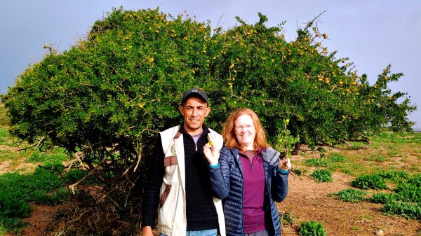
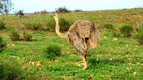
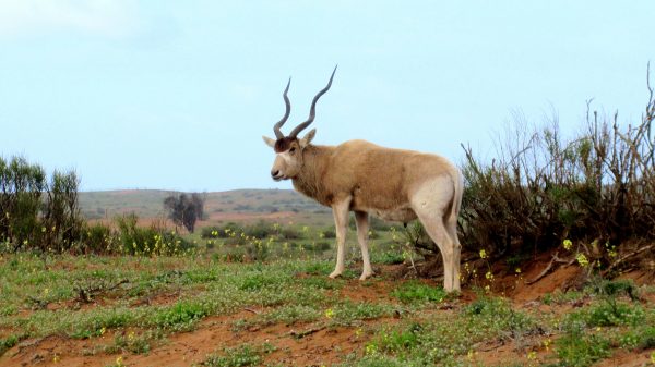
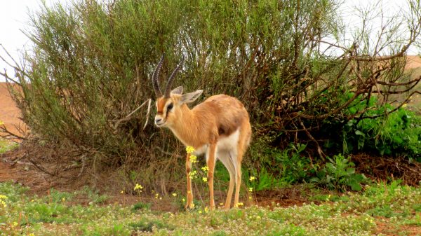
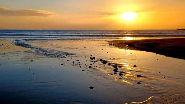
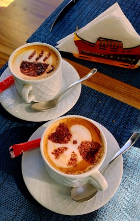
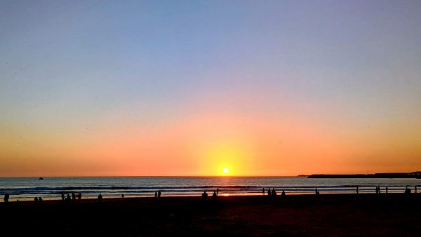
We followed the ‘101’ south along the west coast of Africa. Before arriving in Agadir we stopped to explore some Jurassic limestone caverns carved by the sea — Caves of Cape Ghir.There were a few petroglyphs visible — the Caves of Cape Ghir are known for the discovery of neolithic flint and other evidence of ancient people.We are staying in a condo at the marina in Agadir — excellent location, a pleasant harbor, good restaurants and a 3-mile long paved beach promenade, ‘The Corniche’.Paradise Valley was a day trip into the nearby foothills of the Atlas Mountains.Pink sandstone and sloped rocks make Paradise Valley a popular recreation area.It seems semester break starts today at the university so students are celebrating with a relaxing day in Paradise Valley!Swimming, diving, hollering — we are experiencing a local holiday. Paradise ValleyMeanwhile back to the long sandy beach of Agadir for another sunset on the Atlantic coast.Souss Massa National Park is very large and protects many local fauna and flora. It stretches along the coast from the Souss River valley in the north to the Massa River Valley in the south (picture – near Sidi Binzarne). Beautiful fields of wildflowers, flamingos and spoonbills in the river delta.Our NP guide, Mohammad, showed us the argan trees and how to harvest and crush the seeds for oil. In Souss Massa NP – Rokein StationHe also guided us around a driving loop where we saw numerous ostriches. This is a female and we saw her 5 offspring as well as the darker colored male. Souss Massa NP – Rokein Station.We saw several of this beautifully horned antelope species called Addax. This is a male with a dark patch of hair between his horns — females are light colored. Souss Massa NP – Rokein Station.The Dorcas Gazelle is small — more skittish. This is an endangered species that is protected but poachers are still a problem out side the park. Souss Massa NP – Rokein Station.…and yes we made it back to walk the beach in Agadir for another Sunset.We enjoyed Mama Caterina twice – a local Italian restaurant on the marina for……the gift of good coffee! also good food. Mama CaterinaShopping for souvenirs at the Carrefour – ha ha ha – very Moroccan!We joined many on the beach for our last night in Agadir. A very pleasant week here.
We venture higher in elevation on another blue sky day to enjoy this view of the Dolomites!We took a bus from Lajen to Ortisei, then we took a gondola and the Seceda cable car.Many people are enjoying this beautiful day. This is the Val Gardena valley, is part of the UNESCO world heritage site.The incredible view point at the summit shows all the alpine peaks we can see in the 360 degrees. It is a clear enough day that we could see Grossglockner in Austria as well as some of the tallest Swiss Alps.We shared photo taking before starting out on the Seceda Rim Hike.The rugged Seceda Geisler Gruppe – so picturesque with the snow.There was a bite to the wind but it made for some very photogenic opportunities.We drop into the valley from the top and there is less snow on the trail.Baita Troier Hütte: this Mountain hut is our lunch destination.It is situated in the National Park Puez Odles at an altitude of 2250 meters and it has a wonderful view to the surrounding Dolomites.A fabulous location to look over the valley and enjoy some Italian spirits.Lunch of fried potatoes, Tyrolean bacon, with fried eggs – very satisfying mountain hiking food!Well signed hiking routes to get us back to the cable car. Signs are labeled in minutes not distance. The next sign generally has the same time to the destination which we found very amusing.Maybe we should take another break at the Daniel Hütte?An incredible day visiting Seceda – a special place in the Alps!
We have driven the Grossglockner Alpine Road to the Edelweisspitz Overlook. Take My Breath Away! The view! But the road will make your heart beat also as you can see…The far barely visible peak is the highest Grossglockner – which we are seeing now from the east. What clear visibility!The Edelweisspitz Overlook has a 360 degree view. We could even see the Berchtesgaden peaks – we are only about 40 km from where we first stayed in Anger, Germany.This is a compiled panorama photo of Hohe Tauern NP Grossglockner Peak from the Alpine Road Edelweisspitz Overlook. What a VIEW!The Edelweiss Hütte had a very good apple strudel which we enjoyed with cappuccinos. Because who would not want to linger to enjoy this view? We feel like eagles, not marmots, but thought this carving was quite cute.Another stop along the Alpine Road is Kaiser Franz Josefs Visitor Center with this view of the Pasterze Glacier, the largest glacier in the Eastern Alps, which has melted in the last 20 years to leave this lake.Grossglockner peak is reflected in the lake, before the clouds claim it again.Enjoying the view with Kaiser Franz Josef, who was here with his wife Elizabeth (Sisi) in 1856. He loved this area and as it is when you are emperor, it was preserved for all of us to enjoy. Thank – you, Austria!
We headed up the nearby valley to Kals/Berg for a full day of hiking in the Hohe-Tauern-National Park.We are going to hike the Kodnitztal towards Grossglockner – that magnificent peak in the background, which is the highest in Austria- 3.798 meters.There is fresh snow on the peaks! It is so beautiful and we feel so lucky to be enjoying such fabulous views!The clouds are moving in so this might be our last view of Grossglockner – but we are sure there is much to enjoy here.These are the big five wildlife that live here – maybe we will be lucky to see some natives: golden eagle, chamois, marmot, ibex, bearded vulture.After a little over an hour hike up and up, we arrive at Lucknerhütte. Cappuccinos and apple strudels with vanilla sauce were enjoyed by us on this outdoor deck. We could get used to this kind of hiking amenity.We continued further up the trail to enjoy the autumn splendor.We crossed the stream several times.We saw quite a few marmots, busily eating to prepare for winter. They are very fast, a bit shy, and scurry amongst the boulders. But this one was so busy eating he could not be bothered with a photographer.The geography and rock outcroppings were really accentuated with the early snowfall.We especially enjoyed this rock face that kept us company.Would you look at that?!!!!This is a view back at the valley and the 3,050 foot elevation we have gained hiking up. Wow. Very glad we still have it in us to do this hike!The mountains and clouds have played hide and seek but we end our 5 hour, six+ mile hike with full satisfaction. An immensely enjoyable day.We have good memories of visiting Grossglockner! FABULOUS!!!
Our mountain view apartment in Matrei was very spacious, had nice views of the town in the Isel river valley, including from our balcony.We enjoyed walking the town and visiting the Hohe Tauern National Park museum.One of the walks we did on our no-drive day was above the apartment to enjoy the entire valley of Matrei.The Isel is the longest free flowing glacial river in the entire Alps!Upstream we walked into Hohe Tauern NP to hike the NaturKraftWeg Umbalfälle .The hiking path follows this exuberant water to the glacial source but we only followed it for an hour or so from the end of the road.This is a tributary with a nice bridge near the confluence with the Isel.We enjoyed the wildness of the river, the carved rocks, and the vegetation. This is the Umbalfälle, the Umbal falls.And what do you know – there is a hütte with some hot soup for us! Goulash stew and Tyrolean Knodel Soup, which is a bread dumpling ball of goodness.
Triglav National Park is the only national park in Slovenia. It is one of Europe’s oldest parks, with the first protection dating back to 1924.It is named after Triglav, which rises the highest (2864 m) in the heart of the park and is also Slovenia’s highest peak.We are thrilled to have such a beautiful day to explore this eastern part of the Julian Alps!There are 50 numbered turns – 26 up and 24 down…depending on which direction your traveling.On our way up we stopped at this Russian War Memorial, remembering those that died here in WWI.A few more turns, we found a place for cappuccino and pastry with an incredible view! Life is good……View in the other direction. Spectacular.At the summit of Vršič Pass, elevation of 5,285 ft – a mile high!We did a short hike to get up to this incredible view point.360 degrees of rock. The Alps were formed by the African Tectonic Plate crashing into the Eurasian, dramatically uplifting, then carved by glaciers.After a visit to the very interesting Alpine Botanic Gardens, the informative National Park Visitor Museum, we reached the mesmerizing emerald green waters of Soča River.Teal Water! For those Ernest Hemingway fans, this is where he was driving the ambulance during WWI, and written about in his “Farewell to Arms”. In case you want to read more of the gruesome WWI battle of the area.This area is peaceful and tranquil now. We enjoyed our day exploring.
Prehistoric Pile Dwellings were found along Mondesee (on our drive between Salzburg and Vienna) as well as in many other locations around the Alps – a combined UNESCO World Heritage Site.This culture dates from 5000 to 500 BC.Well preserved pottery that reminded us of Mesa Verde – only this is much much older! We enjoyed our stop at Mondesee MuseumThis exhibit show how they document these archeology sites. The dwellings were built along lake shores but most are under water now, which has preserved the remains well.A video hows how difficult the documentation is. Thank you to all that are working to preserve this ancient culture. If you want to find out more, check out palafittes.org