8/8: Mojave to Vermillion Cliffs

We are getting our kicks on Route 66!
We parked for the night at BLM’s Amboy Crater and hiked to the caldera in the morning. The other side of those mountains is Twenty Nine Palms, where my Dad was stationed when he brought his young bride to California on Rt 66.
We are headed to these mountains across the train tracks into the Mojave National Preserve.
We found a nice site at Hole In the Wall campground. Is there a hole in the wall to continue our hike?
Really is there a hole in the wall?
Well what do you know. Jungle Gym rings to pull yourself up the slot.
Gorgeous cactus and vistas along the trail.
Beauty in the details.
We motored through Las Vegas and followed the Virgin River into the Gold Buttes National Monument established in 2016. Another new monument on BLM land!
We enjoyed the sunset and solitude. We will have to come back to explore more of this park.
Marble Canyon area on east side of Vermillion Cliffs National Monument. We stopped at Grand Staircase Escalante Visitor Center and received a wealth of information to keep us busy for several weeks. Providing of course the monument doesn’t shrink again.
We drove through some Vermilion Cliffs to Lees Ferry. Many changes have come this way with paved roads, pullouts, parking lots, and dedicated campground.
Channeling Wesley Powell: A fabulous day on the Colorado River! This is part of the Grand Canyon National Park and where rafting trips to the canyon begin.
This is another release site for California condors – we were lucky to see a pair fly over the canyon.
We looked through a sun telescope as there were some astronomers holding a special event. The Navajo Bridge leads you to Glen Canyon Recreation Area. We have come full circle on our trip.

7/8: Pinnacles NP

Pinnacles was established as a National Monument by Teddy in 1908 but upgraded to a National Park in 2013. So until another is upgraded, we have now visited  all western mainland US National Parks.
We snagged a camp site with electricity for four nights so we could relax and enjoy several days of hiking.
There are some unique stairways carved into the stone on several trails.
And caves created by falling boulders.
California Condors are released here. We talked to a scientist who tracks them with radio collars like the wolves in Yellowstone. He confirmed the three we had seen overhead were condor sightings!
There are also specially marked trails for rock climbers.
Interesting rock formations up close and personal.
One trail took us to this peaceful reservoir.
with some calm water reflections.
another stairway – actually gets you to the top pretty fast!
And what a view!
So we can find a spot for our lunch break and contemplate the path back to camp.
Heading South, we spent the next night at Carrizo Plain National Monument in the Central Valley. We had the parking lot to ourselves and enjoyed the quietness of the plains.
This was our view of sunset. A big change from crowded Pinnacles campground: Someone at Pinnacles “borrowed” our leveling blocks for 3 nights but luckily they returned them before we left. Can you imagine that lack of courtesy to your fellow camper?
This is the beautiful white alkali flats of Soda Lake – there is a neat boardwalk to take for a closer look. This is another landlocked Basin surrounded by Range.
Another new monument in 2012, Cesar E Chavez National Monument in the California Central Valley was created from his home to recognize the importance of his contribution to the hard working farmworkers. Yes, we can! This is his grave site and memorial garden with water features commemorating the 5 martyrs killed during the protests.

6/8: Golden Gate to Monterrey

We left our cozy camp before dawn to minimize morning rush hour. We were parked in Presidio of San Francisco at 7:30.

We took a shuttle bus to the beginning of the bridge. This was easier than trying to park in this area.

Such a beautiful sight to see! We walked on bridge to first pier on this perfect morning.

We walked the coast of the Golden Gate National Recreation Area. We visited the new National Park Presidio Visitor Center. An enjoyable morning.

We walked to the marina and then by the Palace of Fine Arts on our way back to the Travato.

We drove to Golden Gate City park and were lucky to find near by street parking at 12:10 because it had been closed for street cleaning until noon. There was a marching band competition in the park so a lively time to visit. We wandered into the Japanese Tea Garden for a break.

This is oldest Japanese tea garden in the United States, built in 1894. And is only 3.5 acres but extremely well designed and maintained.

Here is another unique gate at the top of the garden.

There is also a 5 tier pagoda that is over 100 years old.

Nice vignettes of quiet spaces. This white rock is raked with large waves with some islands of green.

The next day we visited two National Historic Sites.We had spent the morning in Richmond, CA at Rosie the Riveter World War II Homefront Visitor Center which is a great museum with well documented films. In Martinez, CA we toured John Muir’s home and contemplated his amazing legacy

His desk has been preserved as when he was using it to write so prolifically. The national park system considers him the father of our incredible parks – how wonderful to have someone so focused on conserving these lands for all generations.

The Travato now thinks it is a sports car since it has done all those twisties on Highway One. It drove us to Laguna Seca Raceway where we had a great camp site on Turn 5. It is all Recreation.

There was a Superbike motorcycle school going on for us to spectate. We drove down to the pits to get front row action.

We raced (just kidding) to Monterrey Bay to enjoy the seaside. We walked Cannery Row to hang out with John Steinbeck and friends.

We enjoyed watching the pelicans, cormorants, seals and kayakers.

Really there is such a sign?

5/8: Pacific Coast

Wahoo! We are back to the pacific Coast! First time in the Travato. The drive over those last foothills is pretty unreal. Note to selves: if navigator says 37 miles is going to take over an hour then turnaround and find another route!

This public land was added to the California Coastal National Monument in 2014 which gave us great access to the ocean.

We enjoyed several hours of beach combing and listening to the waves. A nice wide sandy beach north of the historic lighthouse.

The Point Arenas Lighthouse is the closest point to Hawaii from the mainland, or so they claim.

We enjoyed the waves crashing on the rocky coastline south of the lighthouse. There were also harbor seals sunning themselves.

We parked overnight inland at the Garcia River Casino. We had great burgers at The River Grill and appreciated their hospitality.

Fort Ross National Historic Landmark and California State Park is on the coast south along the winding twisting Highway 1. The Travato is not a sports car!

The Russians built this fort to provide food and supplies to Sitka, Alaska. Many native Alaskans also lived here.

We especially enjoyed seeing this old kayaks. Aren’t they sleek? Many buildings were open with exhibits.

It was situated on the coast for their ships to dock. The Russians also built first windmill here as well as hunted otters.

We were able to enjoy some more ocean time and sunshine.

Sonoma County Regional Park, Doran Beach Cove Campground on Bodega Bay was a perfect location for 3 nights. We camped next to a 2020 Travato so was fun to “be the experts” and to also see what were the new features.

There is a nice long beach to walk. And a secret passage through the rocks behind me.

That lead to this wonderful beach. But watch your tide table as the secret passage is only accessible at low tide.

There was also a harbor and wetlands area on the peninsula so we saw a variety of wildlife, including this sea otter. We were ready for an attack of the Birds of Bodega Bay…ala Tippi Hedren

We drove to the end of the peninsula picnic area for a sunset dinner. We then went for a full moon stroll to enjoy our last night on the coast.

4/8: Yosemite

Yosemite! First day begins with hike to Dog Lake. Suprisingly we had not been to this lake near Tuolumne Meadows.

We enjoyed the reflections in the still morning water.

And enjoying some sunshine.

After lingering, we headed to nearby Lembert Dome as part of our day hike.

Tuolumne river and Meadows view from top of Lembert Dome.

We finished the hike with a bit of the John Muir trail for some solitude.

The next day we went for the Cathedral Lakes, a trail to views we had especially enjoyed 10 years ago.

The lower lake had beautiful meadows.

And a nice spot to enjoy the lower lake among the mountains.

At the upper lake we were able to walk around the entire perimeter to enjoy the peak from many angles.

We felt really good to do this almost 10-mile hike with over 2,000 foot elevation gain!

We drove to Lake Tahoe after our Cathedral Lake hike – that was a difficult drive with a lot of mountain climbing. We luckily arrived before dark but were tired puppies.

Watson Lake above Lake Tahoe had this incredible dispersed site where we could walk to the Lake Tahoe overlook.

We appreciated the beauty of this lake. Nice there are such accessible places outside of our national parks.

Berryessa Snow Mountain National Monument became a monument in 2015 from both Forest Service and BLM land.

We sustained high winds that night. Little did we know that power was out across this area of California – the first of many of the PG&E shutdowns to prevent fires.

3/8: Eastern Sierras

Hiking Methuselah Trail in the Schulman Grove of the Ancient Bristlecone Pine Forest in California.

Located in protected area, high in the White Mountains, part of Inyo National Forest.

Same species of bristlecone pines as we just saw in Great Basin National Park in Nevada, the oldest discovered living trees in the world.

To further the story of the oldest trees on earth, read about Dr Shulman and the Methuselah tree.

We found a beautiful forested area to camp outside of Mammoth Lakes to explore that region of the Eastern Sierras.

We hiked a bit of the Ansel Adams Wilderness in Reds Meadow Valley, in Devil’s Postpile National Monument.

101 foot Rainbow Falls on the San Joaquin River was a nice destination. We did see a little bit of rainbow in the mist.

We enjoyed a lunch break on the wonderful rocks. This photo was taken on a bridge that is on the Pacific Crest Trail.

A unique natural artistic display of pine cones.

Devils Postpile National Monument 60 foot high columnar basalt – made from volcanic lava many years ago.

These were then worn down by glaciers creating a very interesting patio type area of the hexagonal tops.

This gives a sense of the scale. Read more about this interesting geology.

On the road again, laughing…

Mono Basin National Forest Scenic Area

Is it a gorgeous day or is it a gorgeous day?! It brought out the Ansel Adams in both of us. This could be the best shot…

Or is this the best photo?

There are a type of sand flies that breed here. We learned they were a source of protein for native cultures.

Keep safe! A fisherman on the river across from where we camped slipped on a wet rock. Several of us campers and his son lend aid until the professionals arrived. It reminded us all to be careful out there.

San Diego

We had a very nice evening in Poway where my uncle Ken fixed a great salmon meal while Hilary sat on the patio entertaining us. My cousins Kevin and Sheri joined us for dinner making it a very memorable evening. In the morning, we went on Ken’s daily walk around the neighborhood, as he pointed out the various landscape projects he was coordinating. Good visit –

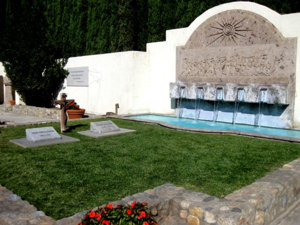
Henry scheduled us for the noon architectural tour of the Salk Institute (Jonas Salk was the discover of the Polio Vaccine). We were lucky to be a bit early as the parking was chaotic, there being the Torrey Pines golf tournament with Tiger Woods playing that morning. But Louis Kahn‘s building has held up well and we enjoyed the leisure time to look at the details. Yet another beautiful January day.

Plaza of the Salk Institute looking towards the Pacific

Salk Institute research offices from cafe

It is only a three story building but there is a floor between each usable floor that is for building systems, so Louis designed the first floor to be garden level. The stairwells have a public viewing, informal meeting area between each of the scientist offices allowing all to have access to the sweeping views of the Pacific.

Looking out stairway across plaza of Salk Institute

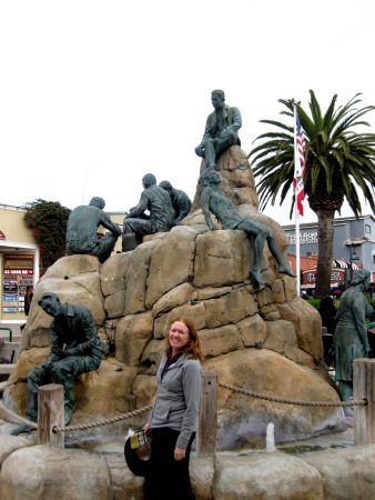
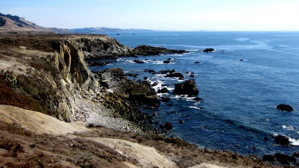
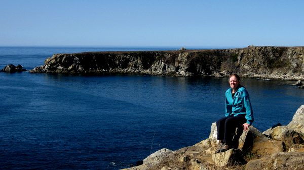
We spent the next day with my aunt Annie, exploring Cabrillo National Monument among other locals. She also took us to the harbor at night to see the large sculpture and the aircraft carrier. Casey joined us for many meals and after 20 years, it was nice to be reacquainted. Thanks to both for another nice visit.

Low Tide at Cabrillo National Monument

A Beautiful Sea Star in the tidal pool

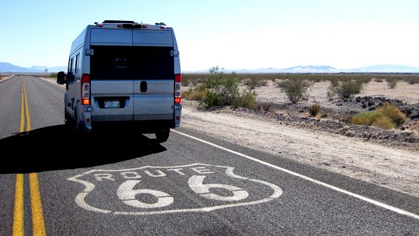
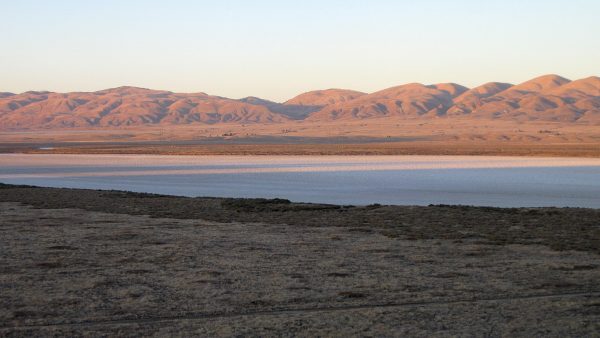
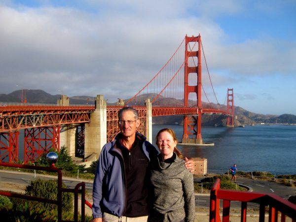
Guess it is time for us to say good bye to California…thanks for the memories!

The Spanish Market in Balboa Park

Oceanside, CA and the Pacific

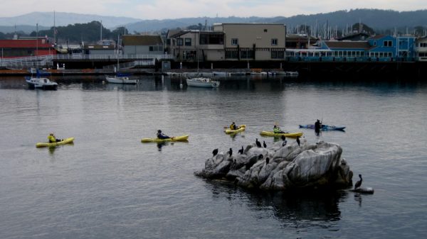
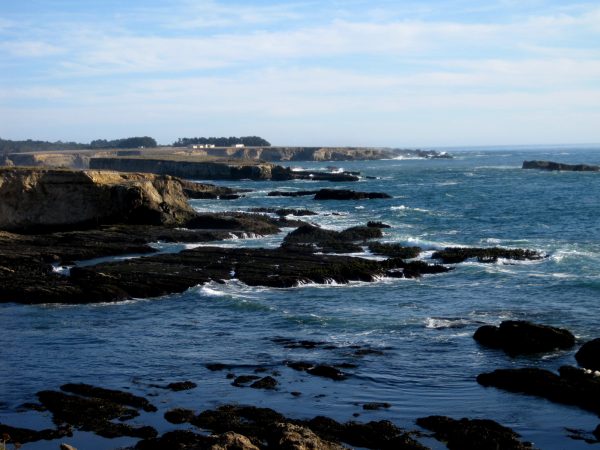
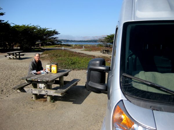
An early dinner at the marina, sitting al fresco enjoying the variety of boats and watching the gulls eying our grilled fish. A stroll along the boardwalk over to the ocean to watch the sun melt into the water. The surfers were taking their last ride and wandering away from the waves. The magic of the Pacific and the California Coast.

January sunset on the Pacific in Oceanside

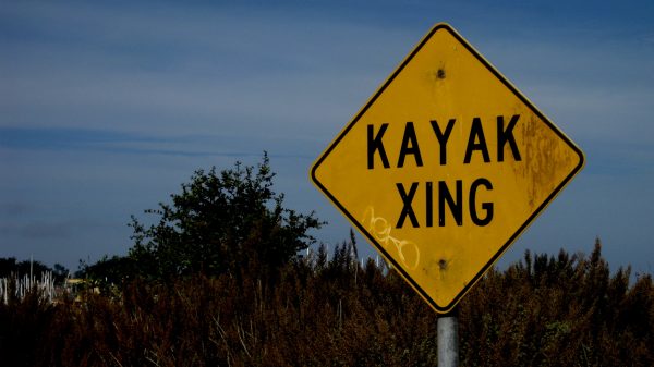
We walked the pier at night and again in the morning.  We captured this fun artistic shot of the morning shadows…

Morning stroll on Oceanside Pier

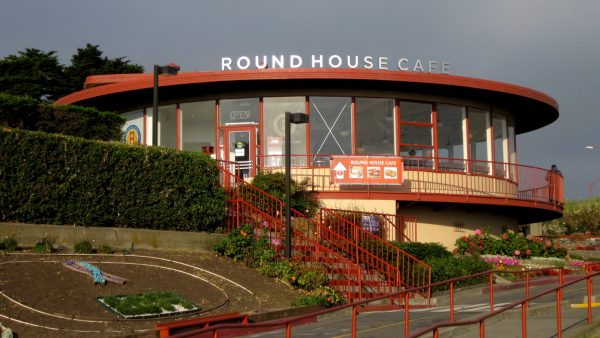
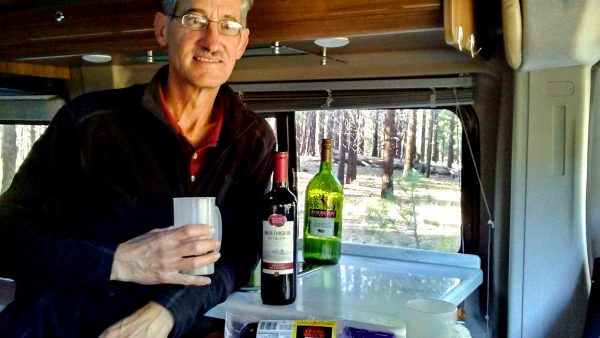
What better way to enjoy your morning java!

The Pacific at Oceanside Pier