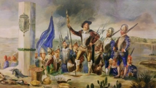
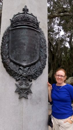
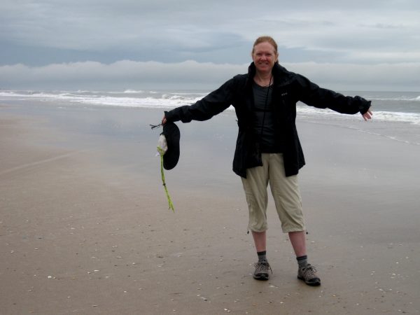
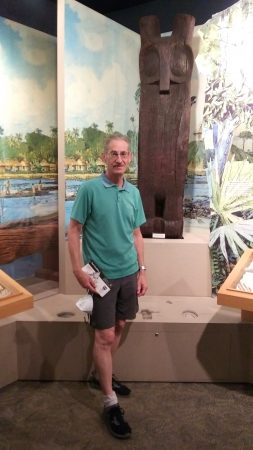
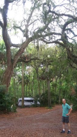
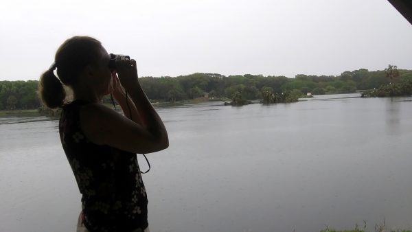
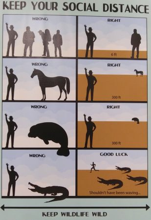
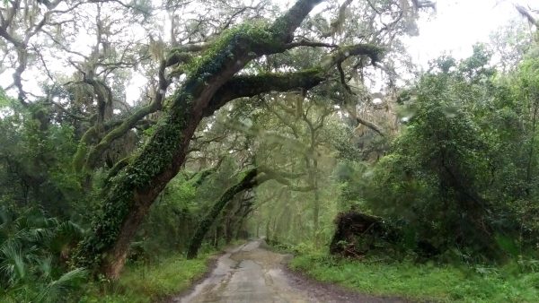
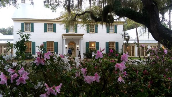
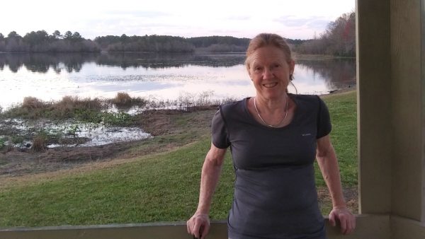
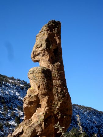
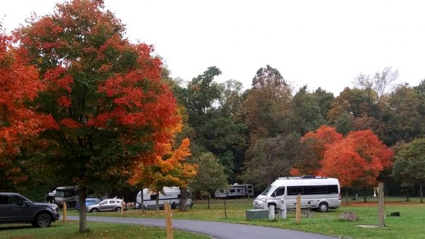
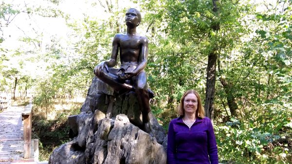
The Ribault Monument commemorates the 1562 landing of Jean Ribault. France’s first attempt to stake a permanent claim in North America was at La Caroline, a settlement near the mouth of the St. Johns River in Florida (North of Jacksonville)Que bon! Ribault erected a stone column bearing the coats of arms of his French King Charles IX to claim Florida for France. There is much history to Fort Caroline National Memorial.The Atlantic Ocean ~ an early morning walk before a rainy day.This pine carved owl totem, preserved from around 1400 at Timucuan Ecological and Historic Preserve, is the largest wooden effigy recovered from an archaeological site in North or South America.We had a great campsite where the Live Oak trees dwarfed the van.The camp ground had wonderful bird viewing pavilion.Luckily we didn’t spot any crocs or alligators! But we kept our distance from the wild humans.Beautiful drive in the Timucuan Preserve and its maritime hammock.Azaleas blooming in front the Ribault Club, built in 1928, a renovated monument to the resort era on Fort George Island.We spent the day enjoying the Atlantic Coast and barrier islands, driving through Amelia Island before ending at Crooked River SP in Georgia.
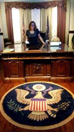
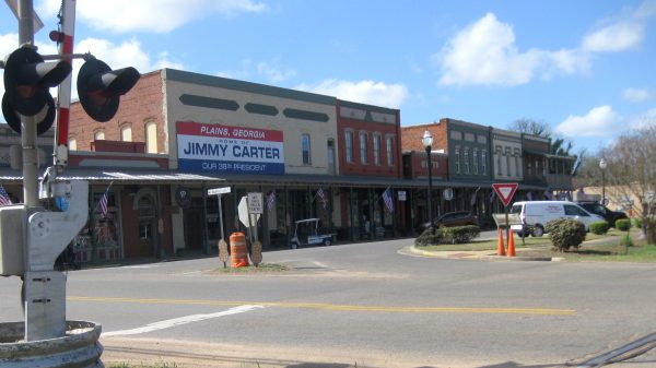
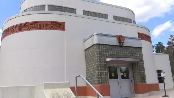
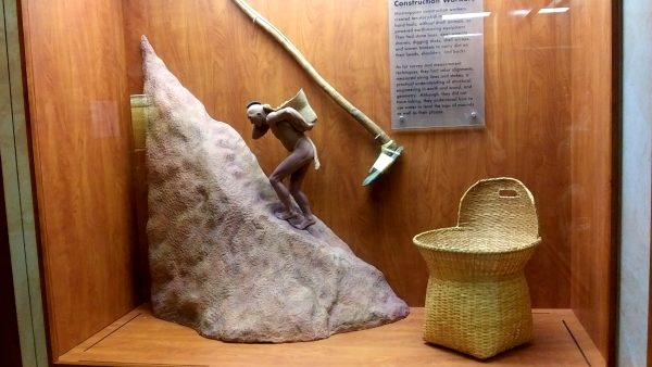
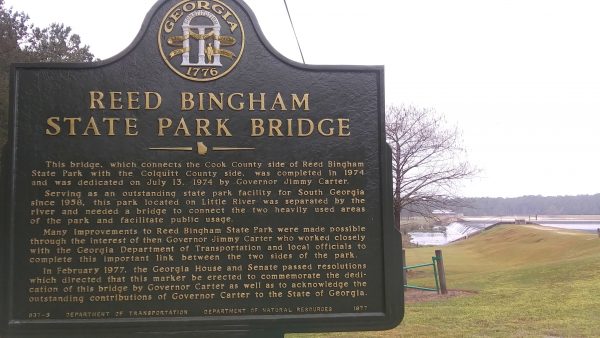
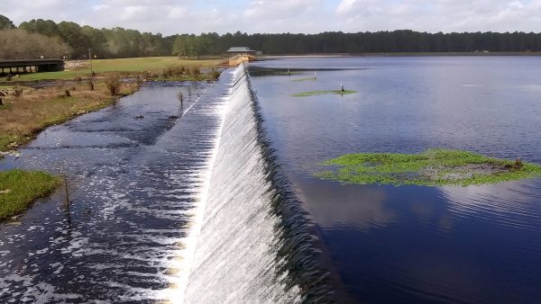
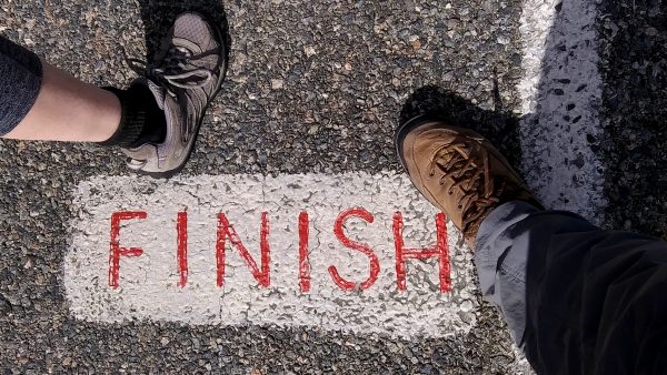
Madam President. A replica of Carter’s oval office in Plains Georgia.1976 was our first presidential election to vote in. We enjoyed the high school museum in President Carter’s hometown.Ocmulgee National Monument in Macon has the only Art Deco visitor center in the National Park Service. These mounds here were excavated by the Smithsonian in the 1930’s.This exhibit demonstrated how much work it was to build the mounds. The baskets when filled with mud weighed about 60 pounds.Governor Jimmy Carter was involved with developing this State Park.A variety of wildlife to see including herons, overwintering vultures, and common moorhens.We stayed 2 nights so had plenty of time to walk the trails.And to stretch our muscles a bit from all the driving!2,836 miles completed to Florida!
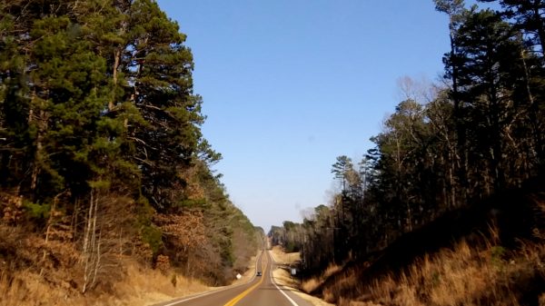
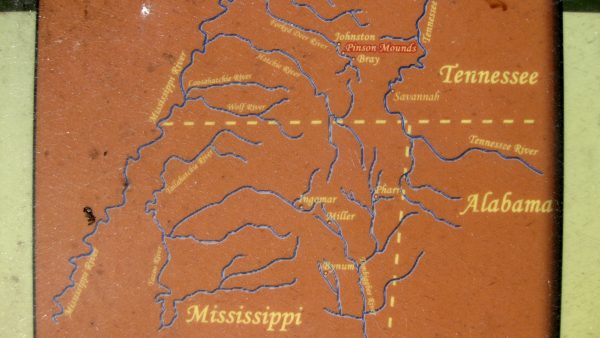
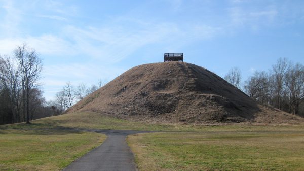
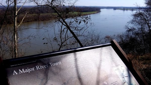
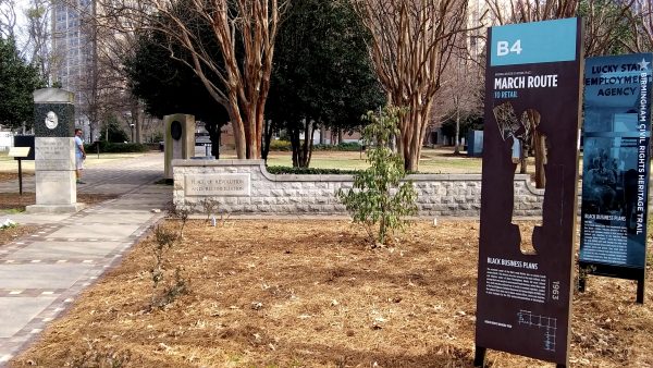
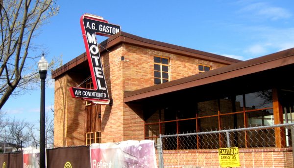
We crossed the Mississippi at Memphis. Through the hills of Tennessee…Chickasaw State Park had this great lakeside campsite for us to relax.We found some mound builders! Many tributaries to the Mississippi have mounds.Pinson Mounds State Park had a great museum as well. One of the tallest mounds.At Shiloh National Military Battlefield there was also a trail to the Tennessee River with Indian Mounds.Enjoying sunset at Whitten Corp of Engineer Campground.Birmingham, Alabama Civil Rights Park was worth contemplating.The historic A.G. Gaston motel is being renovated.We visited Tuskegee University as well as the airfield which had a great museum. We spent the night in Opaleka, Alabama – a pleasant county park.
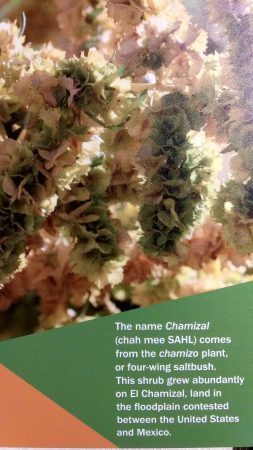
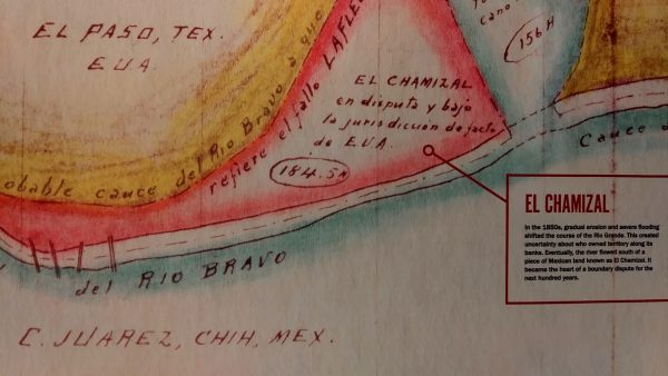
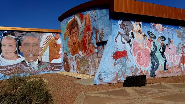
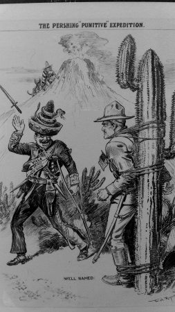
In El Paso, Texas we visited Chamizal National Memorial and learned some US-Mexican History.We have a chamizo in our yard! We planted a four-wing saltbush.Presidents Kennedy and Johnson finally made this land border official with the new river route.It is now a cultural center as well with this wonderful mural on the building.We camped 4 nights at Poncho Villa State Park and learned a bit more of border history.The train ran though Columbus, New Mexico (3 miles north of Mexico) – a pleasant small town.Well that’s all folks for close to the border!
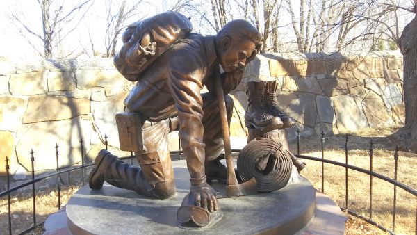
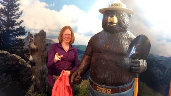
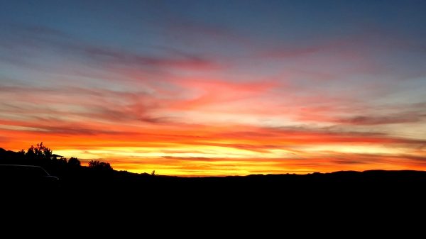
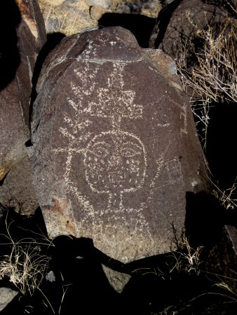
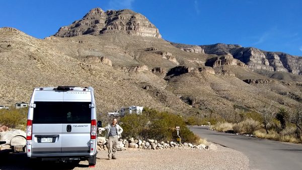
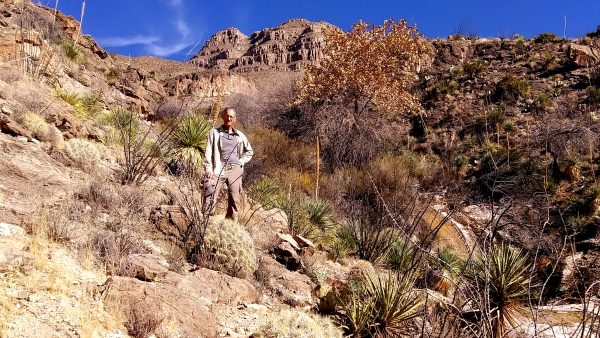
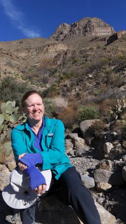
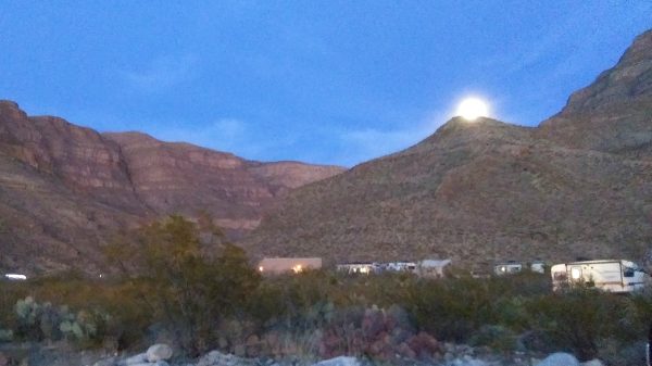
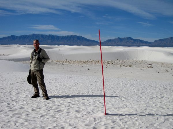
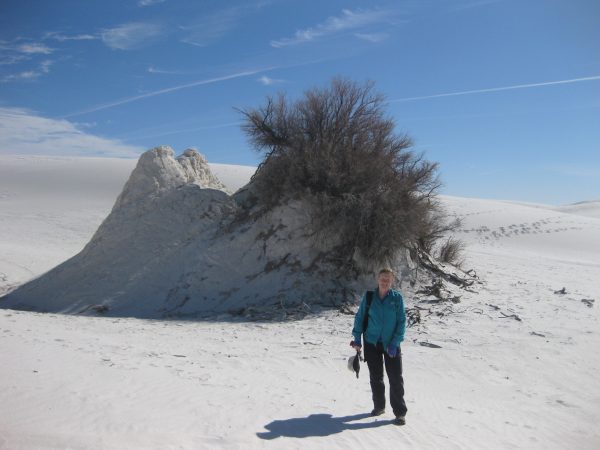
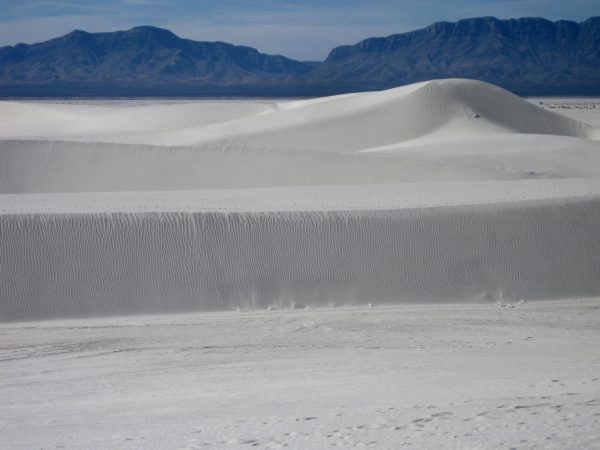
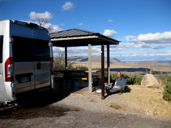
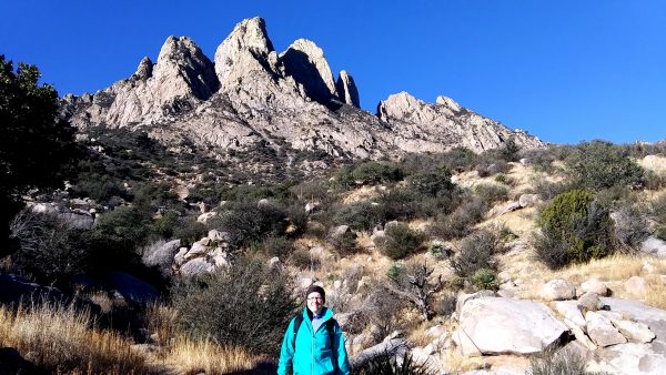
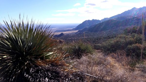
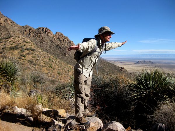
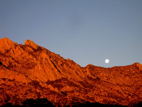
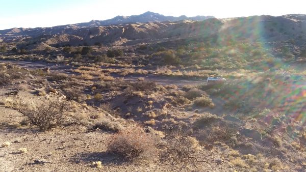
Valley of Fires BLM for 4 nights with full electric – such a nice area to camp.Enjoying our wine o’clock outdoors on 12 January – beautiful day.Travato has 48,000 miles of fun – and a great pullout to commemorate.The Smokey Bear Historical Site has added this tribute to firefighters since we were last here in Capitan in 2016 when the Travato had less than 10,000 miles.Only YOU can prevent forest fires.We walked around Ft Stanton NHS before an Oso Good Chili Burger & Chicken fried steak at Oso Grille in Capitan.Memorable end to a great day trip before heading to Three Rivers Petroglyphs BLM.Two nights with electrical here with very pleasant walks among these petroglyphs.Oliver Lee State Park, Site 19, was one of 2 sites not reserved. We had to go online to reserve after we got there and only available for one night but was worthwhile.We only did a short hike but beautiful cactus and other desert landscape.Our destination was a small pool that creates a waterfall after rains.Almost full moon rise with a beautiful sunset – right from our campsite.White Sands National Park hike to Alkaline Flats, marked with these poles.Interesting wind patterns create an oasis with vegetation.So many interesting sand/wind formations.We were able to get our Site #1 at Aguirre Campground in Organ Mountains National Monument – BLM.Getting ready to hike Baylor Pass somewhere behind me.Looking across to Pine Tree Loop which we will hike tomorrow.Testing aerodynamics against the wind.The full moon setting at sunrise. This is not photo-shopped – it is really what we experienced.
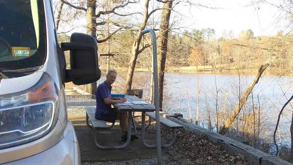
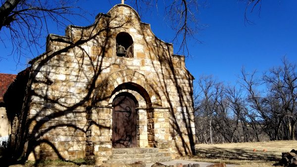
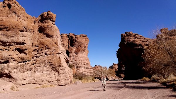
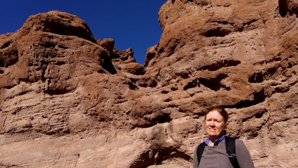
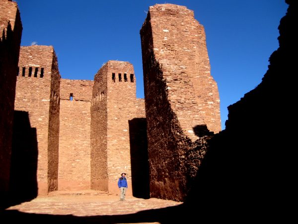
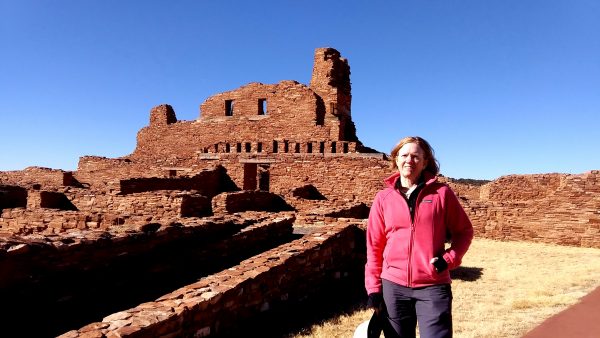
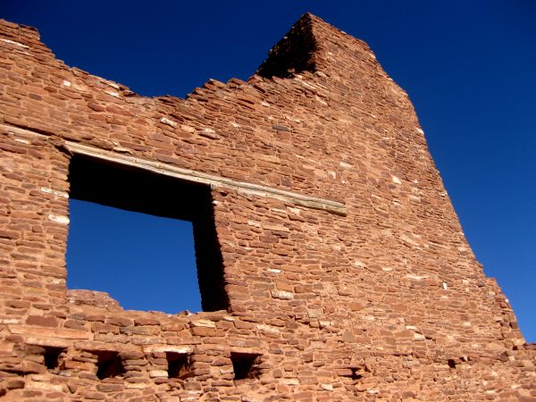
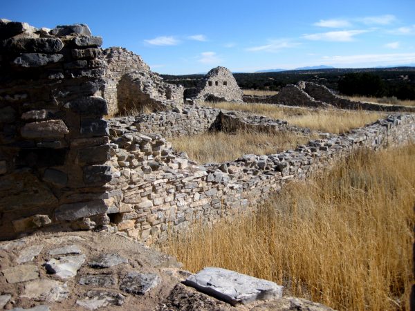
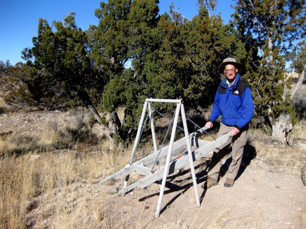
We dispersed camped here at San Lorenzo Canyon BLM area to enjoy the sunshine.We walked into the canyon areas and enjoyed the natural beauty of the rock formations.Interesting colors and layers – very fun to climb on and explore. We were here last year and it was worth returning. https://tealsky.com/2021/02/08/san-lorenzo-and-bosque-del-apache/Salinas Pueblo Missions National Monument has 3 different areas that were built by 17th century Spanish Franciscan missionaries in Native American areas.These were huge cathedral style buildings built in the ancestor puebloan style using stones from the local areas.Really wonderful construction details and such height!The third building has a different type of grey rock in the area which was interesting.An area to learn how to be an archeologist – sifting out the sand.
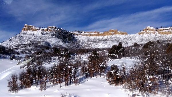
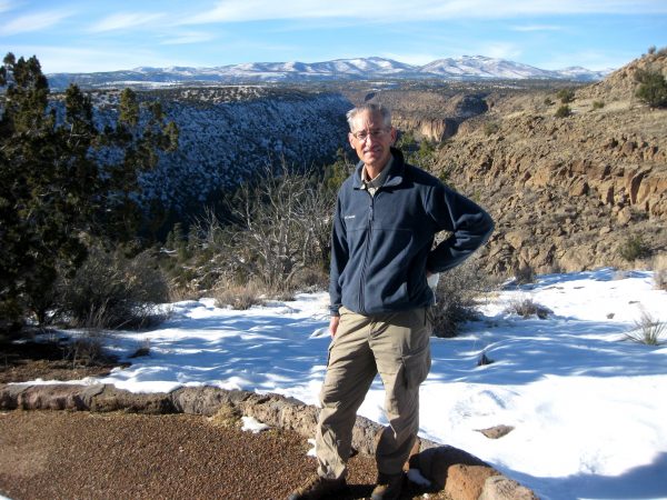
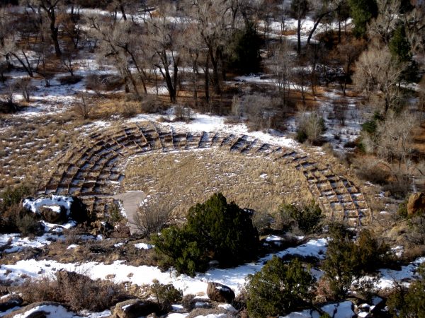
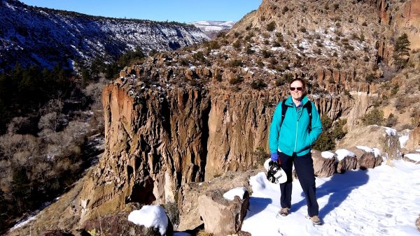
4 January 2022 – clear roads beckoned us to head south into New Mexico.We explored Los Alamos with a nice take out spicy lunch. Then Bandelier National Monument where had our choice of any campsite.We hiked from campground at top of mesa to the Valley below to enjoy the remnants from the past.Gorgeous scenery along the way – keeping our eyes open for cliff dwellings.Ladders to reach those dwelling above us.A rock formation that looks carved but is natural.The second day we hiked further down the canyon to the waterfall where we enjoyed sunshine and solitude.
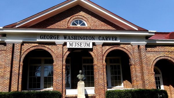
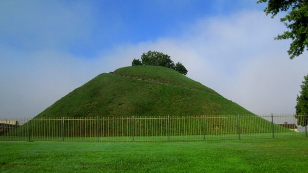
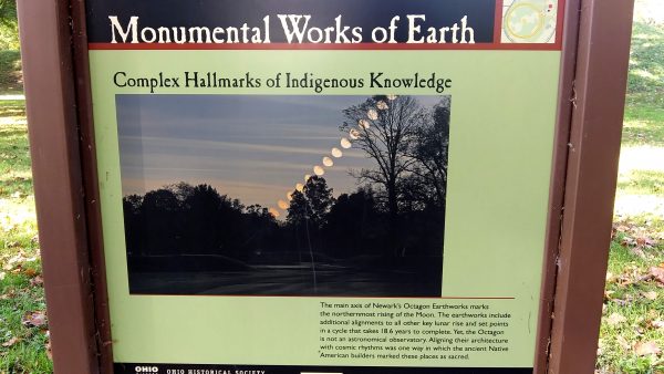
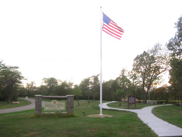
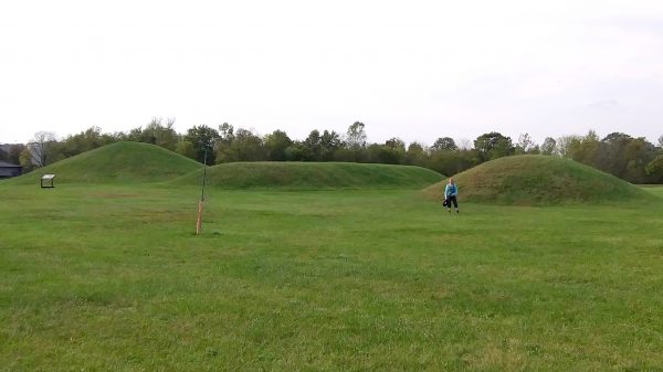
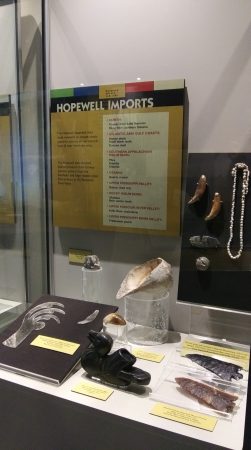
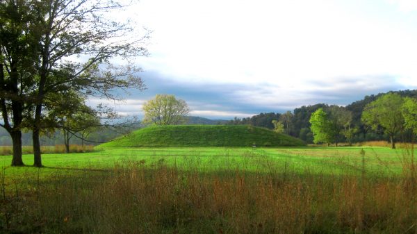
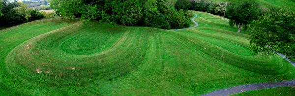
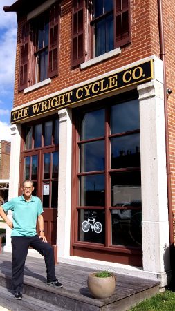
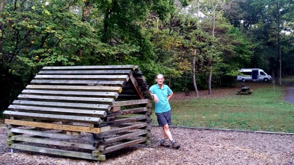
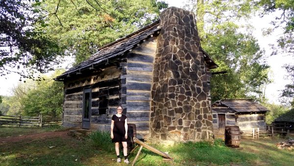
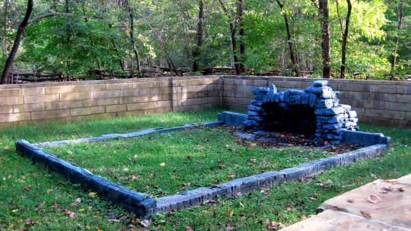
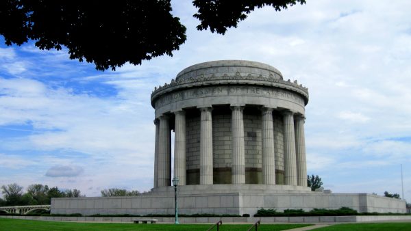
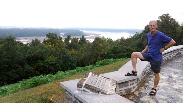
Cuyahoga Valley NP – in Ohio and a new National Park for us. Ledges Hike was beautiful. Earlier in the day we walked around Garfield National Historic Site and learned about the presidential campaign of 1880.Sittin’ on the dock of Nimisala Regional Park, OHIO. That evening it poured – an unbelievable amount of rain.We snagged second to last site at Blue Knob State Park in Pennsylvania. Best fall color. visited First Ladies NHS and Allegany/Pittsburg Portage Railroad NHS today.Friendship Hill NHS was Albert Gallatin’s estate. He was Secretary of Treasurer under Thomas Jefferson and Madison so he came up with funding for the Louisiana Purchase, Lewis and Clark Expedition, as well as the first National Highway. Unbelievably this day we also visited Johnstown Flood National Memorial (1889), Flight 93 National Memorial (9/11), and George Washington’s Ft Necessity National Battlefield (1754).Moundsville in West Virginia was closed but our first introduction to the Mound Builders.Newark Earthworks is a large park like area by Mound Builders. Museum closed but we walked the grounds.The Major Lunar Standstill is situated between the mounds every 18.6 years.Great Seal State Park in Ohio is located in the hills that are on the state seal. We camped here for a night. The Governor chose this park for a COVID memorial – very moving.Hopewell Culture NHP – so many mounds with interpretive signs to explain what was found in the different mounds.Artifacts found here at Hopewell Culture NHPSeip Mound area of Hopewell Culture NHP for an early morning walk/hike.Serpent Mound, National Historic Landmark, Ohio. Outstanding. Apparently the center of the serpent curves align with different solstices, lunar standstills etc. Fascinating artistic and engineering talent.Drove to Dayton Aviation Heritage NHP where the Wright Brothers actually made their first plane. Also visited Charles Young Buffalo Soldiers NM in Dayton area which was an interesting history of a great African American solder that was in charged of overseeing the early Yosemite National Park.Fort Lincoln State Park in Indiana. We are here to see the cabin Abe Lincoln grew up in but it isn’t this one. Today we visited Ft Ancient Mounds and William Howard Taft NHS, and had the best Little Caesars Pizza ever — near Grantsville, Maryland just off I-68.This is a replica built of the cabin which made it easy to picture Abe reading by the fireplace light. This is in Lincoln Boyhood National Memorial.This is the actual preserved foundations of the cabin Abe grew up in, not far from the reproduction.The much older brother of William Clark of Lewis and Clark fame, George Rodgers Clark NHM commemorates the highest ranking patriot of the American Revolutionary WarMighty Mississippi River from the Illinois side looking over to Missouri. The British Fort of Kaskaskia was here, with Cohokia Ft not too far away (we visited Cohokia for the Mound builders). We also visited nearby Ste Genevieve NHP in Missouri, One of the oldest European settlements in the US with a strong French presence.George Washington Carver National Monument. Wonderful to see a NM about the incredible life of someone recognized during their lifetime for their achievements. A beautiful place to visit, take a nature walk, and contemplate. Before we headed home we also visited 2 Civil War National Battlefields: Wilson Creek in Missouri and Pea Ridge in Arkansas as well as Ft Scott NHS in Kansas.
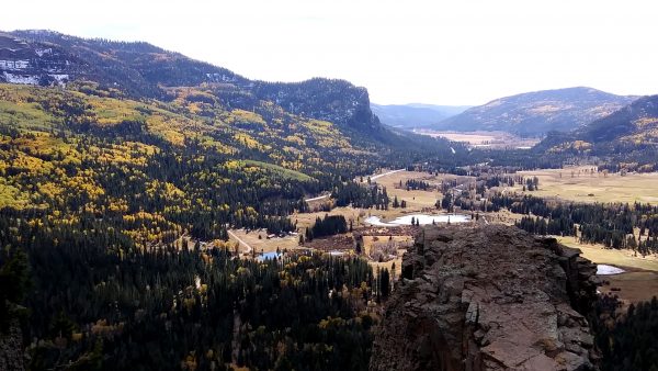
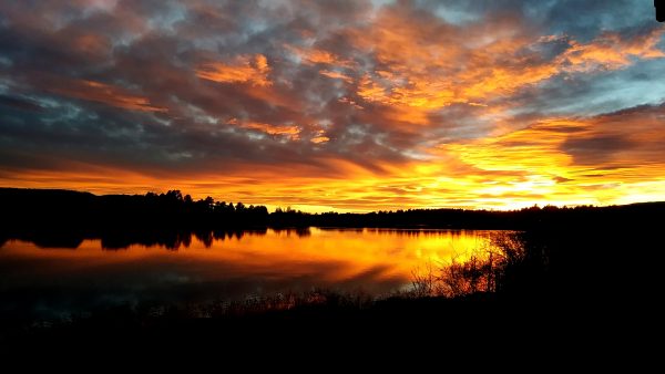
Cresting Colorado’s Wolf Creek Pass with some of the best fall color welcomes us home.We enjoy some of the best sunsets while we recuperate from our 6,030 miles of driving the last 2 months.