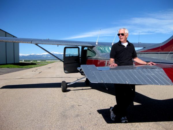
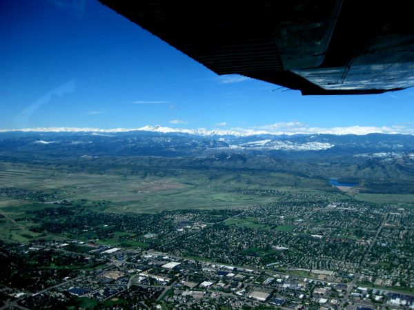
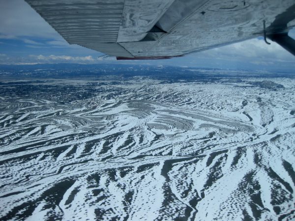
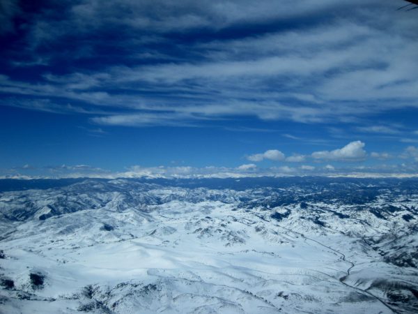
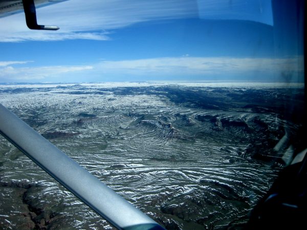
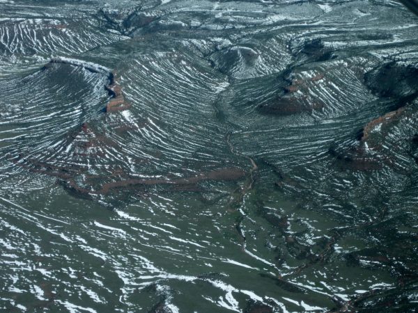
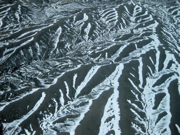
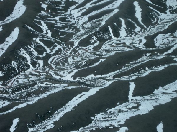
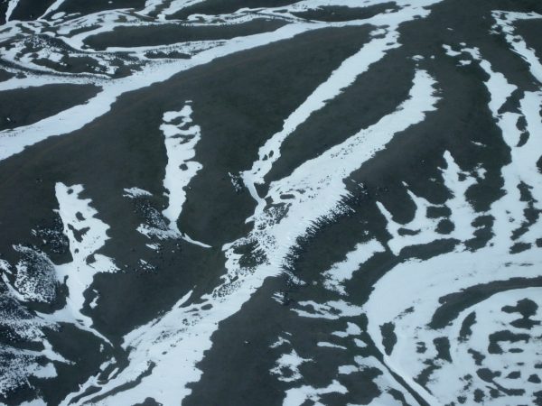
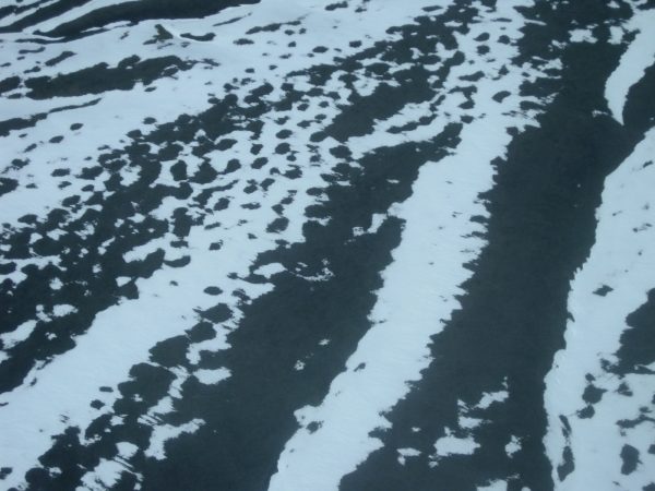
Meet our pilot. These are our friends that got us the work/camp for the National Forest in Sabino Canyon. We visited them in Ft Collins and decided to take to the air. What a treat!Longs Peak overlooking the valley.It is getting smaller and more of the city is visible. Also a touch of Horsetooth Reservoir.A lot of snow last week as we head towards Curt Gowdy State Park, Wyoming.Isn’t it beautiful?!Going over Red Mountain area – looking like a Topo map with the snow outlining the contours.But you can see the red below the snow and the Cache la Poudre River in the valley.Well these are just plain fun images of the snow patterns.Of about 50 photos, these are the best.I am not quite sure what I am looking at!But very interesting patterns. A very pleasant ride over the terrain.
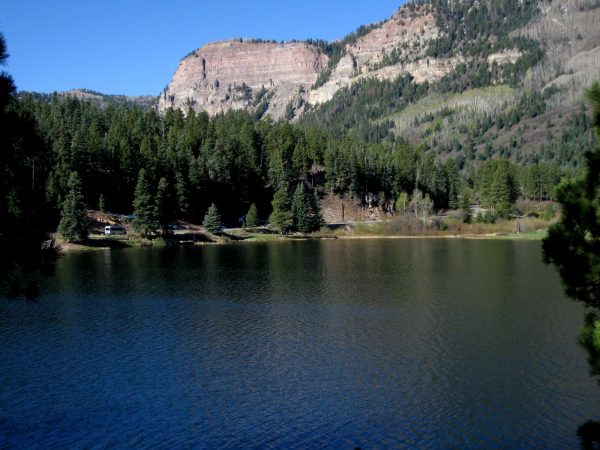
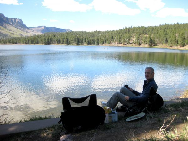
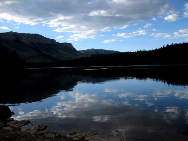
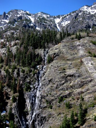
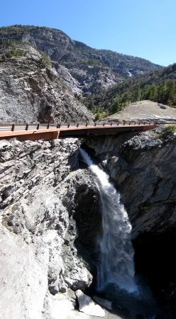
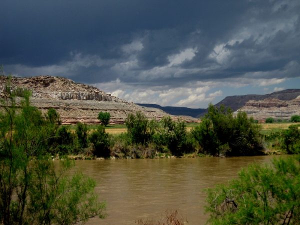
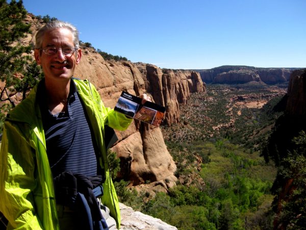
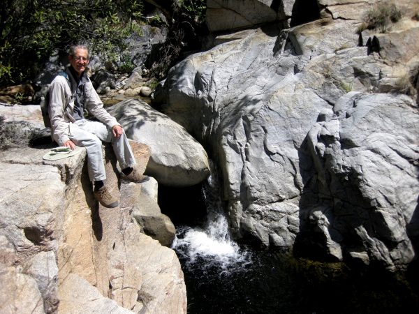
Now we feel like we are back in Colorado! We overnight parked the Travato next to Havelin Lake, a bit north of Durango on the Million Dollar Highway.We enjoyed relaxing by the lake and enjoying the scenery.And watched the Sun set and the lake become calm. All kinds of birds were present but we did not see any large animals.Just north of Ouray we spotted some waterfalls worth stopping the Travato to take a look.This is the road we just came down the mountain on and then stitched together this vertical panorama of the falls.We headed to Ridgeway, Montrose and then to a lunch hike at Dominguez-Escalante National Conservation Area.But the weather turned and we did not want to get stuck climbing out on the dirt road with the Travato. On we went to Grand Junction.And met up with our friends to hike this beautiful trail in McInnis Canyons National Conservation Area. (our pictures from last September)
Sep
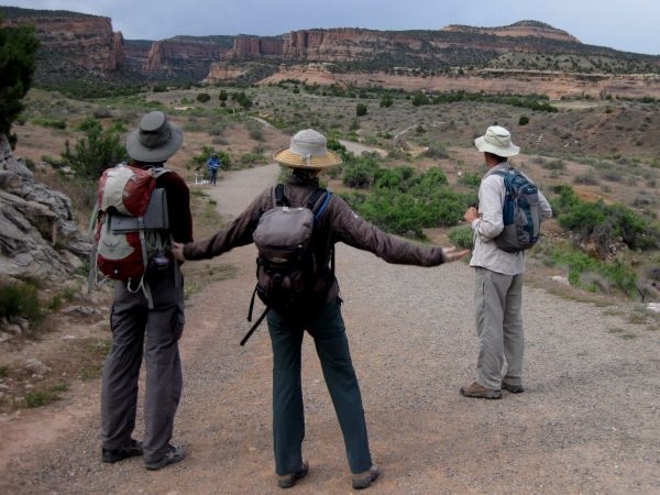
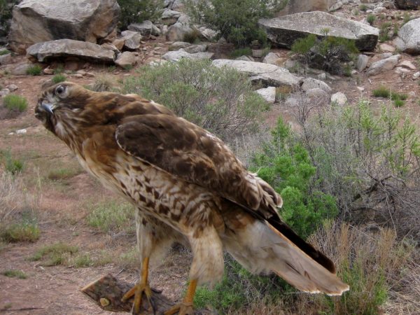
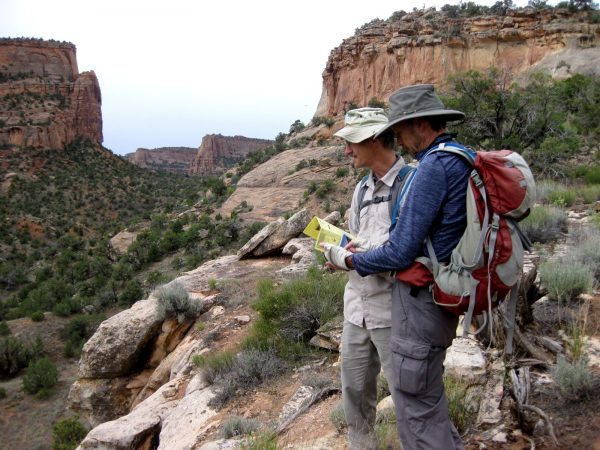
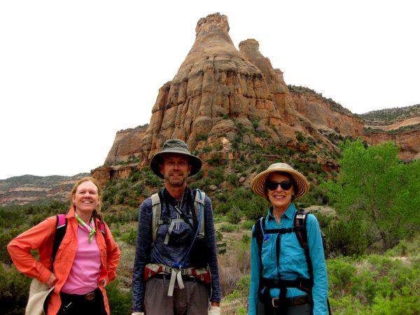
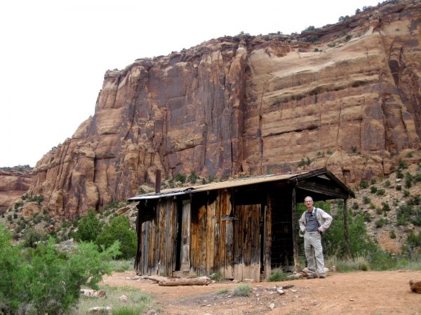
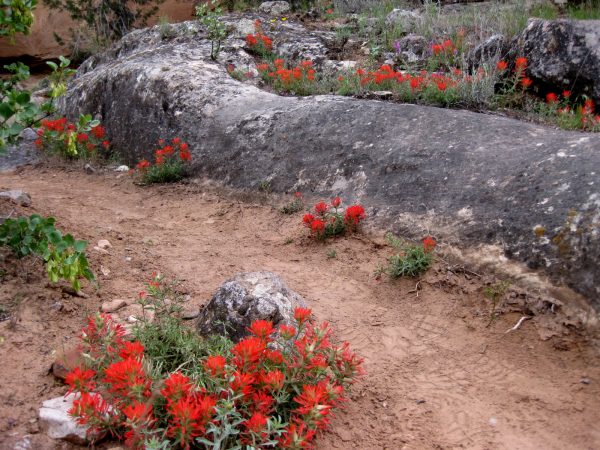
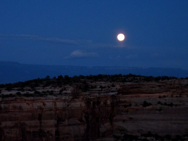
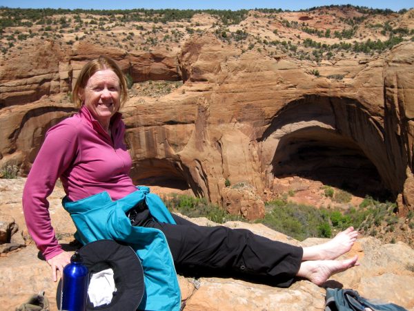
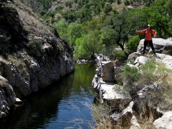
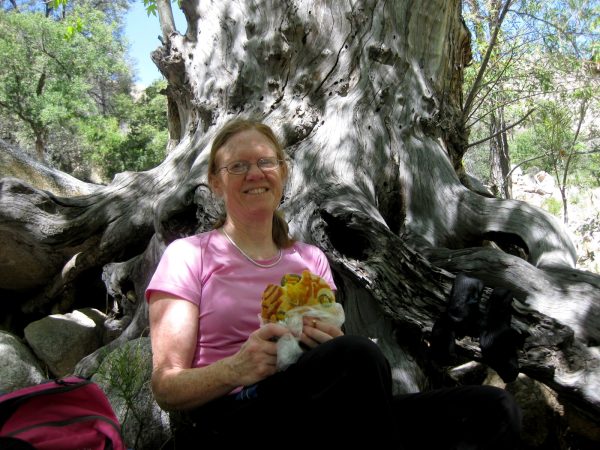
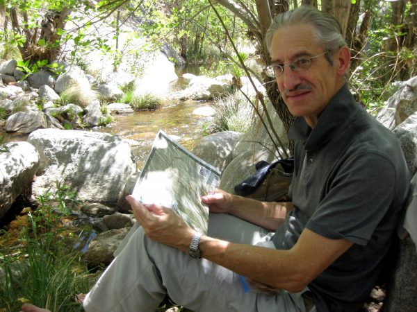
The red tail hawk was waiting to pounce on some school kids! He is a bit stuffed… but was still pleasant to look at.Oh but this was alive alive Oh… coolWere we talking too much and not paying attention to where the trail turned?Photo at the mid point of the Devil’s Canyon trail.Should we check out this real estate? It is need of some TLC but the views are grand.Indian paintbrush – isn’t this lovely?!A full moon over Colorado National Monument after being guest chefs. http://thewesternwagon.blogspot.com/2017/05/colorado-national-monfruita-co-53-517.html
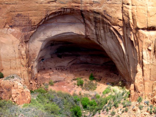
A beautiful day to enjoy this sacred area of the Four Corners region.We took a picnic lunch to the overlook of the cliff dwelling to enjoy the day.A cloud passed overhead and we were able to get this photo – there is a private led tour to give a sense of scale.We were able to get a top spot in he Sunset View campground.And it lived up to its name!
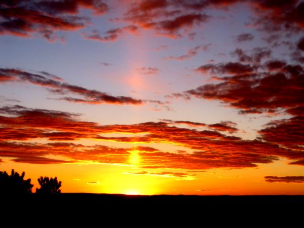
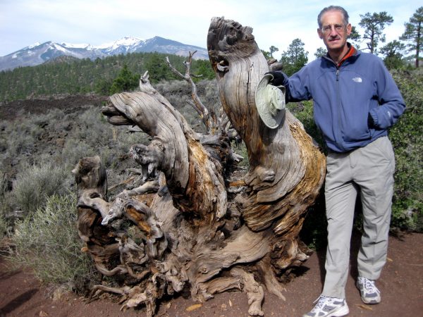
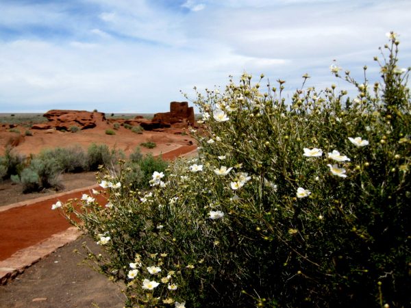
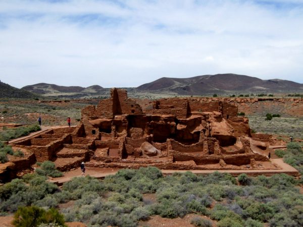
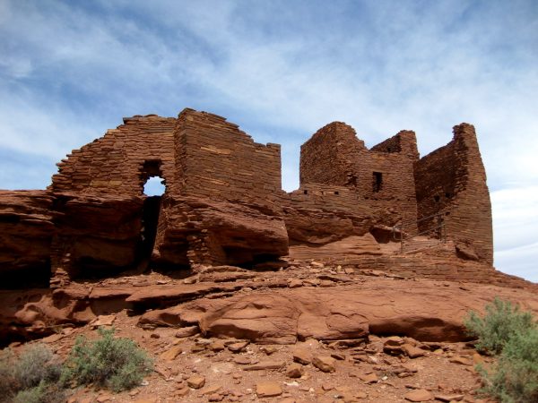
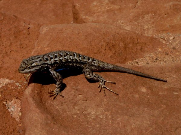
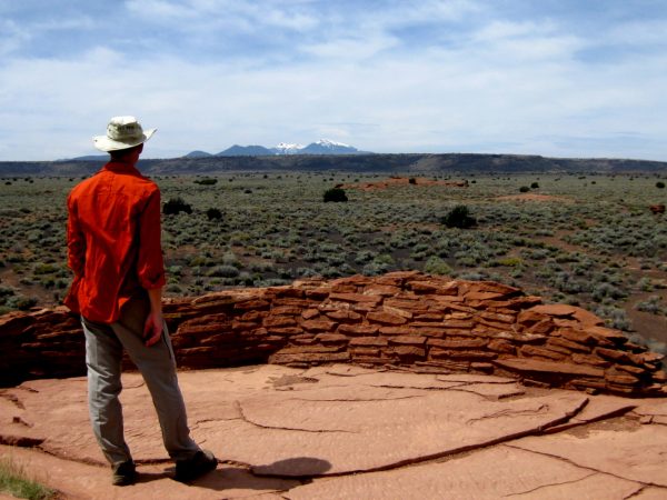
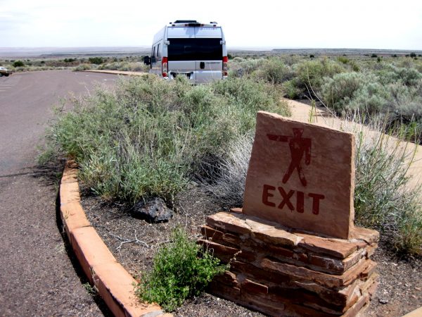
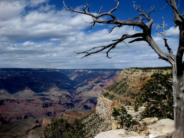
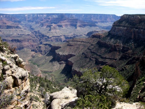
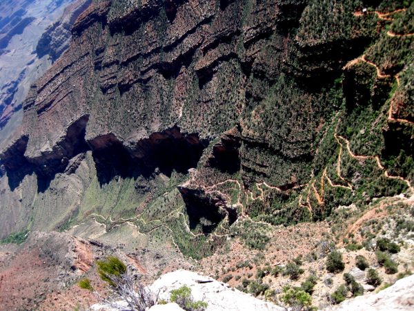
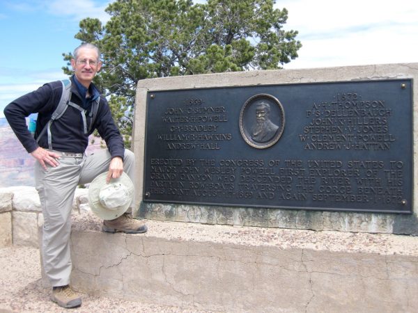
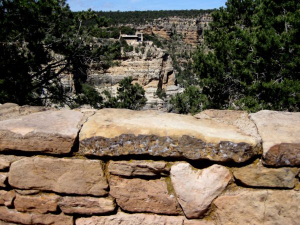
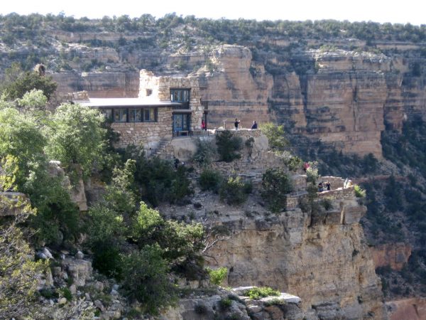
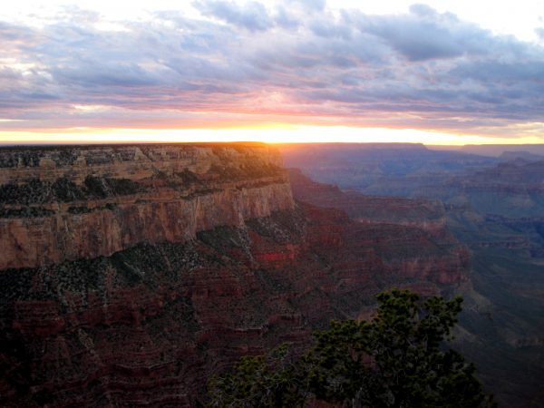
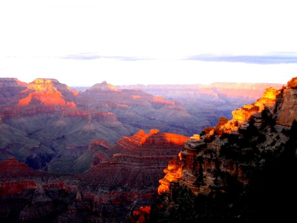
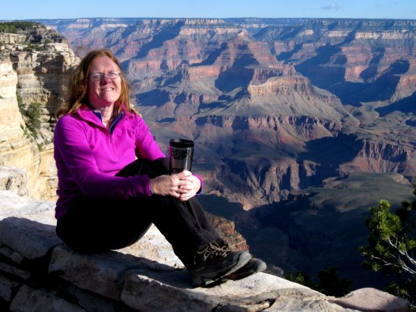
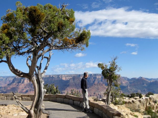
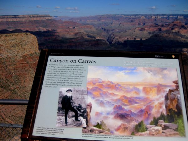
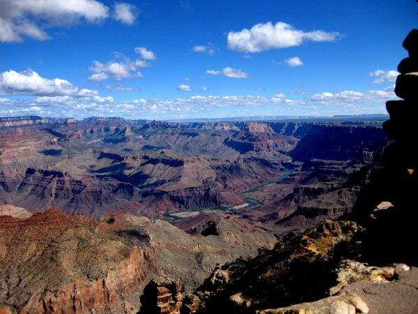
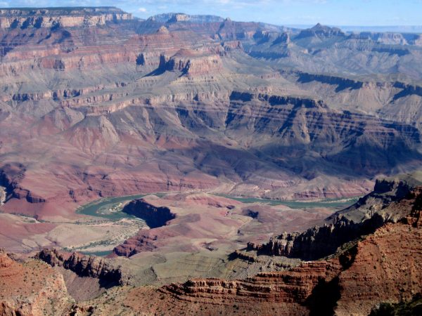
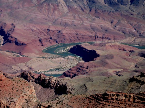
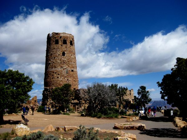
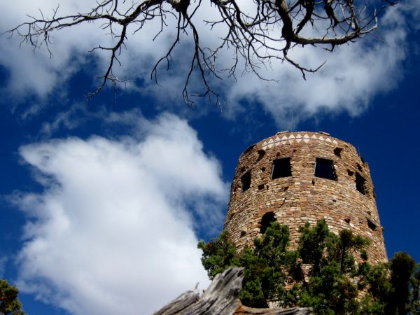
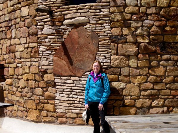
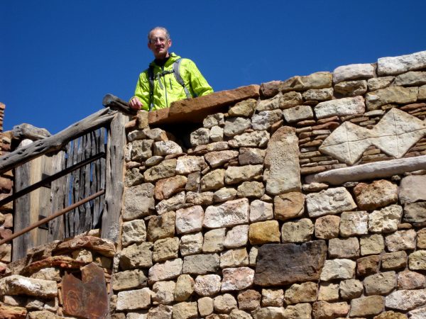
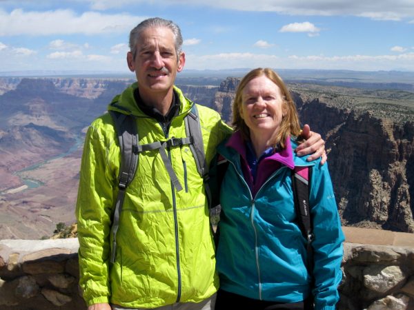
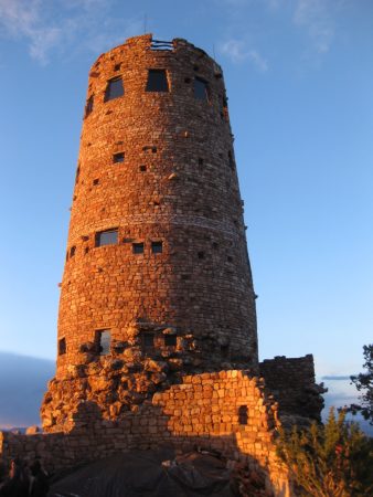
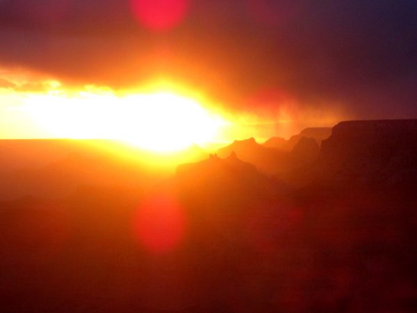
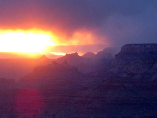
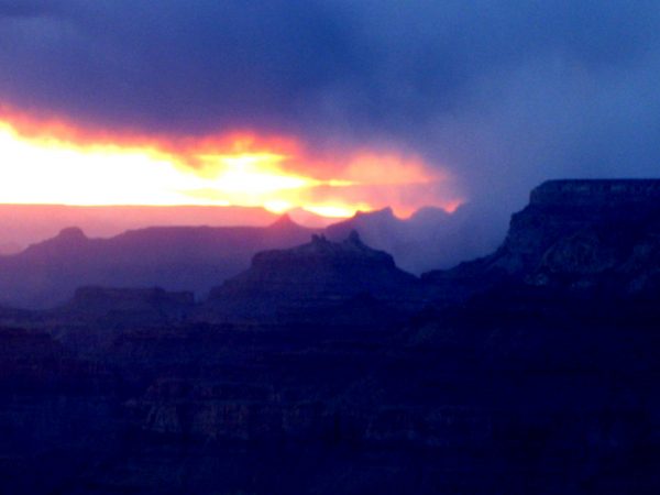
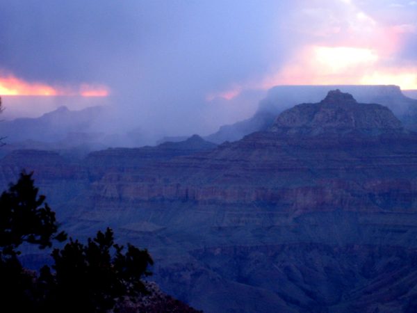
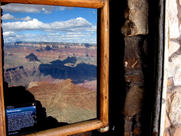
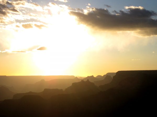
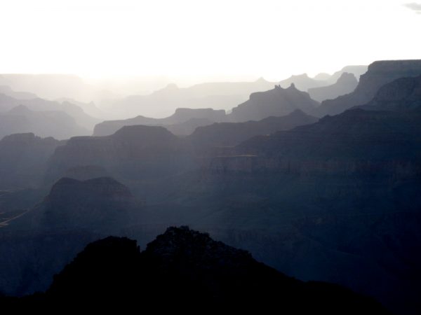
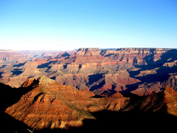
Last January we went to Sunset Crater and Wupatki NM and we returned again to enjoy the hikes and views.The Apache Plume was in bloom adding a bit of color to the landscape.It is so neat to see these ruins and imagine the lives that were lived here.In case you don’t look at the link to last’s years, this is another of the ruin on a hillside.This little lizard came out to enjoy the sunshine.Those are the sacred San Francisco Peaks near Flagstaff.As always, Exit through the Gift Shop! Good thing we can not store much in the van.Grand Canyon! We dispersed south of Tusayan on FR 302 and took the free NPS shuttle into the park – a 15 minute ride to the new visitor center (at least, we had not seen it before).Some things never seem to change, like the Hopi House – wonderful Parkitecture!We did not remember ever seeing the canyon this green. Looking down into Indian Gardens.And this is the Bright Angle path I did oh so many years ago. WOW!John Wesley Powell and his expedition – a very nice monument to these early explorers.We took a ranger led history tour that showed us this heart placed in the wall by a CCC worker. One of the Harvey Girls he was sweet on looked at this part of the wall from her lodging window. Or maybe it was just for his love of the canyon.Either way, I like that it is in front of the Lookout. Another very cool building. Further on is the Kolb Brothers Studio which has a great little museum about their contribution to tourism.We took the shuttle bus to Yaki Point for sunset – worth the trip!Incredible! We stayed on for a star program at the Visitor Center before catching the 9:00 bus back to Tusayan.Early morning drive to Desert View side of the canyon.Very peaceful morning.Nice displays telling about the history like this one about Thomas Moran. He created his own interpretations to make the most of nature.You can see more of the Colorado River from this eastern end of the south rim.There are some rafters going around the bend.Can you see them now?Desert View Watchtower by Mary Ann Colter is another one of her fabulous parkitecture sites.Just fun to photograph and appreciate.I thought I would give you a sense of the scale of the detail.This is a great viewing deck on the roof of the lower round building.A fellow traveler took our picture.We stayed at the campground two nights in site #42 and were able to walk over for some great sunsets.A few of the cool sunset pictures over the canyon.A storm was moving in so the virga gave an interesting element to the sunset.Nice the sun went behind the cloud so you can see more of the Grand Canyon.The north rim is getting the storm. We did have a snow shower in the afternoon but it did not stick.Looking in the black mirror inside the Desert View Watch Tower for a polarized look of the canyon. This was a technique to sketch the canyon.Another sunset with a spectacular vista.Very interesting light to see the canyon in shades of blue.A perfectly clear quiet morning for our departure and final view of the south rim.
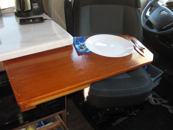
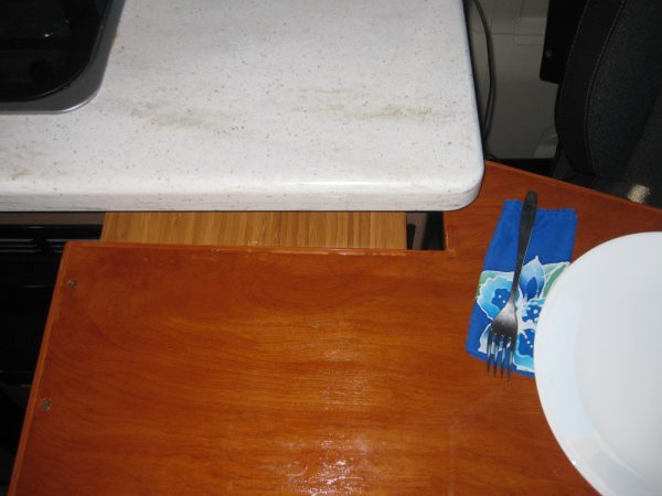
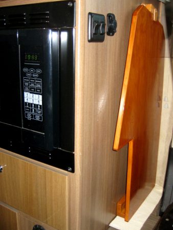
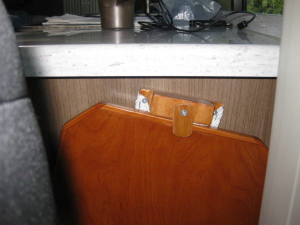
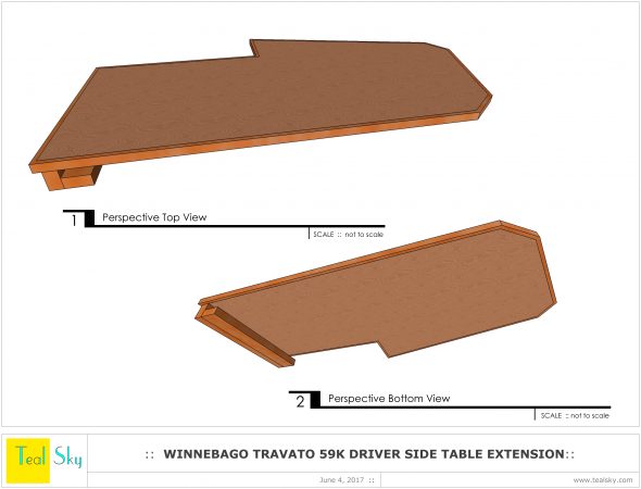
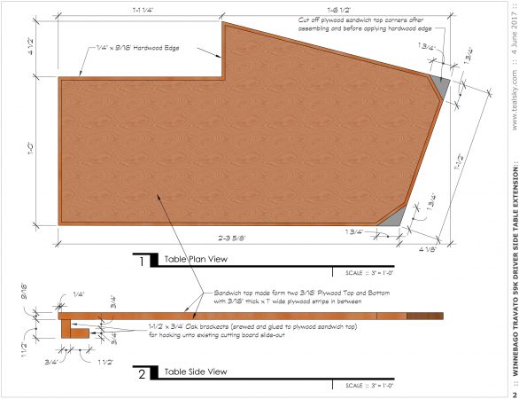
Henry designed an extension table that is install over the top of the pullout cutting board for the driver’s seat to have a better functioning eating/working area. It is better for using the computer and as an added bonus it provides more work area for the kitchen. It also is closer and at a better angle for the driver seat dining experience. Thanks Mark for helping in building it!It has an L shape notch on the top so that it will not become unhooked over the cutting board. The end of the kitchen cabinet basically holds it in place. It moves in and out with the cutting board to make it easier to get into the driver’s seat.The length was determined by the height of the cabinet under the counter so that it could store easily behind the driver’s seat. Shelf liner is loose on the floor but keeps it from scratching during travel.A wooden latch was also crafted to secure the top edge of the table and is screwed into the cabinet end above the power outlet. It is wrapped with shelf liner so no rattling or scratching.
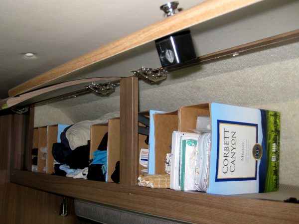
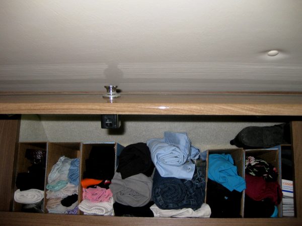
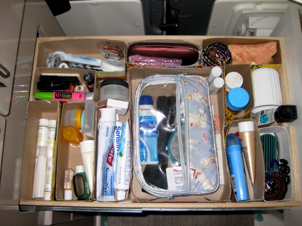
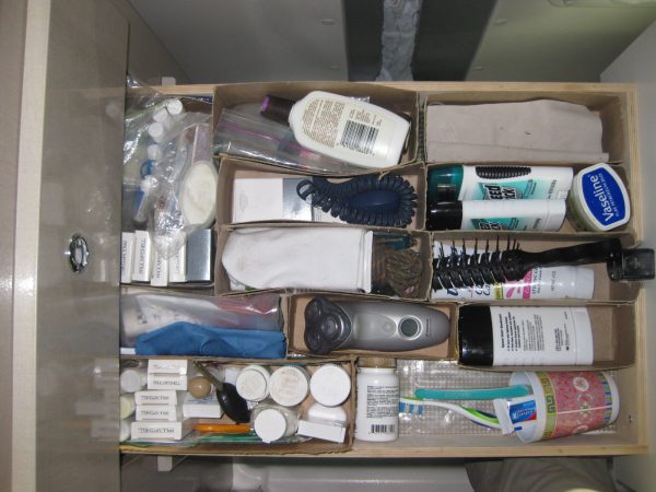
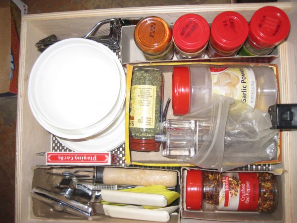
You know we like our wine o’clocks! Boxed wines work much better in the van than bottles and we found a great way to recycle the boxes. Everything shifts in the overhead cabinets during flight. These sturdy boxes act as dividers as well as create a shelf to put other items (or worn clothes) above.One for tights/belts, one for underwear, one for socks, open area between for pants/capris rolled, one for shorts, one for tank top/swimwuits, etc.Other Boxes act as storage dividers in the drawers; don’t add weight and really help organize toiletries. The trick is that the entire drawer needs to be filled with boxes so that none of them can shift during movement.This makes us feel so organized! And it feels like the drawers hold so much more.All the shelves and drawers have plastic shelf liner under the boxes. This may not be necessary but that was installed before the boxes so it probably helps with bouncing.
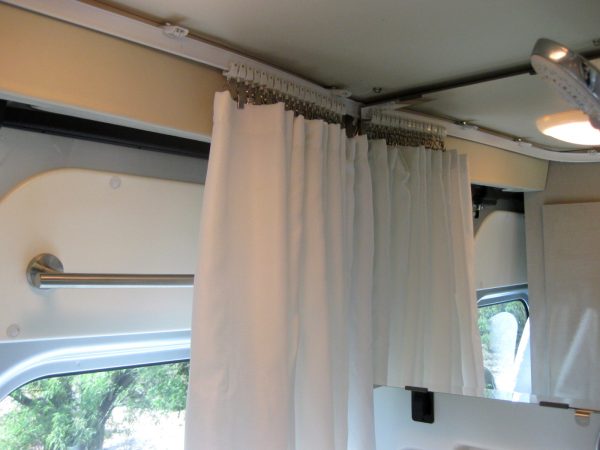
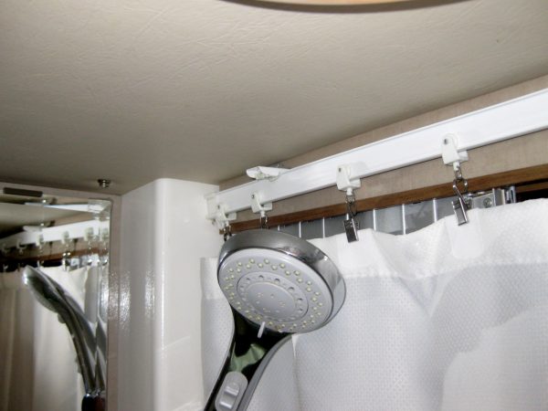
The original shower curtain snapped into the top of the wall/ceiling and we had seen that Wincrasher had done a modification that looked more practical. The first curtain hook is “fixed” at the hinge side of the medicine cabinet and it crosses the back doors, the wardrobe and bath pocket doors to end up behind the shower head on the other side of the medicine cabinet. We open the toilet seat while showering to keep it drier, squeegee mirror and floor then microfleece to dry. This has also solved our problem of water flowing down the door track to deposit itself under the wardrobe.
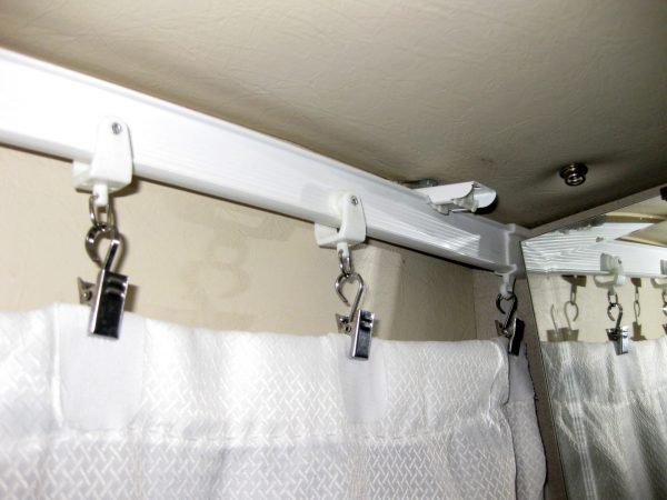
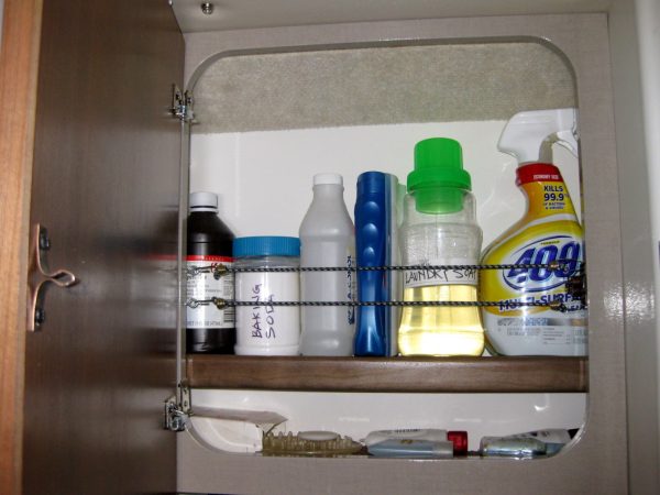
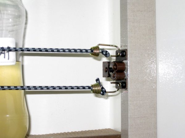
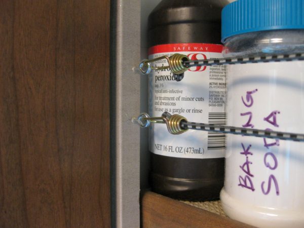
The new rod is “Super More” 5 Meters Bendable Straight Curved Curtain Track Top Side Ceiling Mounting (not all was needed, 19 rollers were used) https://www.amazon.com/gp/product/B01B16BHMQ The existing snap locations were used to screw in new L brackets, needed to purchase separately at Ace Hardware. We drilled two new attachment points at Wardrobe in order to accommodate a larger curve in the curtain track.The Shower Curtain Hangers are “Yueton” Pack of 30 Stainless Steel Clips w/ Hook for Curtain, Photos, Home Decoration (20 were used) https://www.amazon.com/gp/product/B01851VE5K The top of the shower curtain was folded over twice before hemming. White iron on fabric stiffener tape was put on in equal locations, folded over the top so the hook doesn’t snag the fabric and gives it extra support. It has laundered several times very well.Medicine cabinet had the one shelf installed in the middle so we lowered it to accommodate full height bottles. Wincrasher did his a bit different but this allows us to put soaps and little travel bottles on the bottom and maximize the top angle on the back wall.The latch on the right side had two holes located perfect for hooking in the small bungee cords without any modifications.On the hinge (left) side, two eye-hooks were screwed in to accept the other end of the bungee cord. Voila – we can now store full height bottles without them spilling!
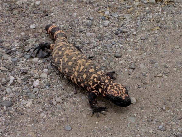
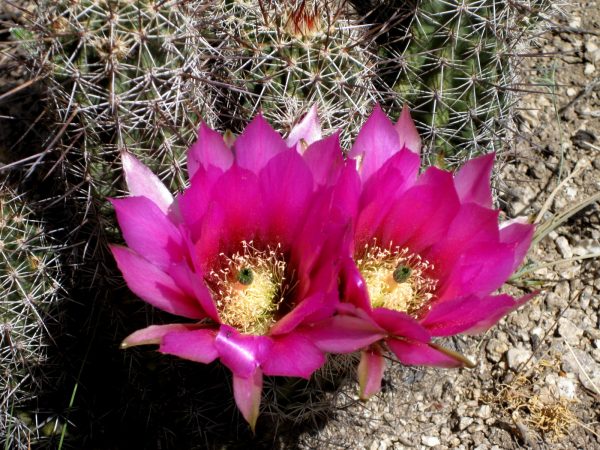
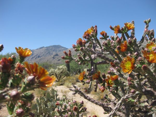
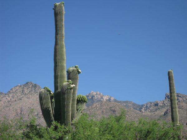
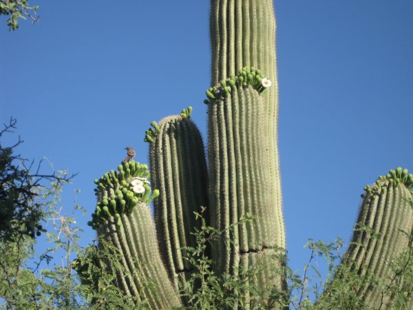
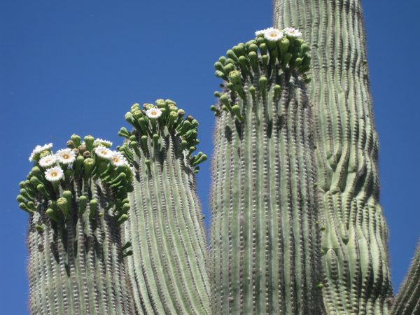
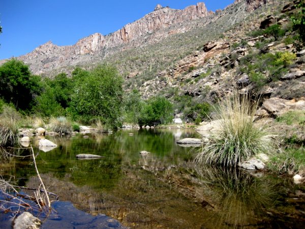
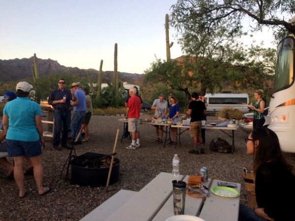
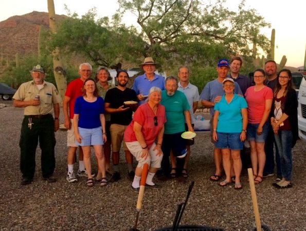
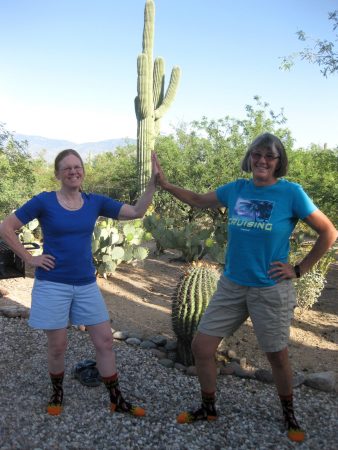
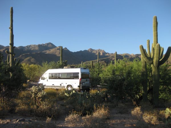
The Brittle Bush blooms were amazing – we missed the height when we were in Florida.One of my favorite locations with the Palo Verde in bloom. The canyon is so green!Ocatillos in bloom as well.The Gila Monsters are out of hibernation. How cool is this!We got a hike in to Hutches Pools – a very hot day but still nice water in the creek.Looking the other direction into a little canyon.Gorgeous cactus blooms!And a nice spot for a picnic lunch.The hike is 8 mile roundtrip from Shuttle Stop #9.The Cholla in bloom – there was quite a variety of colors.This is “our” saguaro, taken from the Winnebago Travato in early morning.A close up of a cactus wren and the flowers of the saguaro.This one was even more prolific! What a sight to see.We feel really lucky to have spent the winter here and to be able to appreciate all these lovely views. We trimmed some branches at this site.An end of season pizza party – make your own and bake on the grille.Group shot of the winter maintenance team – employees and volunteers.We are “hot stuff” with our matching socks!The parting shot as the neighboring 5th wheel has headed towards home a day before us…