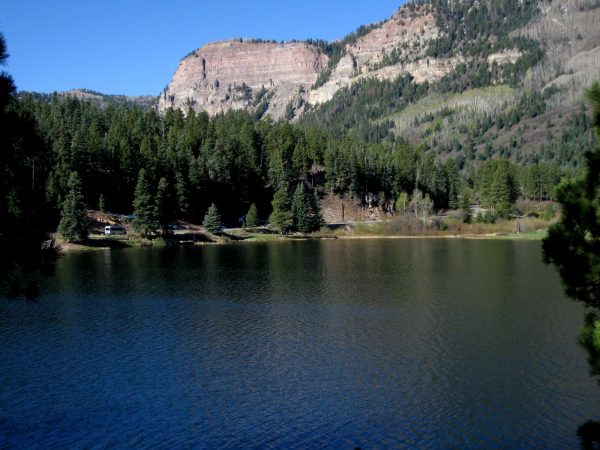
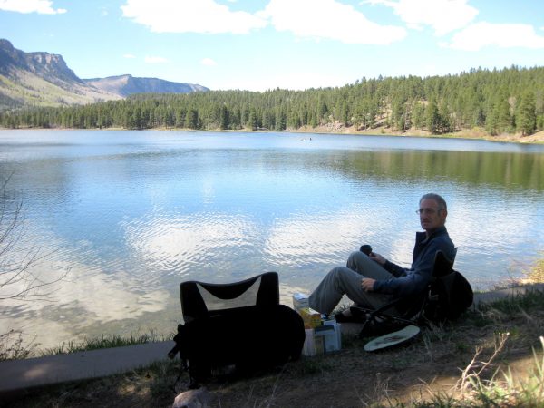
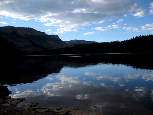
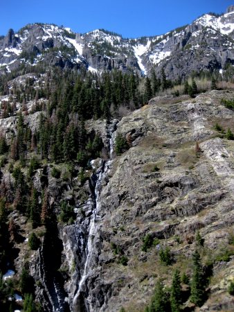
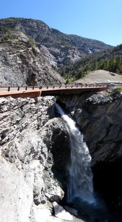
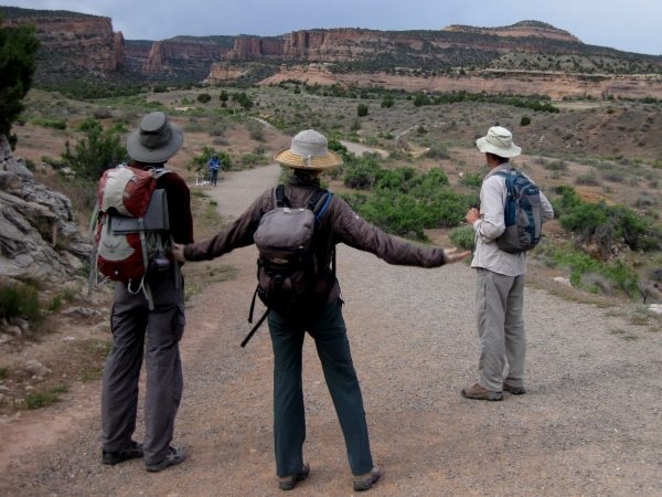
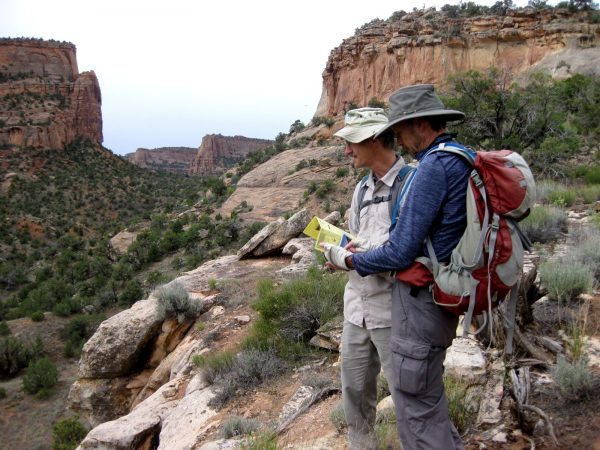
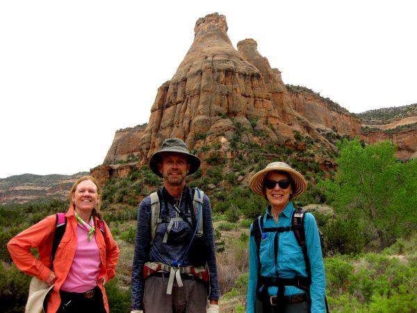
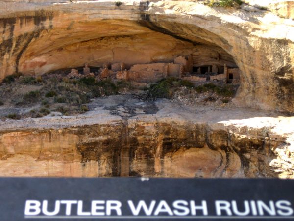
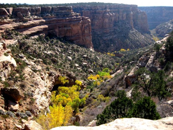
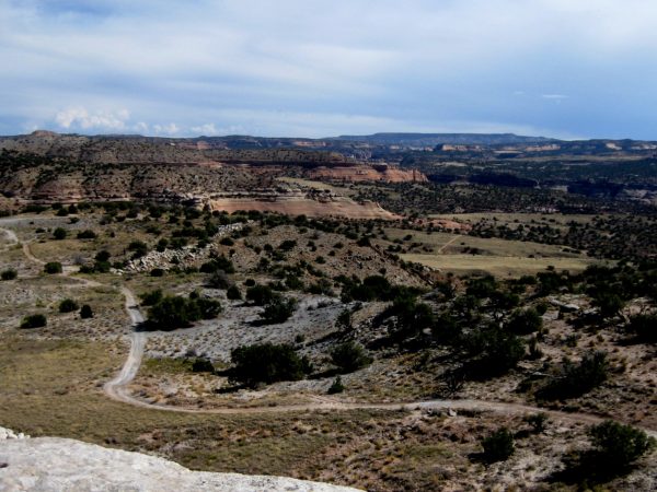
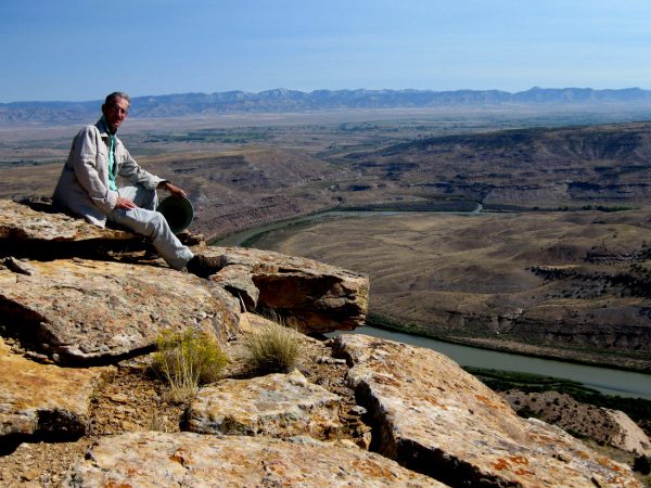
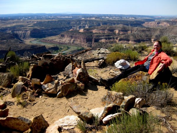
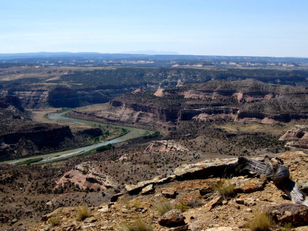
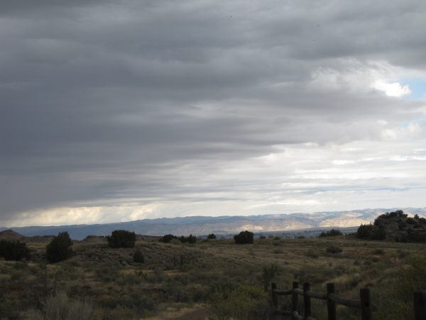
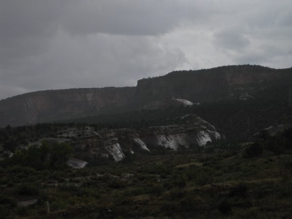
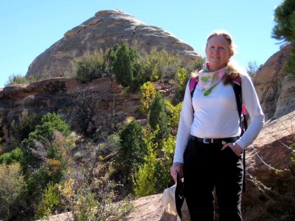
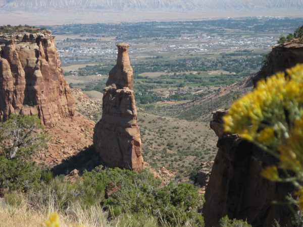
Now we feel like we are back in Colorado! We overnight parked the Travato next to Havelin Lake, a bit north of Durango on the Million Dollar Highway.We enjoyed relaxing by the lake and enjoying the scenery.And watched the Sun set and the lake become calm. All kinds of birds were present but we did not see any large animals.Just north of Ouray we spotted some waterfalls worth stopping the Travato to take a look.This is the road we just came down the mountain on and then stitched together this vertical panorama of the falls.We headed to Ridgeway, Montrose and then to a lunch hike at Dominguez-Escalante National Conservation Area.But the weather turned and we did not want to get stuck climbing out on the dirt road with the Travato. On we went to Grand Junction.And met up with our friends to hike this beautiful trail in McInnis Canyons National Conservation Area. (our pictures from last September)
Sep
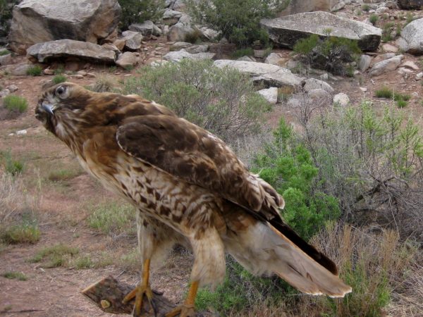
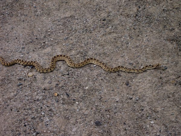
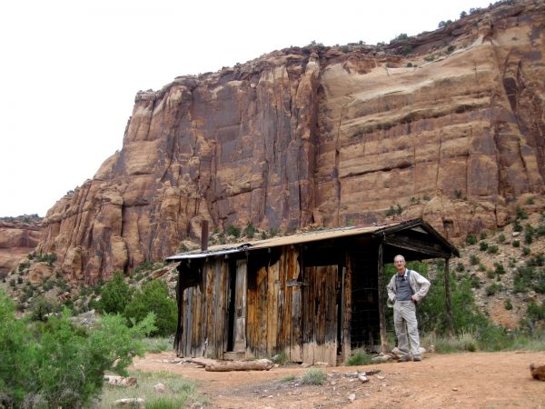
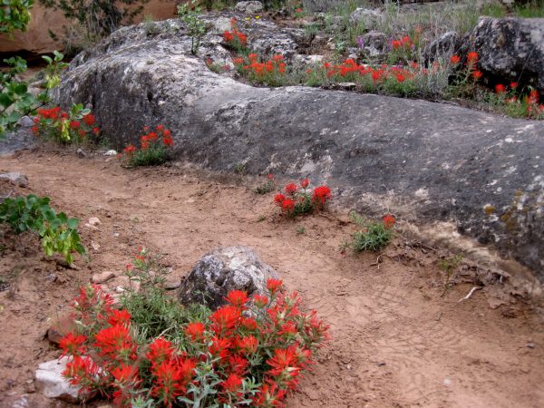
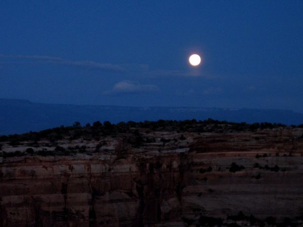
The red tail hawk was waiting to pounce on some school kids! He is a bit stuffed… but was still pleasant to look at.Oh but this was alive alive Oh… coolWere we talking too much and not paying attention to where the trail turned?Photo at the mid point of the Devil’s Canyon trail.Should we check out this real estate? It is need of some TLC but the views are grand.Indian paintbrush – isn’t this lovely?!A full moon over Colorado National Monument after being guest chefs. http://thewesternwagon.blogspot.com/2017/05/colorado-national-monfruita-co-53-517.html
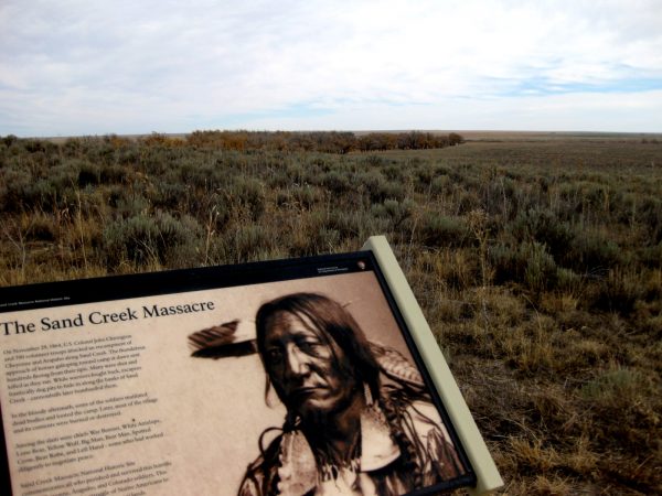
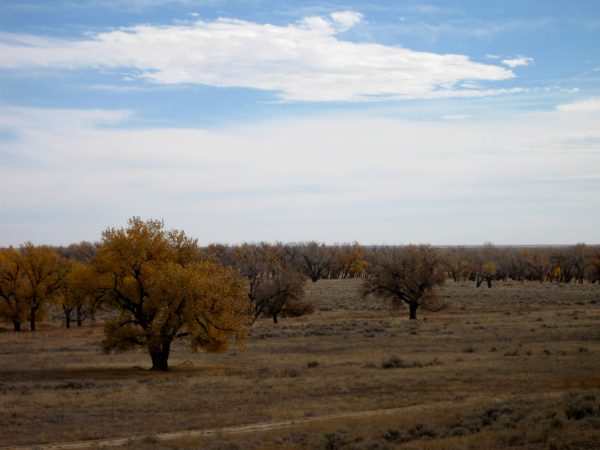
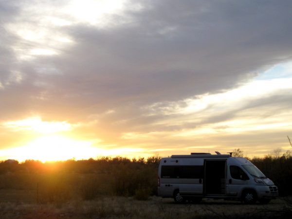
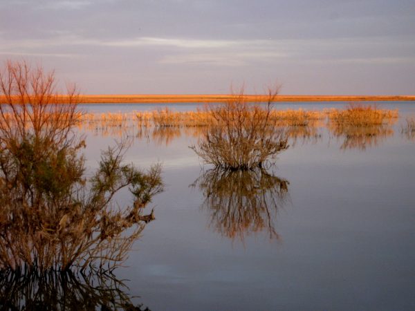
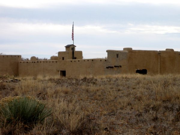
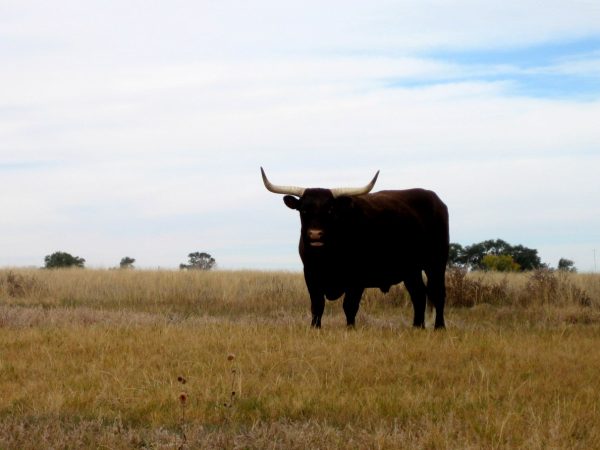
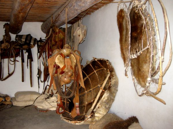
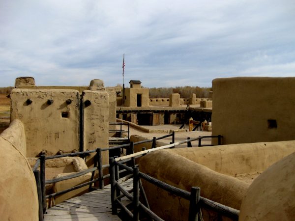
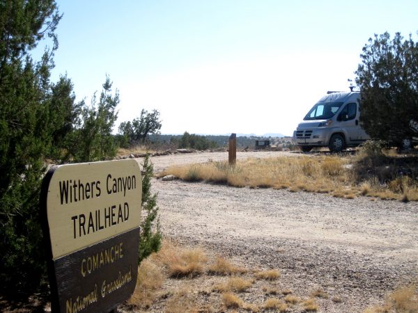
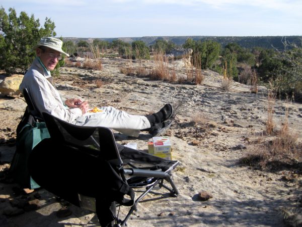
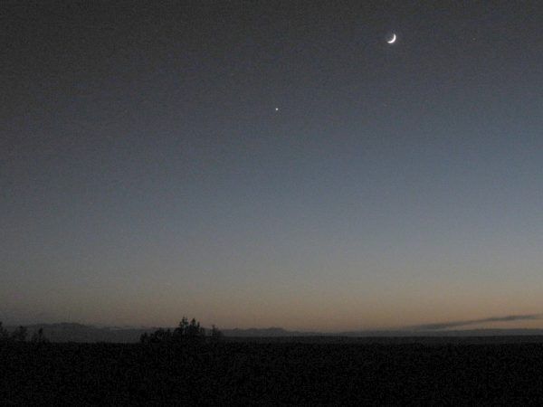
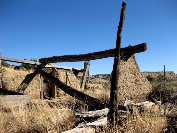
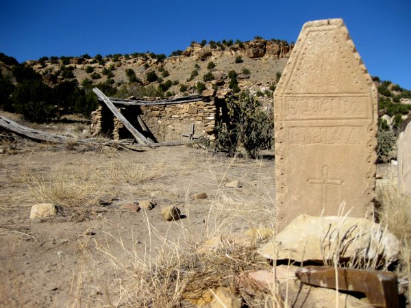
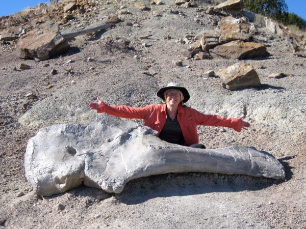
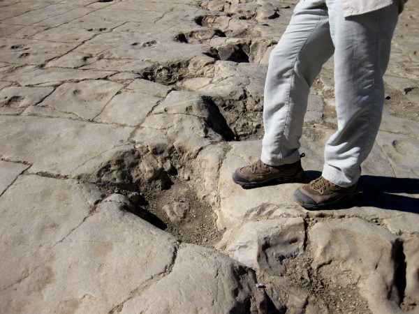
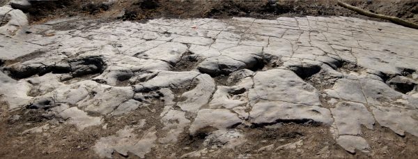
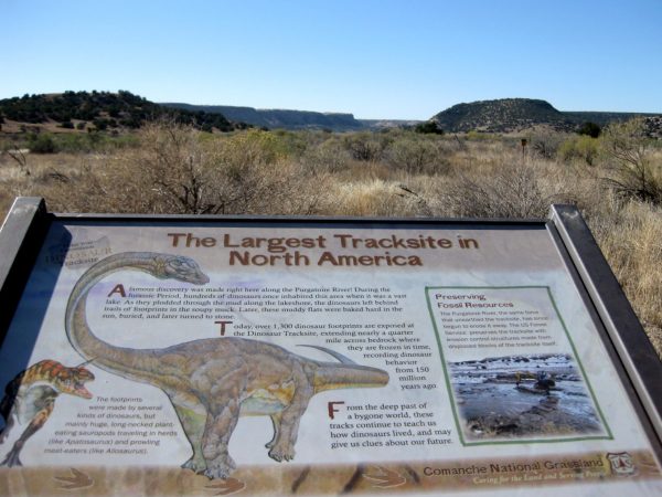
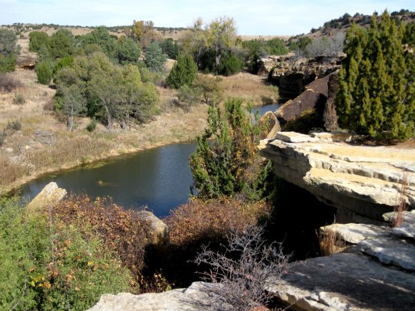
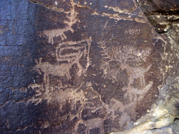
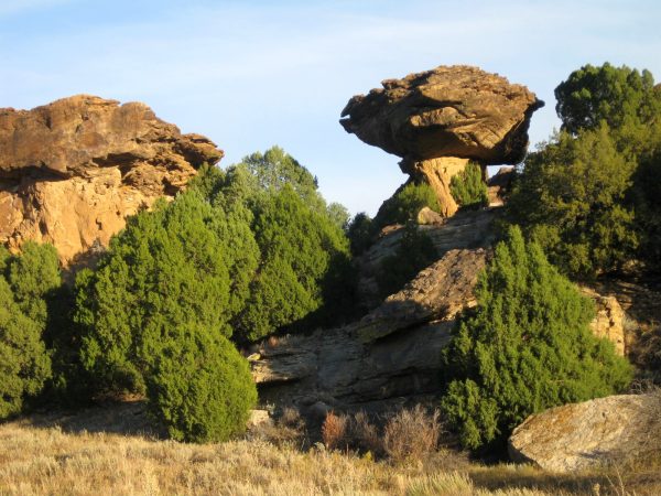
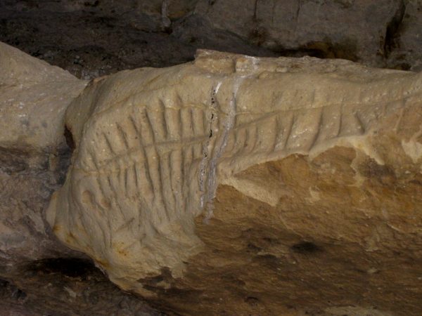
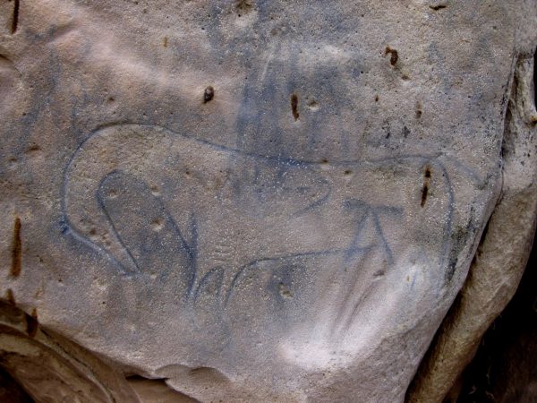
A National Historic Site, we had a ranger overview talk before our walk to the overlook of the massacre site.It is the last day of October – the massacre was the end of November – it surely wasn’t 87 degrees that day!We parked at Nee Noshee SWA for the late afternoon and evening, South of Eads, CO.This is the beautiful wildlife area – we saw a few ducks, raptors, and coots.Bent’s Old Fort NHS with a resident steer greeting us.Beautiful animal. I guess he gets to pull the wagon occasionally.This was a big fur trading area – mostly buffalo skins but here is a river boat made out of one as well as some beaver pelts.A nice piece of history that is recreated here on the Arkansas River.We headed South to Comanche National Grasslands for a few nightsPanoramic views to enjoy on our ‘back patio”. We are surprised at all the canyons in the grasslands.Peaceful sunset with Moon and planets. The Milky Way was awesome!Picket Wire Canyonlands hike first had this dust bowl ruin.On old chapel ruin and cemetery of another settlement.But dinosaurs are why we have chosen this trail – this is a thigh bone a tad larger than mine!And footprints a tad larger than ours!This is a panorama of Theropod dinosaur tracks. Well worth a 12 mile RT hike.Largest Tracksite in North AmericaWe stopped for lunch at Carrizo canyon.And did a short hike to these amazing petroglyphs of elk.We camped at Vogel canyon and enjoyed sunset on Balance Rock.This was the view from the Travato!We hiked to some more petroglyphs. This is a calendar that marks the solstice.And some amazing drawings. We were disturbed by recent graffiti and had many discussions of why someone would deface these treasures.We enjoyed our picnic lunch by this arch as we were in no hurry to get back to camp.
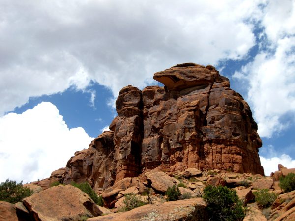
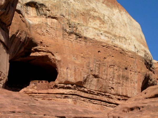
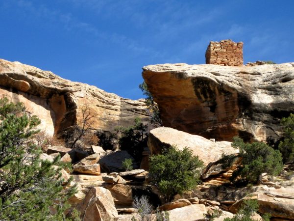
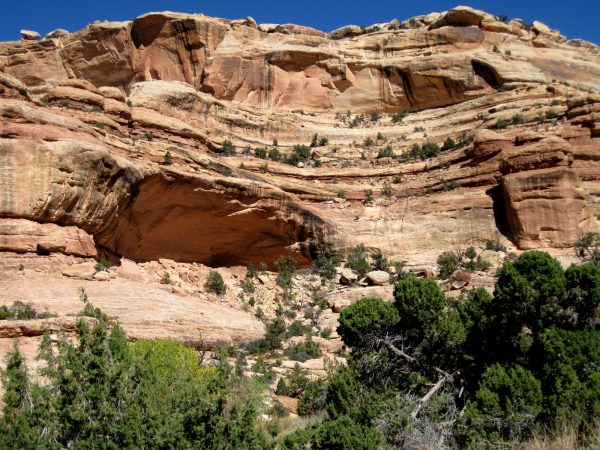
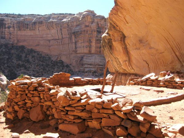
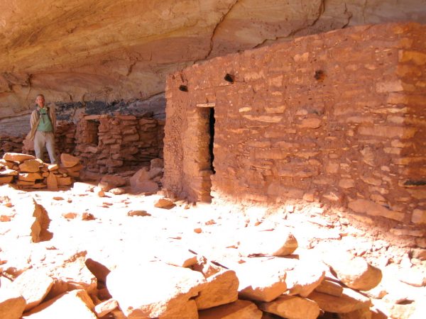
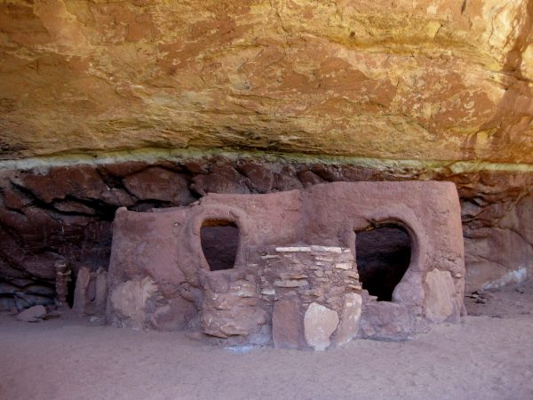
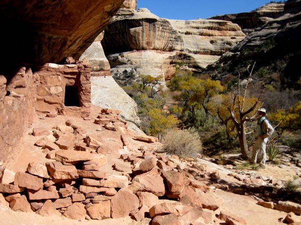
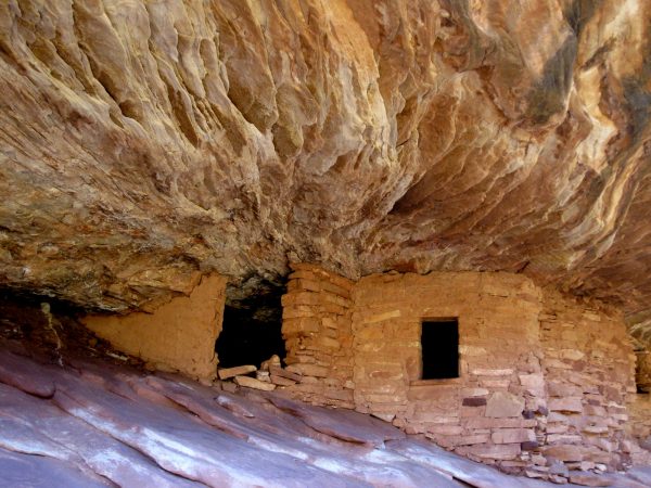
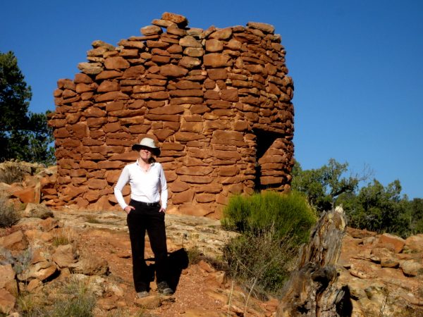
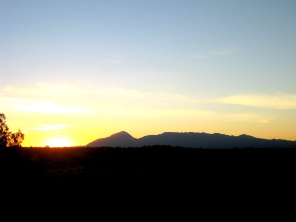
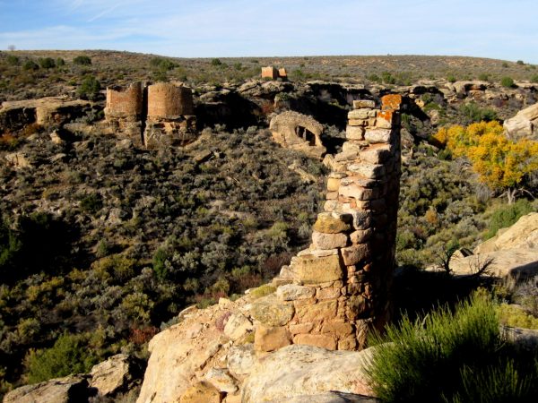
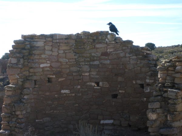
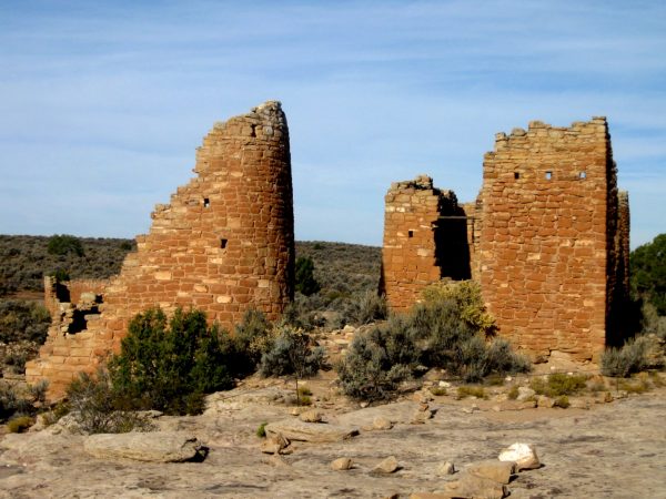
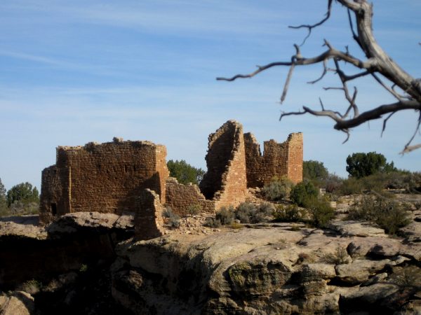
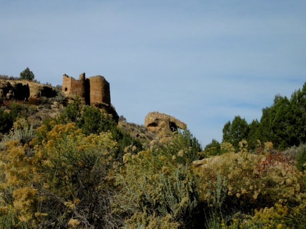
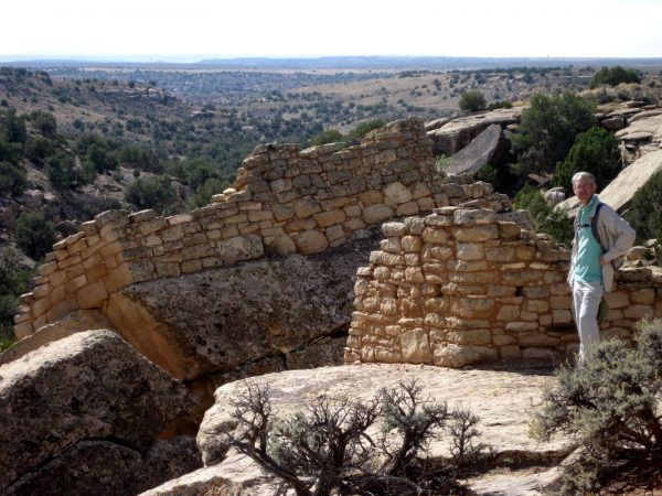
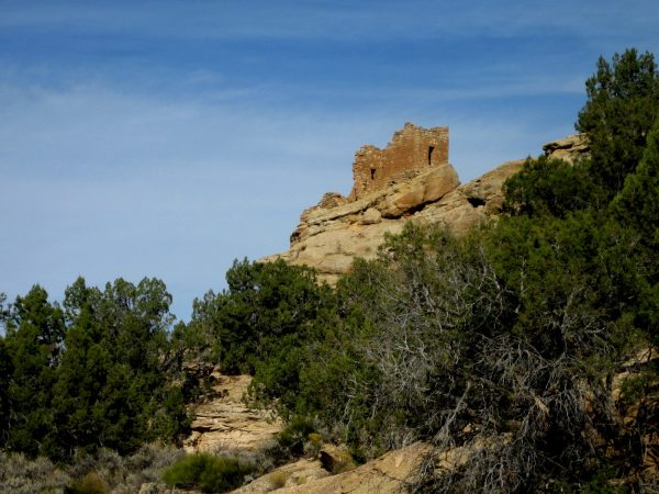
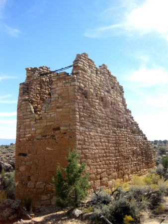
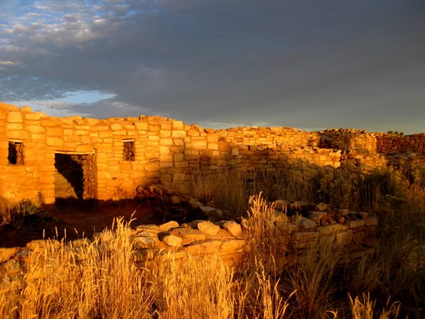
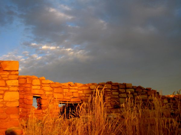
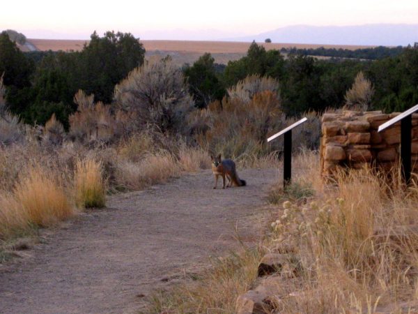
Canyonlands NP Needles district house in the cliff was a 10-mile round trip hike.This was a short hike near Combs Ridge south of Blanding, UT.A nice little tower on the ridge from our hike to Jail House Runis and Perfect Kiva.This is the Perfect Kiva which we hiked up to see closer.View from the Perfect Kiva looking back across the valley.It is a BLM site and had a nice booklet describing so many of the features and artifacts found there. Fascinating!Natural Bridges National Monument was the first National Park in Utah. It is quite spectacular.We took the trail to the Horsecollar ruins.It had a one log ladder to climb up – not so bad but going down I was glad to have a good companion.This is a gorgeous bridge on a gorgeous day.This is our “Million Dollar View” campsite that we had stayed at before. We were here five nights this time. The dark skies and stars were spectacular.House on Fire ruins – if visited when the sun is just right it appears to be in flames. who came up with that?Before Hovenweep NM we hiked around this canyon to see other cliff dwellings.Beautiful craftsmanship.Sunrise over Sleeping Giant from our campsite at Hoovenweep National Monument.Morning loop hike at the monument to see these treasures.The spirit raven was watching.The wood supports in these buildings are original.The sites on the rock ledges are such interesting selections of places to build.There is a house tucked under that large boulder.The cliff partially collapsed but the dwelling stayed attached to its foundation.We wore ourselves out with a bunch of shorter hikes and the day kept getting hotter and hotter.We sat and enjoyed this for a while – really detailed and intricate brick laying.Early morning at Lowry Pueblo in Canyon of the Ancients.It felt really special to be able to experience this lighting.Mr Fox even had to check out the photographer. That is Sleeping Ute Mountain in the background.
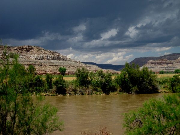
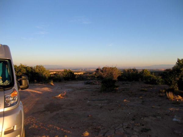
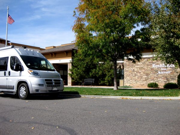
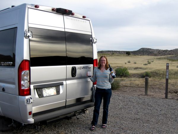
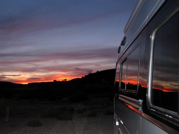
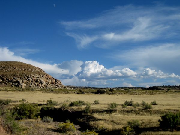
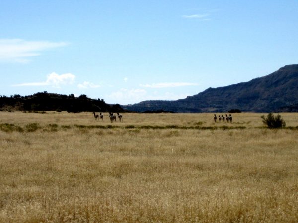
A great month at the Residence Inn Marriott in Grand Junction. Leaving our new friends, spoiled with all the comforts of good breakfasts, social hours, pool/hot tub and convenient location.Thank you to Dean Moore’s crew and the crew at Transwest for getting our van in tip top shape. And thank to Marriott for the Plum Creek Palisade wine to celebrate!Enjoying the sunset at Rabbitt Valley after a long day of getting the Travato reloaded and ready for the road.We were able to do some hikes right from the camp site so had two great no drive days.This was the view we enjoyed from the camp site.This herd of pronghorns were shy of us but not the ATVers.Both hikes took us to the Colorado River to enjoy this type of view.It is a rough life to hang out here!
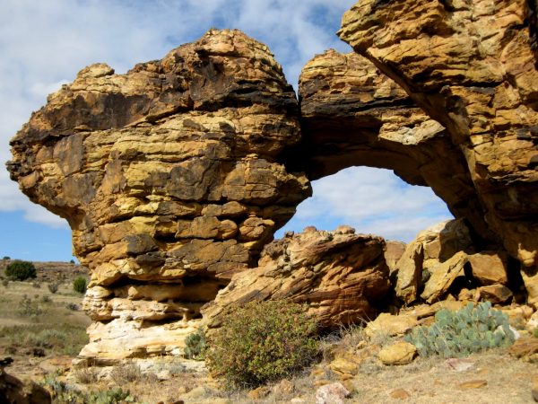
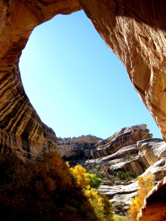
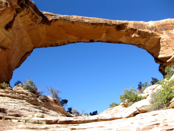
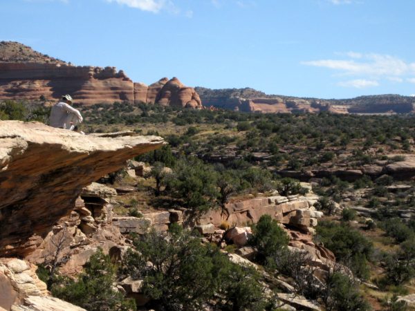
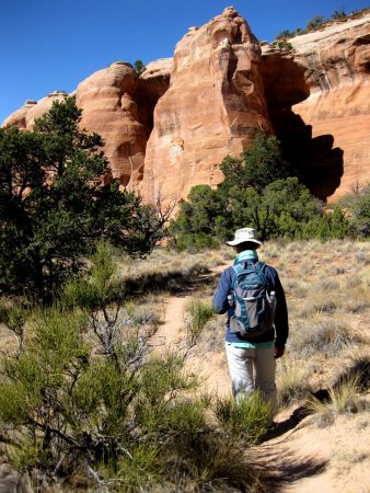
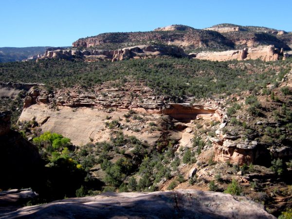
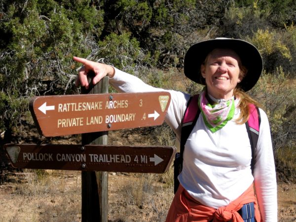
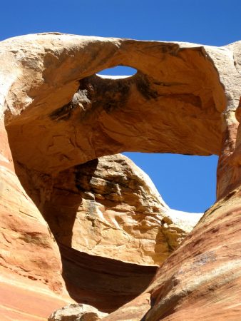
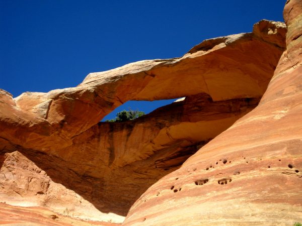
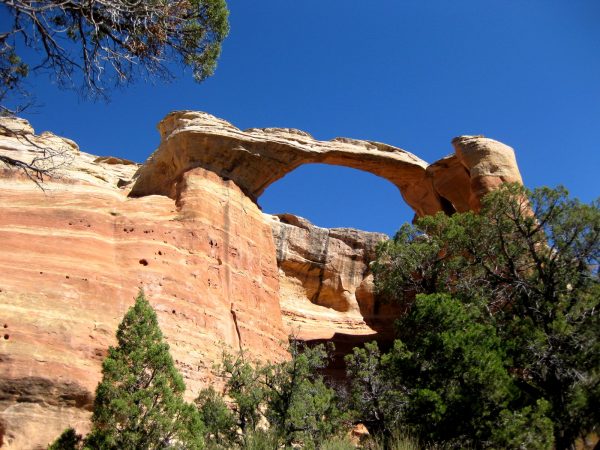
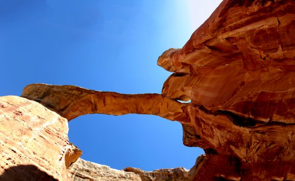
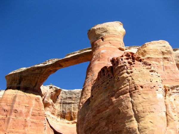
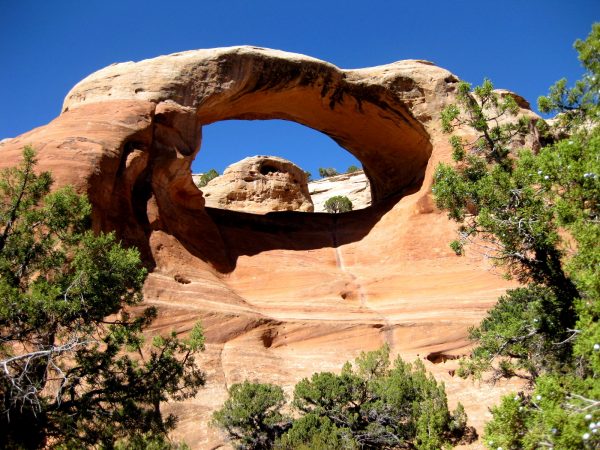
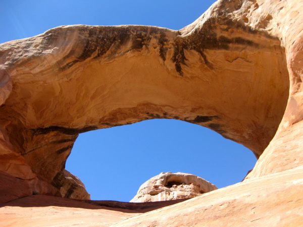
On the trail again – it was 48 degrees when we started and 64 when we finished. Perfect!Is that the trail down there? We were not expecting all the elevation gain – we ascended and descended three mesas – both ways!We are over half way to the arches – it is 7-miles in and 7-miles out! Most of this trail is in the Black Ridge Canyons Wilderness section of McInnis Canyon.There are 7 arches – a very high concentration for one hike. They were breathtaking and not just because we had hiked 7-miles!Very fun to appreciate on such a gorgeous day.This got our vote as the most beautiful arch we have seen. Sorry Utah…We took too many photos but this upward looking panorama seems to capture the awe of being there.Walking past it gave a different viewpoint that was also interesting.This is the last arch we hiked to – there might have been one more but we stopped here to eat and enjoy before heading back.Fun to climb up for a closer view. Really amazing what nature can do, given enough time.
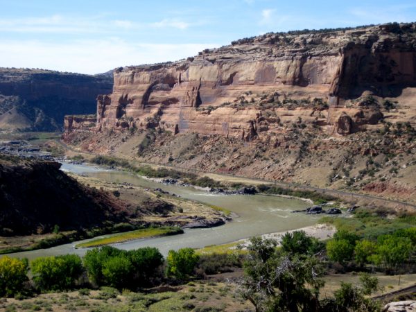
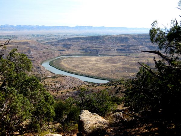
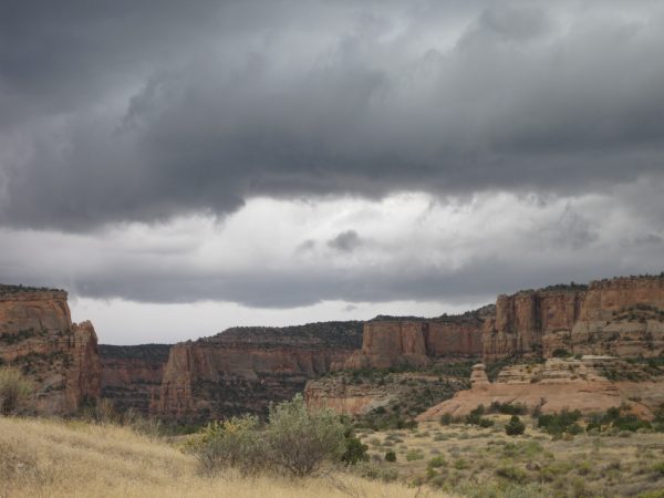
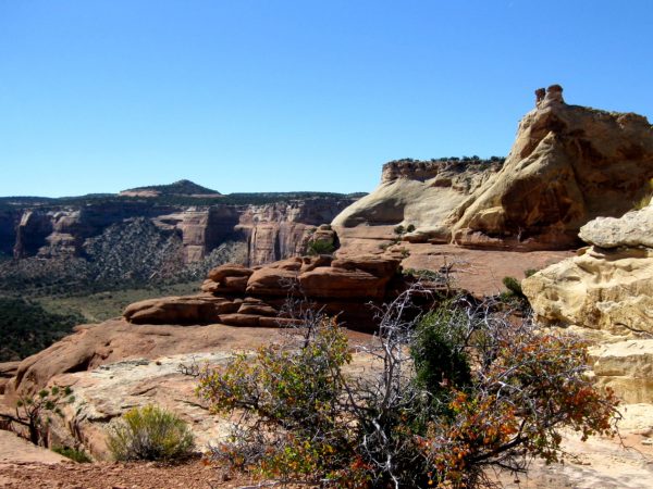
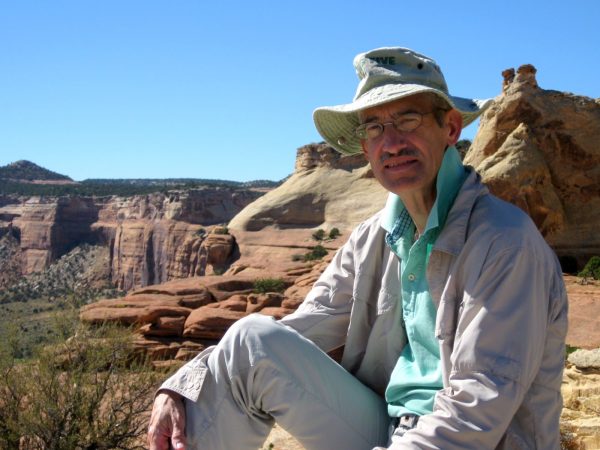
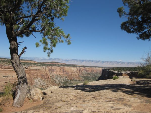
McInnis Canyons National Conservation Area for another day of hiking – Rabbit’s Ear Mesa Trail to overlook Colorado River, close to the Utah border (Exit 2 on I-70).It took an hour to hike to this spot, 700-feet elevation gain, but worth every step for the view!Clever stone arm chairs were created in this perfect overlook for us to appreciate.Looking towards Utah with the La Sal mountains on the horizon.Another day we headed to Devil’s Canyon trail under dark skies.The lighting was very interesting with the sun shining on the Book Cliffs across the valley.We got caught in the rain but it made all the rocks shine – even though it also made the trail a bit slick and muddy.
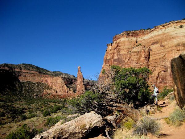
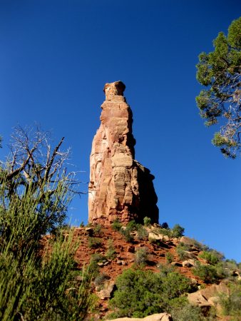
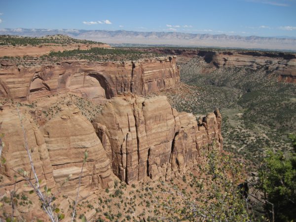
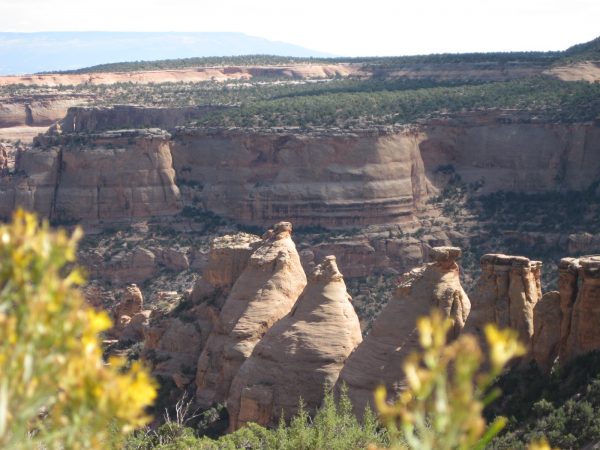
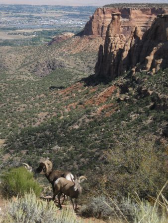
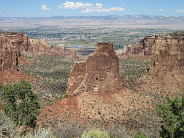
Independence Monument – we did a morning valley hike to see this pillar up close.There are naturalization ceremonies here and 4th of July flag raisings and rock climbers today! The library had an entertaining John Otto impersonator talk about how he built these trails and championed for this to be a National Monument. So glad we had people like him in the early 1900’s!Another day hike from the valley to Liberty Bell formation – named after the bell in Philadelphia.It is a steep hike but worth it to enjoy the solitude and views.Nice photo op!Another day we drove the full rim drive – this is looking back at the Liberty Bell across Ute canyon.There are so many canyons that would be fun to explore. We enjoyed all the little overlook hikes, a cooler day, and no need to hurry.These are the coke oven formations. There is a CCC water diversion tunnel built near here with some information on their time building the roads as well as a ranger cabin that is still standing. Such amazing stone work!Big horn sheep live here – we felt so lucky to see them!The back side of Independence Monument looking down on the trail we hiked.We enjoyed this view of Independence Monument while eating our picnic lunch.
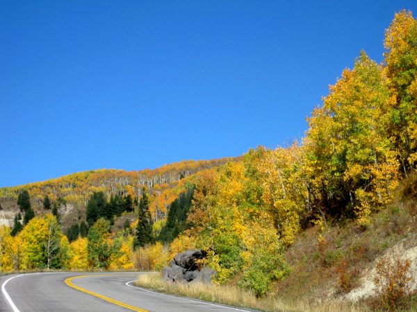
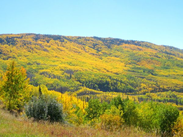
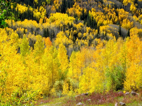
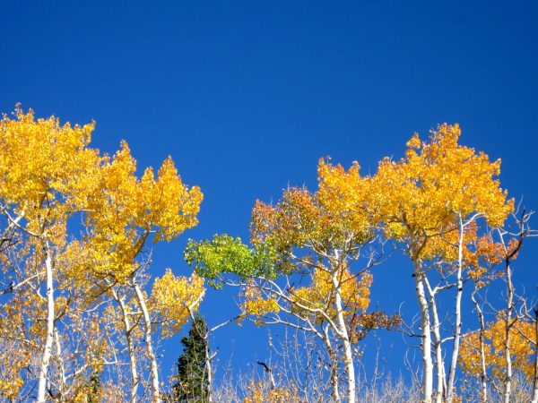
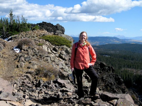
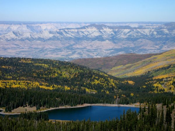
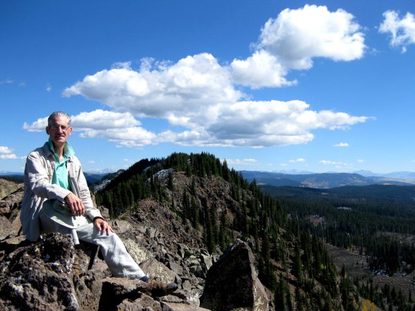
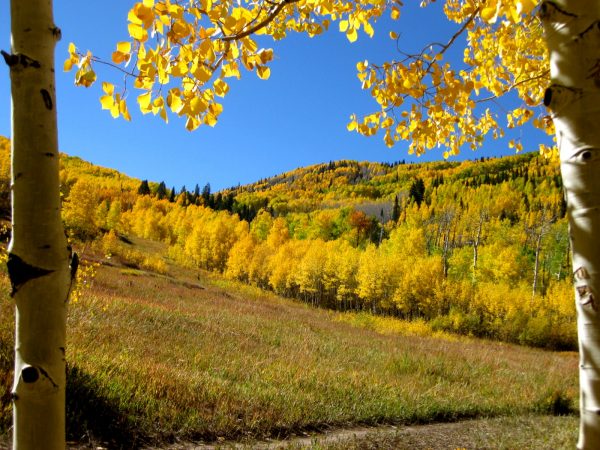
A perfect fall day for a drive up the Mesa!The amount of aspen around Powderhorn Ski area was breathtaking.Quaking aspen in a light breeze, shimmery golden in the sun – actually quite a bit of orange on the leaves as well which was a bit unusual.This is real – just an amazing blue sky!A hike up Crag Crest to enjoy the view with our picnic lunch -notice a bit of snow on the trail….winter is coming.Amazing views were worth the three miles or so to the summit.Clouds were forming only over the peaks but added some interest to our views.It was great to hike amongst the colors, the views and the sunshine. A great day!