We headed high above the morning clouds on a beautiful day.Breathtaking!Looking down on the valley of the Salzach river and the town of Werfen, Austria.We have hiked up, then taken a steep Gondola ride – still a bit more climbing to reach the Eisriesenwelt Ice Cave.Heading into the World’s Largest Ice Cave! A first for us.There is still a lot more climbing once inside – we carry gas lanterns to light the way.Ice formations! Some with special added lights at key locations.Scenic!Artistic!Mesmerizing — nature at it’s finest! Here is more geology science –After an hour and half or so, it is time to exit this special ice wonderland.To the historic Dr Oedl Schutzhaus restaurant at the top of the gondola.We enjoyed a delicious hot bowl of goulash soup.With the same view as the birds.
Not a place we would find Lewis Hamilton…Red Bull Hanger 7 – SalzburgEven if you are a Mercedes fan, there is plenty of glitter and glam to enjoy.Architecturally this is really a dynamic space.The Formula 1 beauty is in the details!And there is more! A fun interactive where we plunged to Earth from space.
In the hills south of Salzburg is Hellbrunn Palace.Built in 1615, it is a fun place to explore. Unicorns outside……and inside. Nature was promoted.Roman inspired amphitheater…. Augustus in the centerWhat are we watching?The trick fountains spurt to life.All the fountains are powered by engineered water ways to create this extraordinary garden.Neptune, the Roman god of water, would be very pleased. Abundant water makes for a vibrant dahlia garden.A perfect place for the gazebo, “I am sixteen going on seventeen…” – one of the Sound of Music iconic locations in Salzburg.The mountain views from the palace grounds.
Salzburg! To start at the very beginning: we toured the fortress on the hill above town.Salt is the very beginning – A salt model of the same view of the town!We looked out over the land that the fortress protected.A UNESCO world heritage city, we enjoyed wandering the sights.Other A+ RS travelers! They cut up their Rick Steve’s guidebook the same as we did! A funny encounter!This is Mozart’s birth place which makes this a very musically oriented city.We lunched alfresco on lasagna and tortellini with prosciutto while people watching.YUM!!! Good to the last taste.
Berchtesgaden is Germany’s only Alpine National Park.We wandered along the shores of Lake Königssee.A perfect day to enjoy the calm waters and watch the boats cruise by.They played the bugle to hear the echos off the walls – that was the only interruption to the solitude.A great place to take a break and soak your feet.There was always the luge option…Or the BBQ option back at the apartment! We are enjoying all of the amenities 😉
Our first view of the Alps! We flew into Munich and drove a few hours south to Anger, Germany.Our first home – Staufen-Chalet Hochreit. We have the deluxe one bedroom apartment with a personal infrared sauna.The view from our window at sunrise.The view as we leave in the morning, looking towards the south.Who wouldn’t want this scenery on your commute?Almbach Gorge is nearby and our first day calls for a leisurely 7-kilometer hike with a 1,000 foot climb.Water is a beautiful color. The trail is fun with lots of bridges and catwalks.At bridge #19 is the high Sulzer waterfall and where we took a trail up, above the canyon.We climbed the trail to the Mesnerwirt Chapel, near Ettenberg, and ate our picnic lunch enjoying the view! Alltrails linkA final moment of enjoyment of this alpine view before heading down to our car.
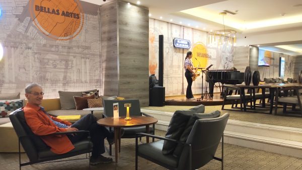
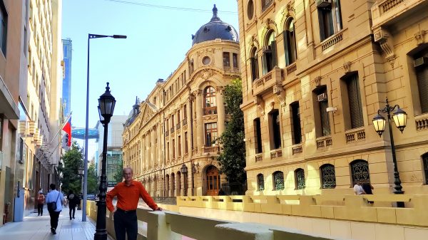
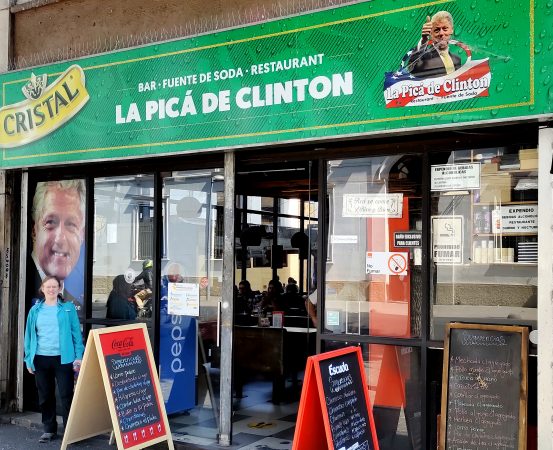
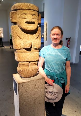
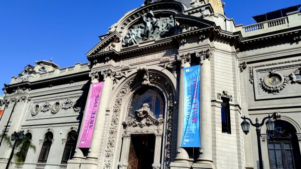
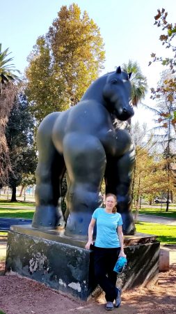
Le Meridien Hotel was the perfect place to relax after seeing the sights. Saxaphone and piano music with some wine and a buffet dinner in their Bar Latitude!Wonderful historic building in Santiago like the Bolsa de Comercia.The Mercado Central was designed by Gustave Eiffel.History from 1998 at La Pica de Clinton! Lets stop in for a Cola.We learn of all the ancient cultures and their art at Museo Chileno de Arte Precolombino.Another beautiful Beaux-Arts building housing the Museo Nacional de Belles Artes.A Caballo by Fernando Botero! We have enjoyed our South American experience here in the capital of Chile.
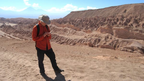
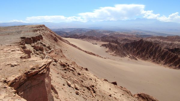
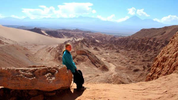
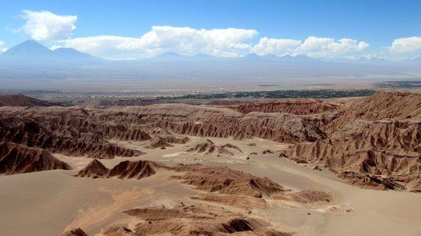
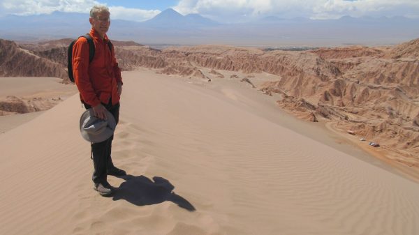
Where are you taking us this time?They call this Valle de la Muerte. Death Valley?Well it is pretty hot but I will enjoy the red rocks and the sand dunes.Really this was a misunderstood hearing of Marte (Mars). NASA has tested their Mars rovers here.We just climb down this dune to the car! You see it down in the lower right…way down there. Another successful navigation….