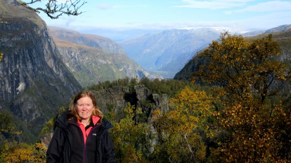
We headed up the nearby valley to Kals/Berg for a full day of hiking in the Hohe-Tauern-National Park.We are going to hike the Kodnitztal towards Grossglockner – that magnificent peak in the background, which is the highest in Austria- 3.798 meters.There is fresh snow on the peaks! It is so beautiful and we feel so lucky to be enjoying such fabulous views!The clouds are moving in so this might be our last view of Grossglockner – but we are sure there is much to enjoy here.These are the big five wildlife that live here – maybe we will be lucky to see some natives: golden eagle, chamois, marmot, ibex, bearded vulture.After a little over an hour hike up and up, we arrive at Lucknerhütte. Cappuccinos and apple strudels with vanilla sauce were enjoyed by us on this outdoor deck. We could get used to this kind of hiking amenity.We continued further up the trail to enjoy the autumn splendor.We crossed the stream several times.We saw quite a few marmots, busily eating to prepare for winter. They are very fast, a bit shy, and scurry amongst the boulders. But this one was so busy eating he could not be bothered with a photographer.The geography and rock outcroppings were really accentuated with the early snowfall.We especially enjoyed this rock face that kept us company.Would you look at that?!!!!This is a view back at the valley and the 3,050 foot elevation we have gained hiking up. Wow. Very glad we still have it in us to do this hike!The mountains and clouds have played hide and seek but we end our 5 hour, six+ mile hike with full satisfaction. An immensely enjoyable day.We have good memories of visiting Grossglockner! FABULOUS!!!
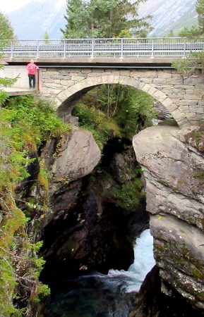
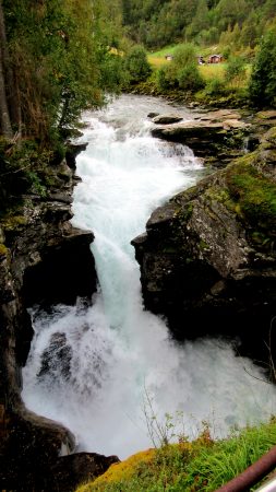
Our mountain view apartment in Matrei was very spacious, had nice views of the town in the Isel river valley, including from our balcony.We enjoyed walking the town and visiting the Hohe Tauern National Park museum.One of the walks we did on our no-drive day was above the apartment to enjoy the entire valley of Matrei.The Isel is the longest free flowing glacial river in the entire Alps!Upstream we walked into Hohe Tauern NP to hike the NaturKraftWeg Umbalfälle .The hiking path follows this exuberant water to the glacial source but we only followed it for an hour or so from the end of the road.This is a tributary with a nice bridge near the confluence with the Isel.We enjoyed the wildness of the river, the carved rocks, and the vegetation. This is the Umbalfälle, the Umbal falls.And what do you know – there is a hütte with some hot soup for us! Goulash stew and Tyrolean Knodel Soup, which is a bread dumpling ball of goodness.
The Hills are Alive! We are on the ‘SOM’ WanderWeg (hiking trail) to the alpine meadow above Werfen, Austria where one of the movie scenes was filmed.La – a note to follow so…”Do Re Mi… in case you forgot the lyrics!…a long long way to run…Could it be Maria singing “The hills fill my heart with the sound of music…”?And Clint Eastwood used the Hohenwerfen Castle in the background for his movie “Where Eagles Dare”.
We headed high above the morning clouds on a beautiful day.Breathtaking!Looking down on the valley of the Salzach river and the town of Werfen, Austria.We have hiked up, then taken a steep Gondola ride – still a bit more climbing to reach the Eisriesenwelt Ice Cave.Heading into the World’s Largest Ice Cave! A first for us.There is still a lot more climbing once inside – we carry gas lanterns to light the way.Ice formations! Some with special added lights at key locations.Scenic!Artistic!Mesmerizing — nature at it’s finest! Here is more geology science –After an hour and half or so, it is time to exit this special ice wonderland.To the historic Dr Oedl Schutzhaus restaurant at the top of the gondola.We enjoyed a delicious hot bowl of goulash soup.With the same view as the birds.
Our first view of the Alps! We flew into Munich and drove a few hours south to Anger, Germany.Our first home – Staufen-Chalet Hochreit. We have the deluxe one bedroom apartment with a personal infrared sauna.The view from our window at sunrise.The view as we leave in the morning, looking towards the south.Who wouldn’t want this scenery on your commute?Almbach Gorge is nearby and our first day calls for a leisurely 7-kilometer hike with a 1,000 foot climb.Water is a beautiful color. The trail is fun with lots of bridges and catwalks.At bridge #19 is the high Sulzer waterfall and where we took a trail up, above the canyon.We climbed the trail to the Mesnerwirt Chapel, near Ettenberg, and ate our picnic lunch enjoying the view! Alltrails linkA final moment of enjoyment of this alpine view before heading down to our car.
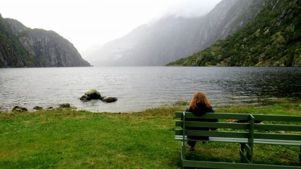
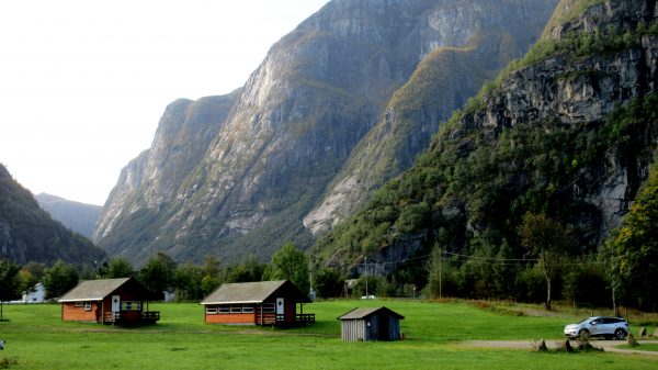
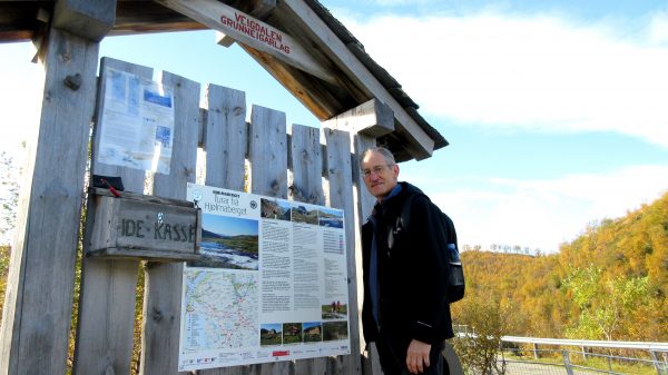
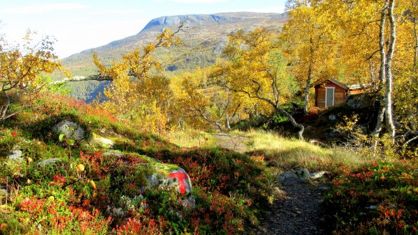
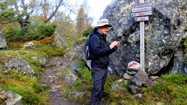
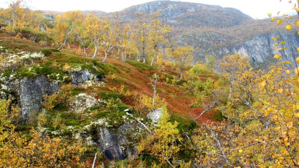
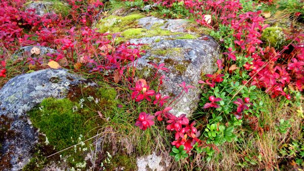
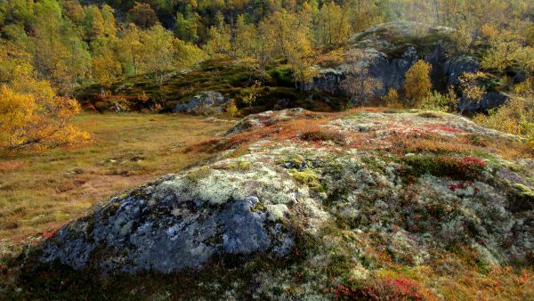
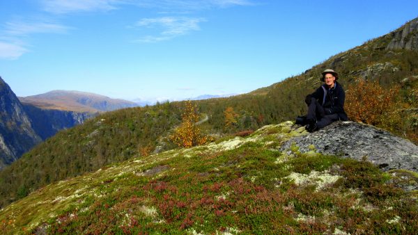
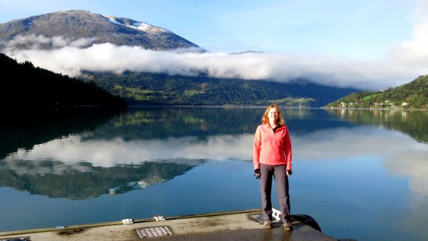
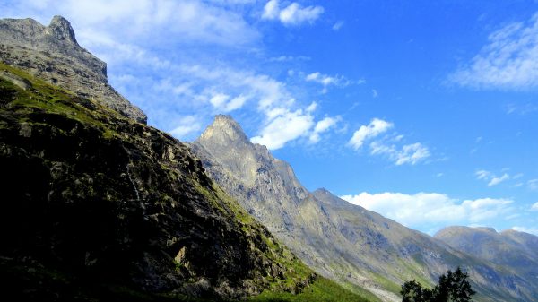
Saebo Camping on Eidfjordvotnet is a perfect spot to watch the world go by!Our Saebo Camping Cabin is the larger one in the center.It is very close to Hardangervidda National Park.The trail we took is well marked with red ‘T’. There were some cabins here – how fun that would be to hike to this spot for the night.Getting us located on Locus Maps. This app has been so helpful in all our navigation. We loaded all of Norway for free.Great views!Great fall colors!Detail of those wonderful colors and textures.Amazing variety of lichens and moss.Even a comfy rock for a picnic lunch!And back to Saebo Camp to enjoy the fjord lake: Deep breath. Exhale. All is well.
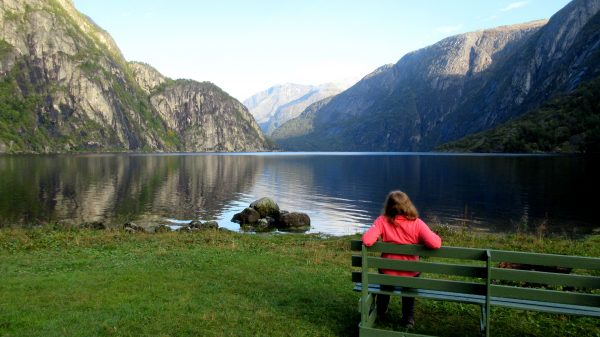
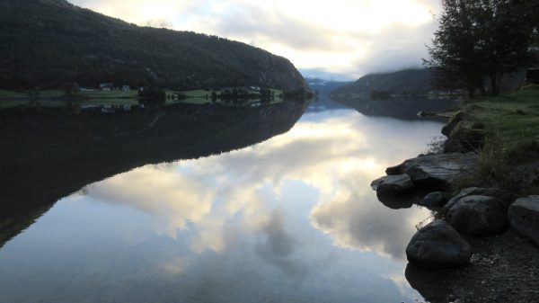
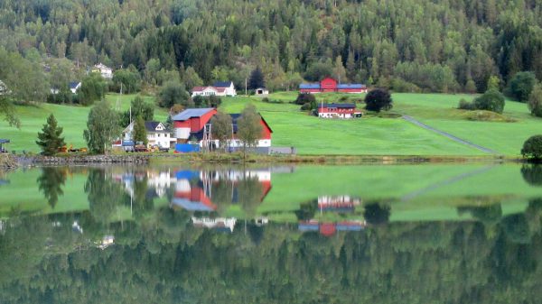
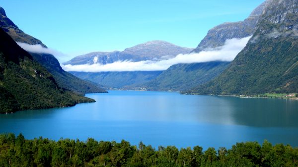
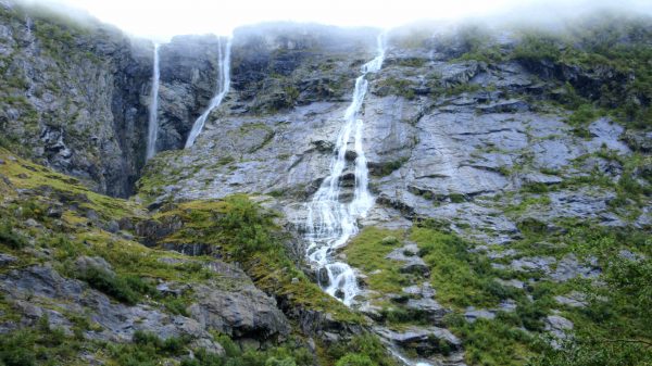
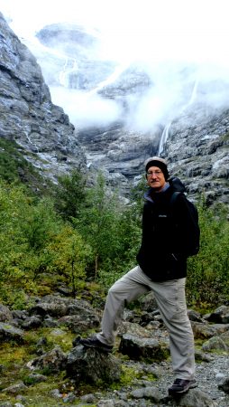
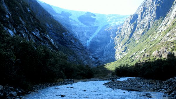
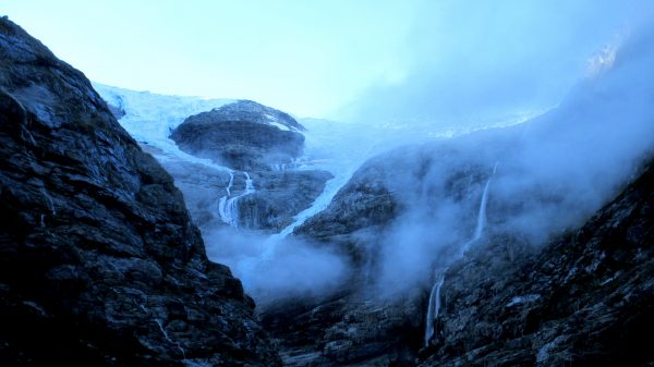
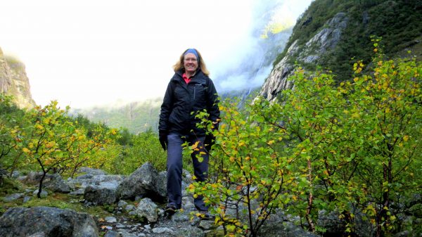
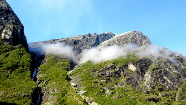
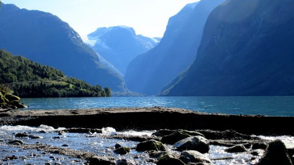
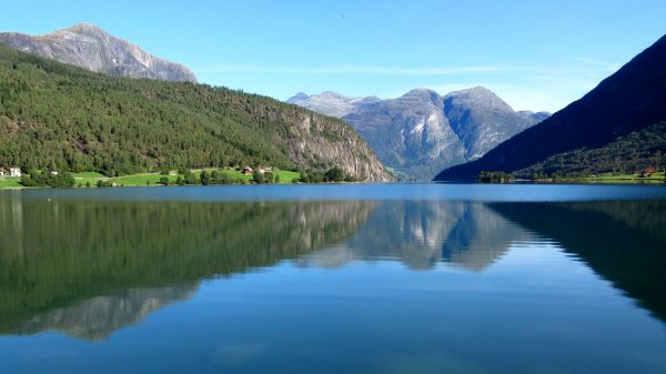
We took our coffee from our cabin at Mindresunde Camping to the shore of Lake Strynevatnet as the morning was so calm,This is the farm across from our cabin reflected on Lake Strynevatnet.We drove through Loen and loved the valley clouds over the Innvik Fjord.Possibly the same cloud has now settled over Lovatnet Lake. Amazing color of the glacier melt water as it reflects the sky on this crisp September morning. We are repeating our route from yesterday as the forecast is to be sunny today.However, there is a low cloud at the end of the road near Kjenndalsbreen Glacier. These waterfalls seem to fall right from the cloud.The sun might break through so we can see the Kjenndalsbreen Glacier.The Kjenndalsbreen Glacier is a branch of the Jostedalsbreen glacier, the largest glacier on the European mainland.Ice and water and rocks: Carving the land with their power.The sun finally illuminates the Kjenndalsbreen Glacier. The ice looks so blue because it absorbs more red and yellow light and allows more blue light to pass through. This is more noticeable on large blocks of ice like a glacier.The lush green landscape on our hike at the base of the Glacier.The green is so green. The color of the moss is so vivid. Quite a feast for the eyes!We enjoyed the sunny day with a picnic along Lovatnet Lake looking back at Kjenndalsbreen Glacier.And back at “our” Lake Strynevatnet we soaked up some rays, appreciated the clear skies and the wonderful reflections.
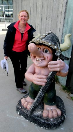
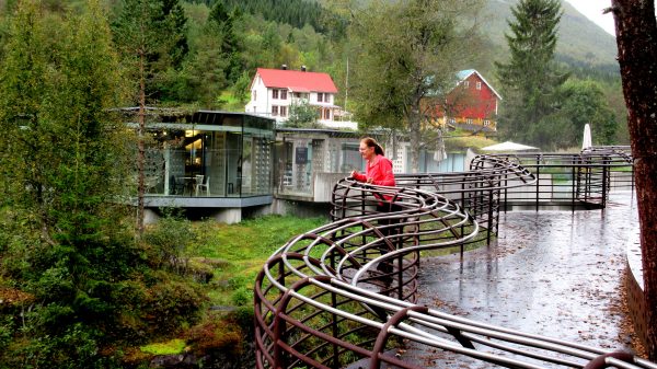
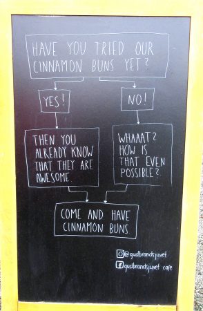
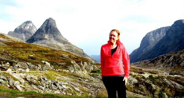
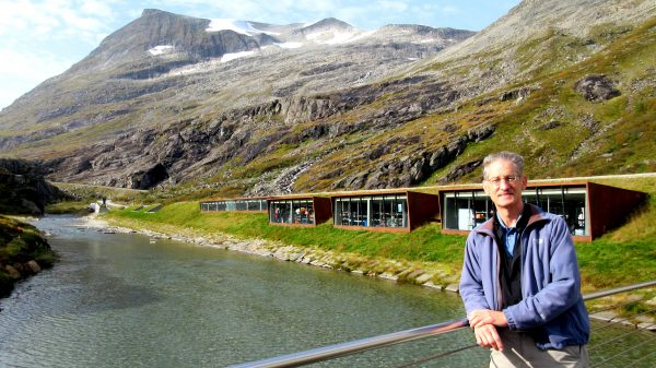
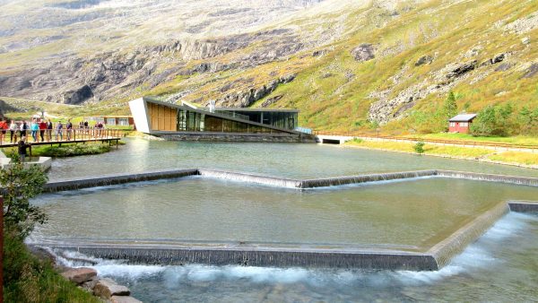
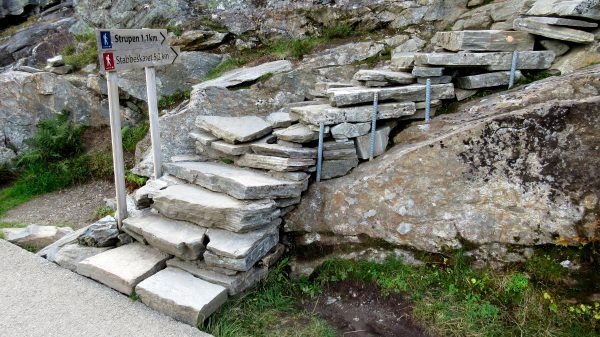
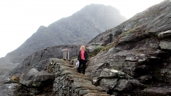
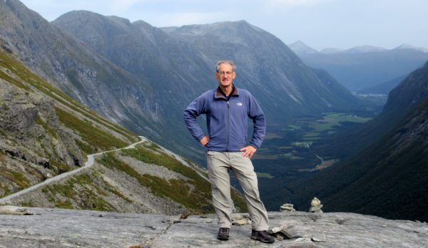
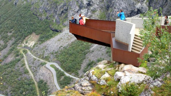
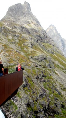
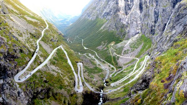
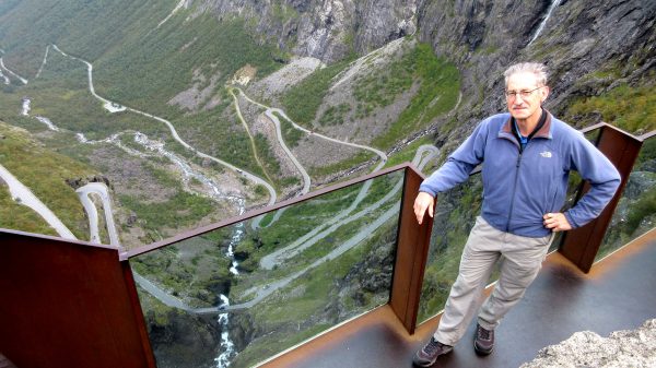
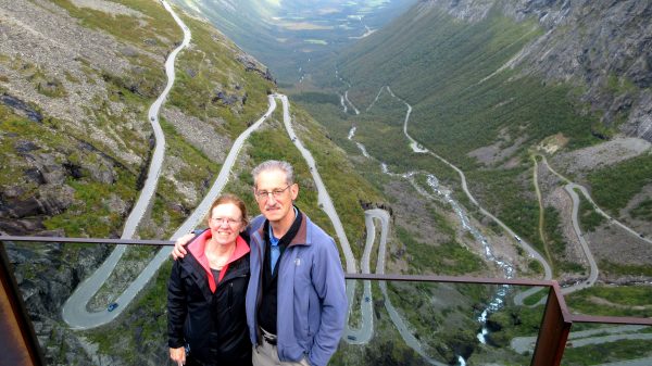
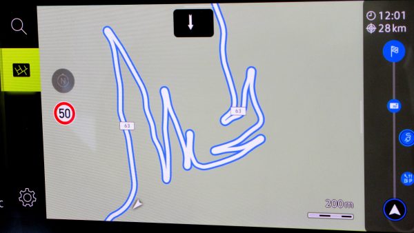
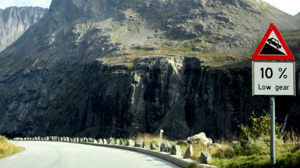
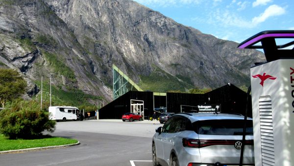
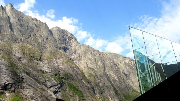
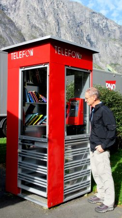
As Norse legend tells it, the first rays of sunlight can turn the mythical trolls into stone (if they don’t hide in time!) so we will explore where trolls have been in the mountains.Our first stop was at the Gudbrandsjuvet Gorge.The Valldøla River has cut large potholes and intricate formations into the rock.Another interesting viewing area with fun art/architecture to experience the Gudbrandsjuvet Gorge.Sign outside the Gudbrandsjuvet: the cinnamon buns were awesome! Still warm from the oven they fortified us for the troll search.From the Trollstigen plateau, rising above the Isterdalen Valley are the three peaks: Bishop, King, Queen (Bispen, Kongen, Dronninga). which led us to debate if the bishop or queen had the most power…We passed over the glacial moraines with some snow still left in the upper valleys (where the trolls live?). We arrived at the Trollstigen Visitor Center.The Trollstigen cafe is undergoing repairs from an avalanche this winter but we could still appreciate the design and the location.We followed the water cascading to the first Viewpoint.We detoured from the paved path to follow these Sherpa stairs 1km for a private view point.What a stairmaster!Great view of the valley!And we were able to see the next cantilevered Trollstigen Viewpoint.And a take my picture balcony with The Bishop and The Queen.The Trolls Ladder (mostly one-lane) was completed in 1936 after 8 years – an engineering marvel. Imagine working in this valley carved out by the glacier, roaring rivers and multiple waterfalls!A better view of the waterfall through the vertigo inducing glass railing.An offer to take our picture resulted in this fun shot pointing to the future!Our GPS pretty much shows the same curves we have just photographed on this one-lane road. We are here in the morning so have missed dodging the tour buses.Ready or Not. We will probably regenerate many kilometers on the battery of our EV.At the end of the valley is another Troll spot: Trollveggen Visitor Center. We recharged the car while we ate a picnic lunch in this beautiful setting (cafe closed for the season).Europe’s highest vertical mountain wall has several climbing routes.We could browse for a book in this converted telephone booth lending library.Ramsdalen Valley: the route following the River Rauma has been named Europe’s most beautiful railway line. Filmed around here is the latest Mission: Impossible – Dead Reckoning – Part One