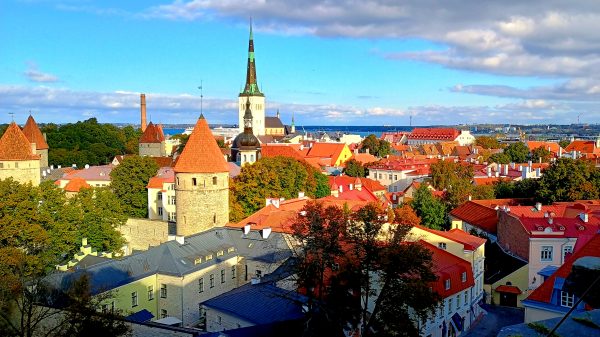
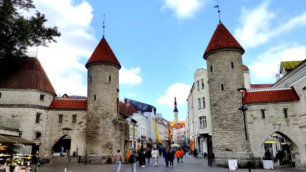
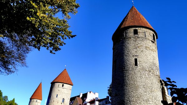
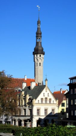
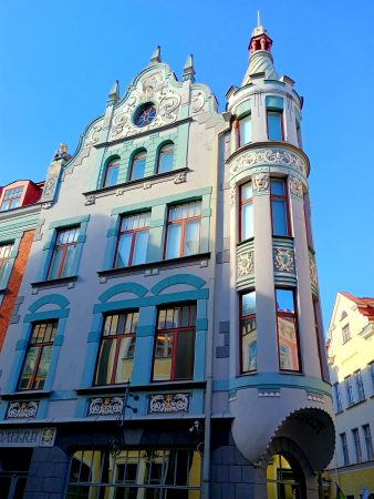
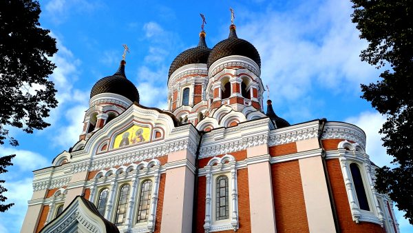
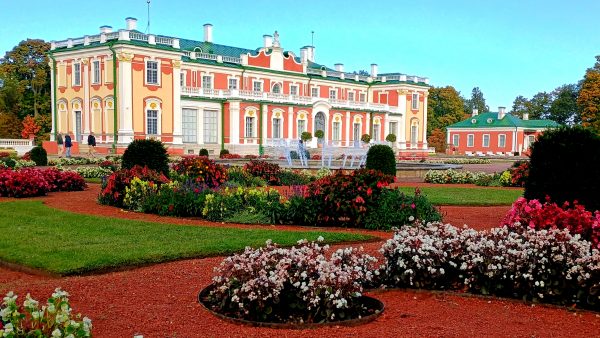
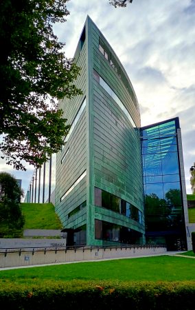
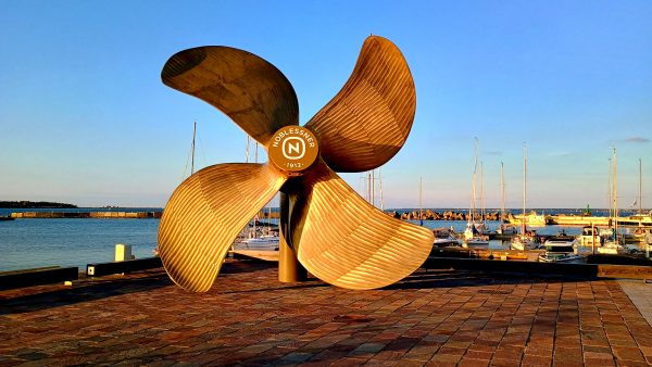
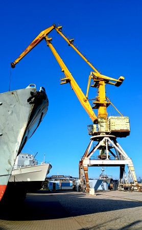
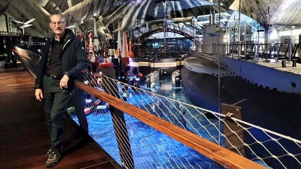
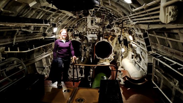
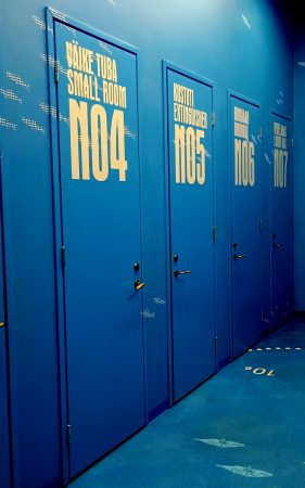
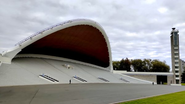
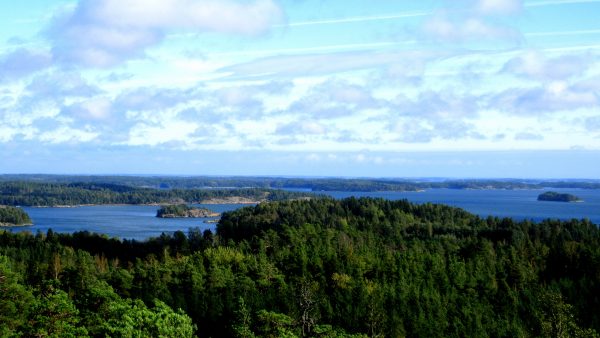
Tallinn! This is a view from upper Old-Town UNESCO world heritage area, looking out to the harbor of the Gulf of Finland – Baltic Sea. Estonia has a long and complicated history but this is a positive time to be visiting the capital city.Medieval defense towers and walls surrounded the city. In 1285, Tallinn, then known more widely as Reval, became the northernmost member of the Hanseatic League –- a mercantile and military alliance of German-dominated cities in Northern Europe. We visited their buildings in Bergen, Norway — another UNESCO protected area.There were 66 of these towers – peaceful today to enjoy in the sunshine.The highest steeple is Church of the Holy Ghost, officially from 1319, in the cobblestoned streets of Old Town.Wandering the streets we loved this Art Nouveau building in Old-Town: Reichmann House, 1909. Estonia at this time was an outpost of the Tsarist Russian Empire.The Alexander Nevsky Cathedral is a very Russian building, 1894. This Eastern Orthodox cathedral is in center of upper Old Town and appreciated by tourists, if not all the locals.The summer Kadriorg Palace of Czarina Catherine and Peter the Great, 1718. Estonia is where the Russians with means liked to spend their summers. There are a lot of manor estates in the surrounding countryside.We visited the architectural museum and learned more about this unique building with much of it underground. KUMU-Art-MuseumWe stayed near this part of the Seafront in the Noblessner neighborhood. It is a renovated and revitalized sea harbor area. The history dates back to 1912 when Emanuel Nobel (nephew of Alfred Nobel) and Arthur Lessner founded the Russian Empire’s most important submarine factory, which built a total of 12 here. An order for an additional 20 never got made due to the 1917 October Revolution.Lots of big ships you can tour. Dominated by this fun crane! Maybe for putting submarines in the water…probably only yellow submarines!The formal Seaplane Harbor Hanger has been fully rehabilitated and now is a fabulous Museum. You enter the mid level which is the water line so to speak, then above is the sea planes with military history, and below is the submarine, archeology finds and history areas.Hunt for Red October! Inside the 1936 Lembit submarine. I will never complain about a bed again — maybe……Even the bathroom was fun as underwater submarine marked doors like Extinguisher N05.Had to visit the Song Festival Grounds. In 1988 300,000 gathered here — one-third of the population — using song to demand their independence. The next year while holding hands a human “Baltic Chain” stretched 360 miles from Tallinn to Vilnius in Lithuania. The Estonians fought for their independence and their continued development in their country shows their pride.
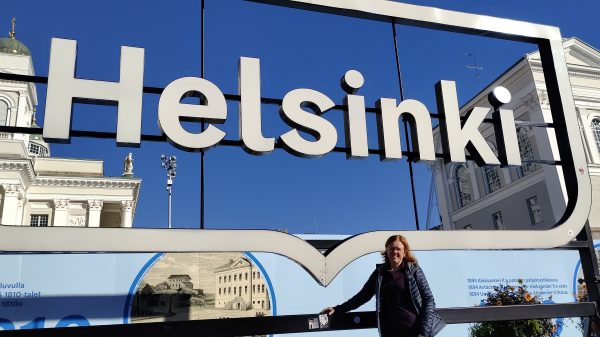
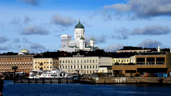
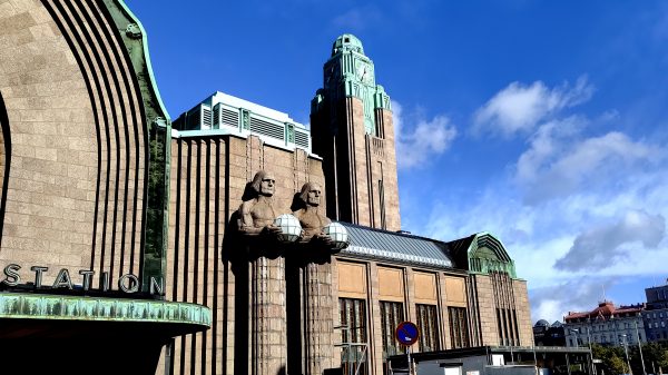
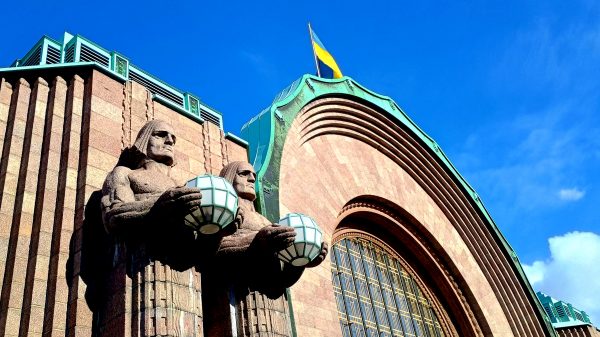
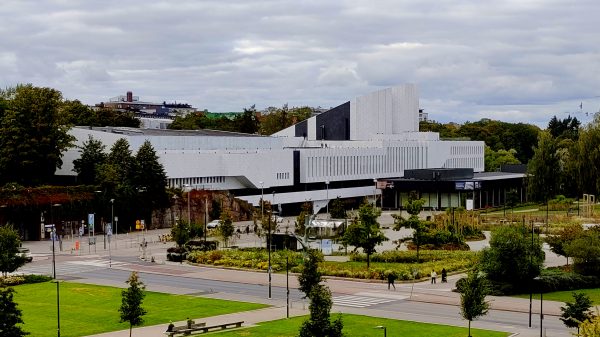
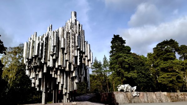
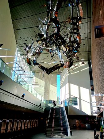
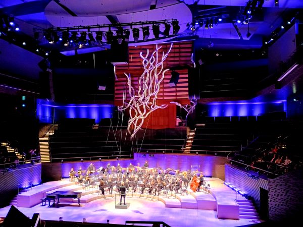
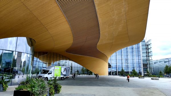
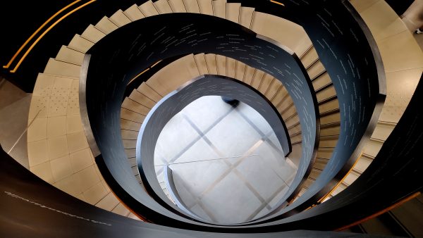
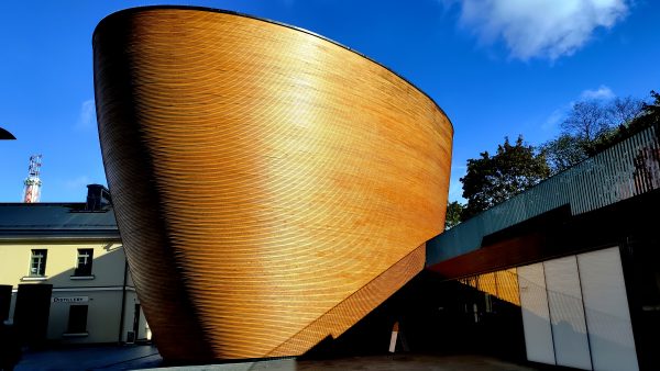
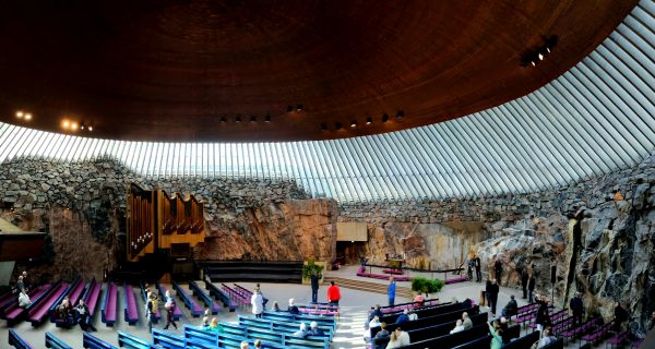
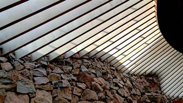
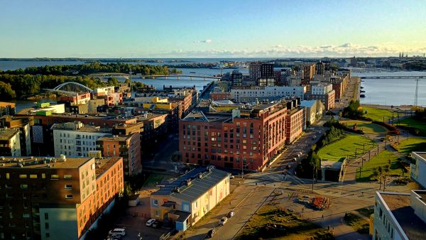
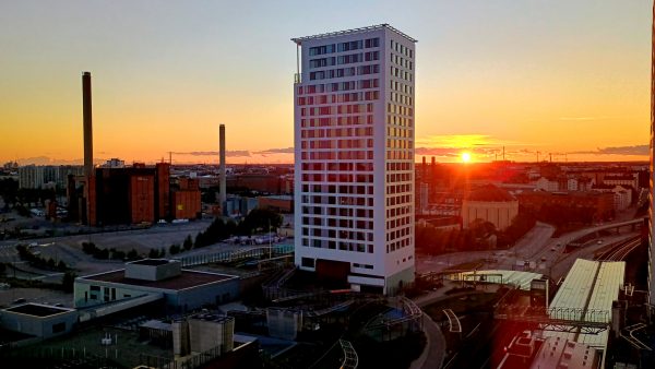
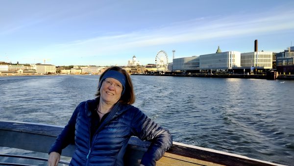
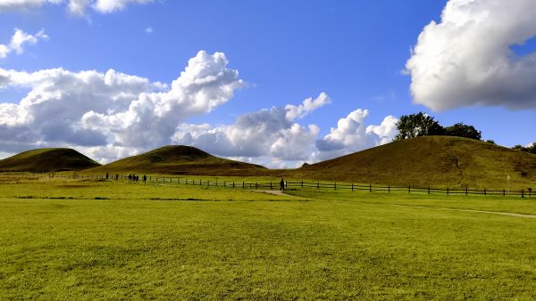
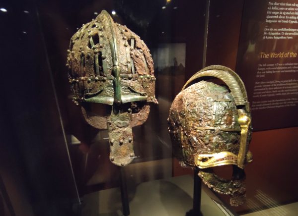
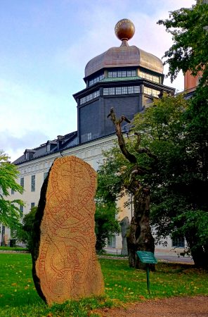
Welcome to Helsinki! We are looking forward to experiencing some of Finland’s great architecture and design.Lutheran Cathedral is a prominent landmark. Completed in 1852, it is one of several Carl Ludvig Engel’s architectural masterpieces — German architect hired by Russian czar Alexander I to master-plan Helsinki.We arrived by train (from Turku) to Helsinki’s main station designed by Eliel Saarinen, 1912. Very cool clock tower!‘The Lantern Bearers’ stand proud on either side – designed by Finnish sculptor, Emil Wikström.Finlandia! A great exhibit inside about Alvar Aalto and modernism. Clad in white marble it is a stunning building.The composer, Jean Sibelius wrote the famous symphony Finlandia. This is a fun monument to him and his “love of music” — 600 stainless steel pipes!Standing underneath the forest of pipe organs is interesting. You can hear the wind play the pipes.Helsinki Music Center, 2011, is another fun building and also houses the Sibelius Academy, one of the largest music academies in Europe. It provides the highest level of music education in Finland.We were lucky enough to get tickets for one of their Wind Symphony Concerts. Many great conductors around the world come out of this academy. The metal flame looking sculpture above the Orchestra is the new 2024 Concert Organ — largest in the world and great looking also.Also nearby is the Oodi Library, 2018, which has really fun architecture and a great space to loiter — which is encourage.The unique spiral stair inside lists all the types of people the library caters to — including tourists!Kamppi chapel of silence, 2012 — or is that ‘The Cone of Silence’ — is a little architectural gem in the middle of busy-ness to contemplate some quietness.Temppeliakio Rock Church, 1969, was a unique experience. The circular ceiling dome is 13 miles of copper ribbon coiled. Panarama of the half the round sanctuary that is carved into the bedrock.Rock meets glass and metal detail – Temppeliaukio Rock ChurchWe had a great apartment at the Kalasaastama metro stop. This is the view from the rooftop 30th floor common party deck.It is one of 5 high rises in a development built around 2010 — it overlooks the soon to be completed longest bridge in Finland. Watching the sunset from our 15th floor balcony over the shortest tower.Leaving Helsinki, we cruised 50 miles of the Baltic Sea to Estonia.
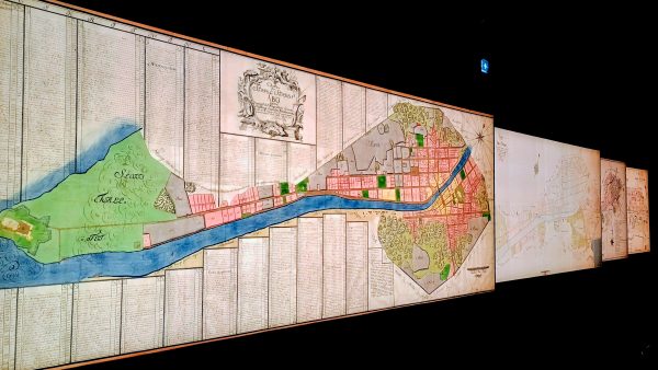
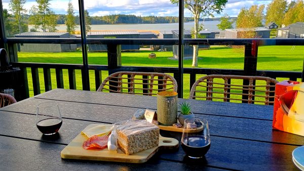
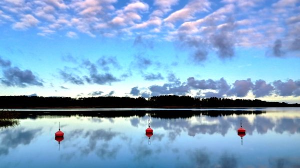
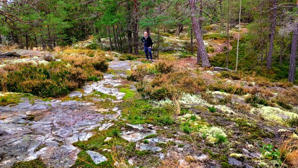
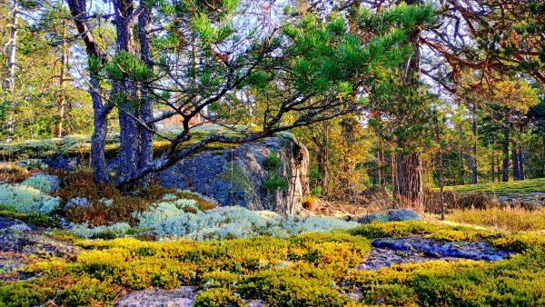
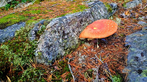
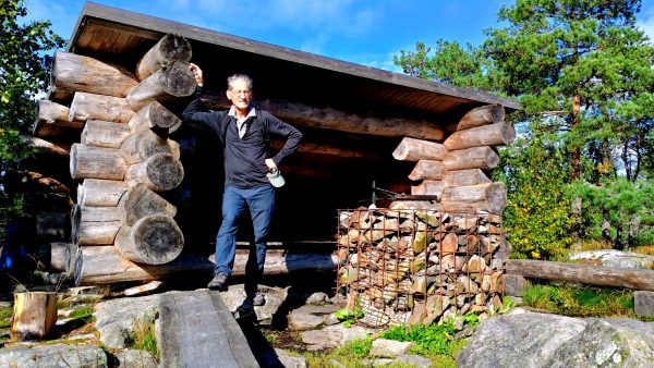
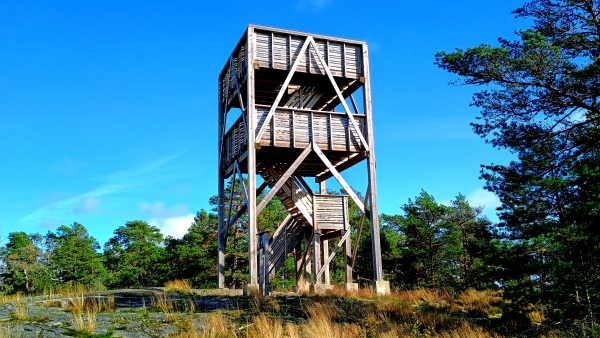
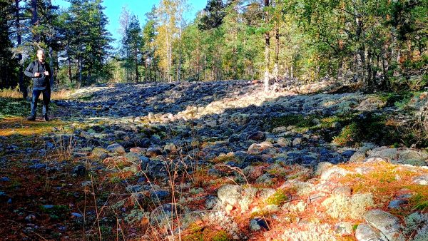
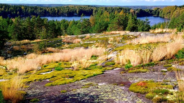
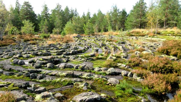
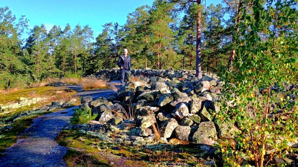
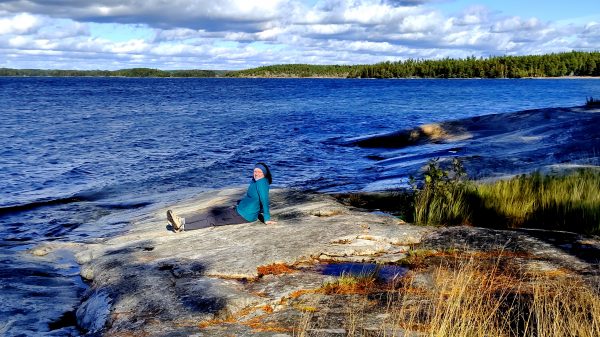
Finland! From the ferry dock in Turku, we had an early morning stroll along the Aura River until we found some coffee and pastry!The Aboa Vetus (old city)Archeology Museum had huge maps of Turku’s development as well as medieval foundations discovered when building the museum. Turku has history dating from 1229 and was rebuilt after a huge fire in 1827.An hours drive in our rental car brought us into the archipelago and on the second largest Finnish island of Kimitoon. We are staying in Villa Eden for a week, next to the Merikruunu Hotel. A beautiful retreat with its own sauna and hot tub – we are ready for some tranquility.Our first morning we walked to the water…Nice!!! Norrfjärden is this inlet of the Baltic Sea.Hiking the Senatsberget trail near Dalsbruk. Our breath is taken away by the beautiful mosses, lichens, and heath on the exposed bedrock……Minature gardens……And lots of varieties of mushrooms. More than we can ever remember seeing.This area is full of ferns. But all the forests seem to us to not have a shrub (mid) layer. and the tree trunks are very straight with not many lower branches. Instead they reach for the sky.Finland hikes have strategic shelters to gather with your friends and family.Senatsberget has a real lookout tower to get a birds eye view……Of the nearby Archipelago. Feeling lucky to have such good hiking days to appreciate returning to our sauna. Very Finnish!Teijo National Park had this Jeturkasti Trail. We are standing on an ancient glacial lake shore from 9,000 BCE. There are allegedly quite a lot of these in Finland, and they have circle depressions created by our early ancestors for cold food storage.After coffee at the Nature Center, we drove to the Sahajarvi Trail in Teijo National Park. A kilometer in, we had a hand ferry to get us to a picturesque island……Perfect rock for a picnic lunch.Also in Teijo National Park-, the Nikkallio overlook — on our third hike of the day — gave us more amazing moss on bedrock with a view of the lake Hamarinjarvi.Another morning we headed to near by Vastanfjard to check out a Labyrinth – or a Nordic Maiden’s Dance Site. This was built in 1910 — potentially on a site of a more ancient one. We enjoyed walking it, looking at the moss, thinking about the rituals, and the quietness of the dawn.Sammallahdenmaki UNESCO bronze age burial site near Rauma. This was a very interesting park with great signage explaining the importance of these archeological finds.More bedrock with glacial striations! Mesmerized by the Baltic Sea and Archipelago National Park from nearby Sandon Beach.
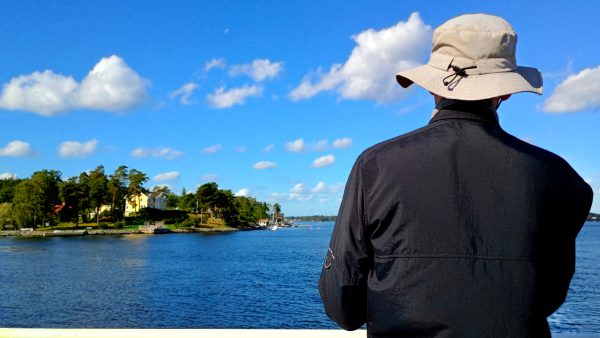
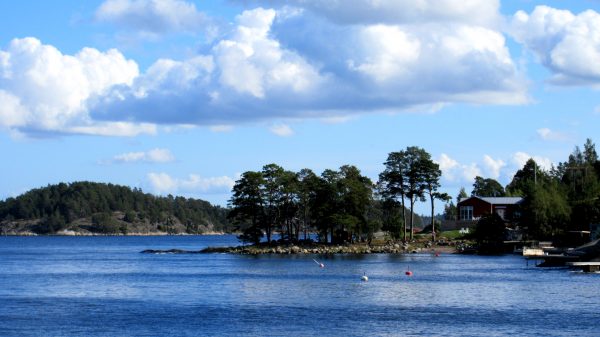
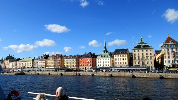
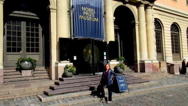
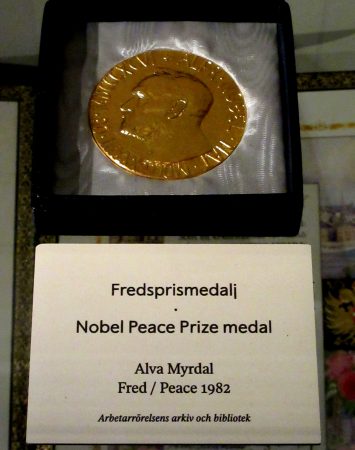
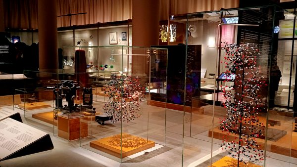
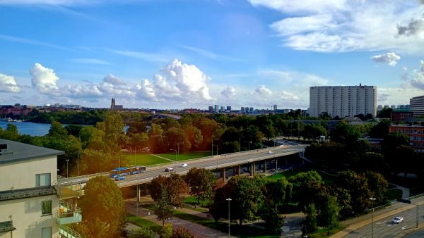
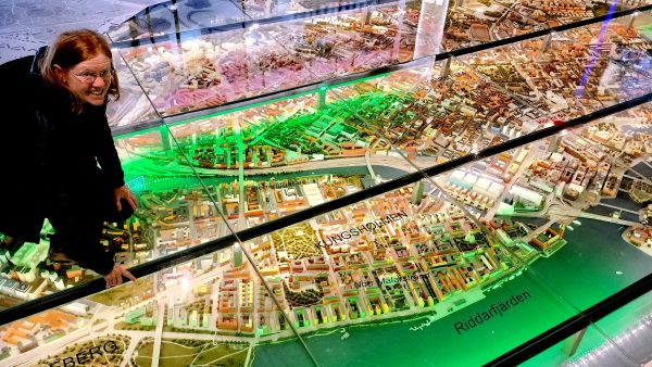
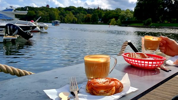
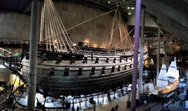
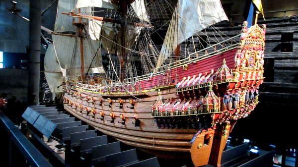
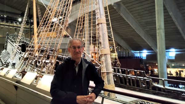
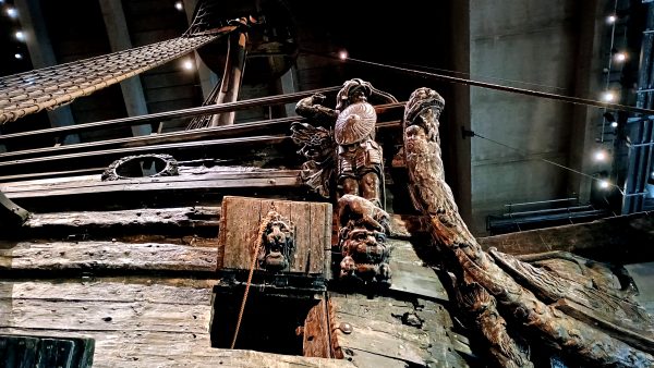
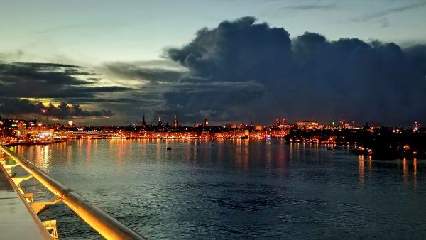
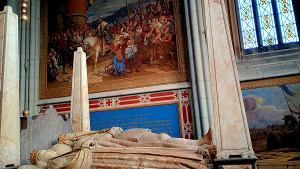
A beautiful blue day to explore the Stockholm Archipelago! We cruised beyond the city and viewed the vacation homes, quiet coves, rocky outcroppings, and others out enjoying the day on their boatOur ferry stopped at 4-Brygga (piers) serving small communities but we decided to just go along for the ride and not get off.We returned to Gamla Stan, the old section of town, with many wonderful buildings including the royal palace.We enjoyed the very good Nobel Prize Museum, where artifacts and information highlight many of the achievements that were awarded.Alva Myrdal was born in Uppsala, Sweden. She co-won this medal for all her global efforts to lead to nuclear disarmament: The nuclear race was a major concern, and she fought for nuclear weapons-free zones in Europe. The world needed that in 1982 — and still does today!There are 5 types of medals awarded: Peace, Medicine, Literature, Physics, Chemistry. In 1895, Alfred Nobel stated in his will that the returns on his capital were to be distributed annually as prizes to those who have “conferred the greatest benefit to mankind”.Since 1943, IKEA creations have helped make everyday life better for many people — spreading the “Flat Pack” and common sense from Sweden to around the world.We stayed a bit out of the center in a quiet Marriott Courtyard Hotel, enjoying this view from our room.The bridge we could see, Riddarfjardens Vasterbron, from our walk thru the park from dinner at an Italian restaurant – on the way to Ralambshovs Parken next to our hotel.Pointing at our hotel on the Stockholm City Model — a pleasant 20 minute walk to city center. Or we became masters of the SL transportation system with trains, subway (t-ban), trams, ferries, and buses! A great 7-day pass, well designed app, and we appreciated the value and convenience it added to our visit.Can’t beat this setting for FIKA! enjoying a great Cinnamon Bun with Cappuccino watching the local river traffic. Waffle cafe at the marina near Nobel Parken.We crossed over to another island which has the Vasa Museum. This masterpiece sunk on its maiden voyage on its way out of the harbour — it made 1500 meters before it sank!!! It was rediscovered and recovered 333 years later. With much archeology research and preservation, the museum has been hosting this well preserved ship since 1990.This is a model of what the warship looked like in 1628 when it sank. There is a lot of detail to the symbolism this ship represented. It was commissioned by King Gustavus Adlophus, who never got to see it — since he was off in Poland fighting a war against his cousin Sigismun.There are 64 guns on three levels, the ship is high at 172 feet, and too skinny which made it unstable with gusts of wind.The Vasa museum has exhibit on life in sailors in 1628, with types of food they ate, how it was salvaged, how it is preserved — really a detailed and interesting museum. click on the link to learn more.Stockholm sparkles as the sun fades — we’re on the overnight sailing to Turku, Finland on the Viking Line’s ferry ‘Glory’. We had great time and weather exploring Sweden.
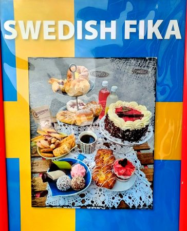
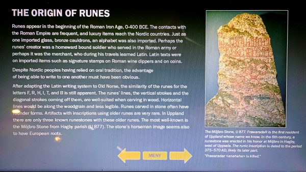
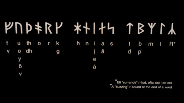
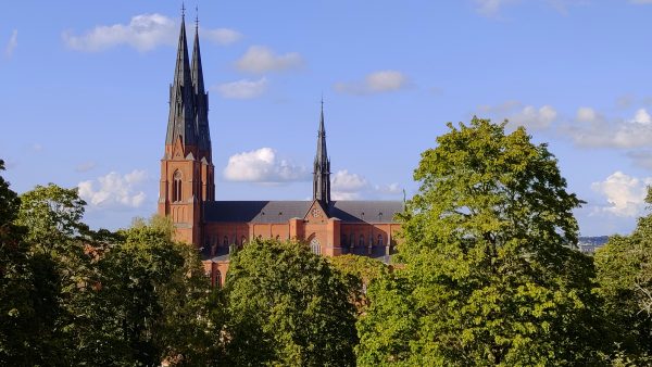
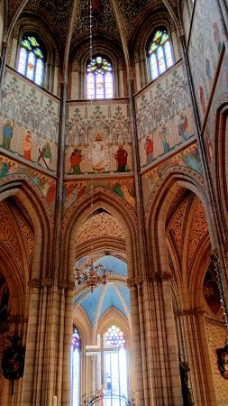
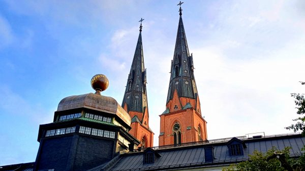
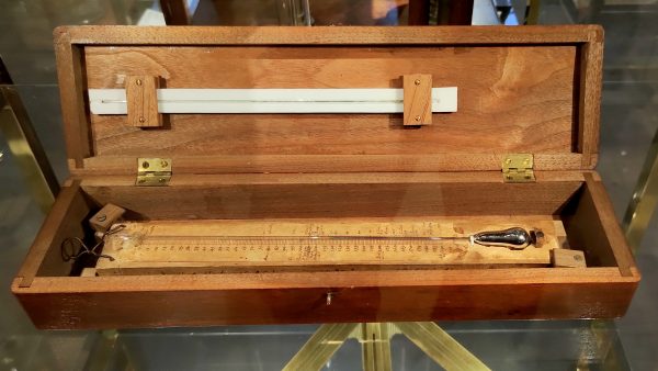
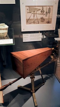
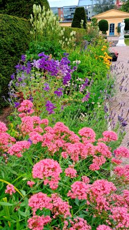
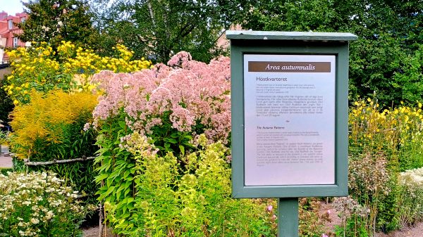
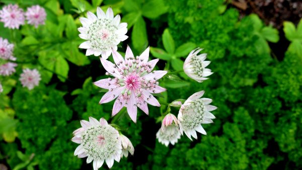
Welcome to Sweden – the land of FIKA! Used as both a noun and a verb, fika is a Swedish institution–coffee with a snack. The word fika is an inverted form of “kaffi,” the 19th-century Swedish word for “coffee — their adaptation since coffee was banned five times between 1756 and 1817. Well the tradition has persisted.Gamla Uppsala had mound builders! The Viking used to sail directly here 1500 years ago when the Baltic Sea was higher and this was the center of their world. There was even a “ting” here — the site of the annual political assembly of all the tribes — where laws were passed.Some amazing items found in the unlooted, un-cremated viking grave mounds like these intricate helmets. The leaders were buried in their boats with their horses amongst many treasures.Gamla Uppsala was also the center of all the pagan Swedish kingdoms. All these kingdoms came together 1,000 years ago and also became Christianized here.The Gustavianum — the university museum — holds these treasures and has a garden full of Rune stones found there — an ancient burial site.We learned a lot about Rune Stones that we found interesting. Old Norse language is based on Latin, and Runes started appearing around 400 BCE, in the Roman Iron Age. This county in Sweden has the most amount of Runes, which are being documented and maintained.The alphabet for the Rune is simplified into these symbols. Can you write your name?Uppsala has a very visible Cathedral, one of Scandinavian’s largest and most historic, completed in 1435.Gorgeous gothic architecture and murals in the longest nave in Scandinavia!King Gustav Vasa brought the Reformation to Sweden in 1527 so got the prized chapel space. In the tomb sculpture, he is flanked by his two wives — the first died young but the Gustav wanted her next to him in the afterlife — and murals depicting his illustrious life.The dome on the Gustavianum is a sundial on the exterior, and inside is the anatomical theater. Plus a great museum that has other non-viking treasures……Like Anders Celsius’s Thermometer! What is special about this is that the numbers are flipped — in that water boiled at zero degrees, not 100. He later reversed the numbers. He was a colleague of……Carl Linneaus, also a professor here, who used this Microscope to come up with his formal classification system for naming plants and animals — that we still use today.We went over to Linnetradgarden, which is the oldest botanical garden in Sweden. It was founded in 1655 by Olof Rubeck the Elder, gutted by fire in 1702, reworked by Linneas according to his system for arranging plants.This is the Autumn Parterre, with imported plants from the state of Virginia. Many varieties of Rudbeckias – you might have some in your yard! Linneas named to honor Olof Rudbeck the Elder and the Younger.Just a beautiful flower in its prime! And a treat to be in the house — now museum — that Linneas lived and the garden he tended. Contemplating walking in the footsteps that were before us in Uppsala.
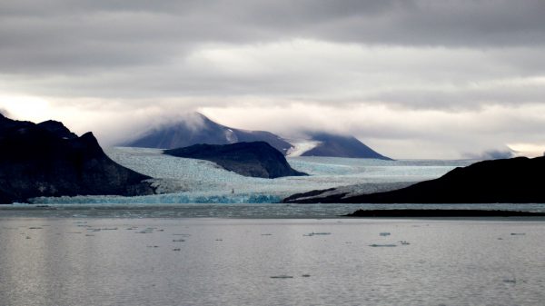
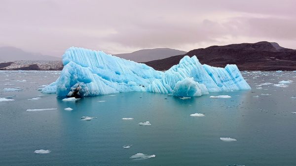
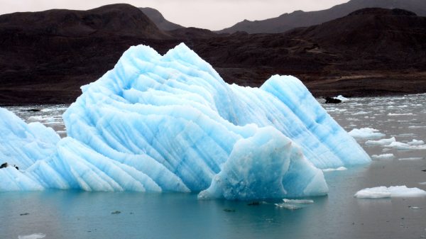
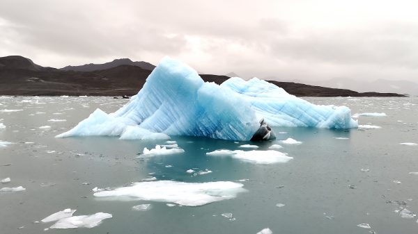
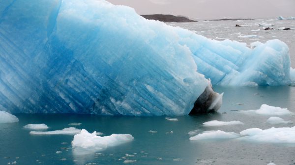
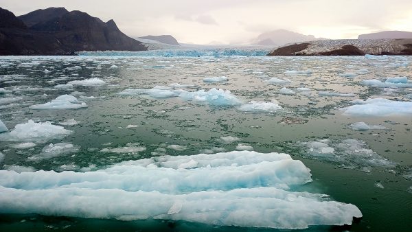
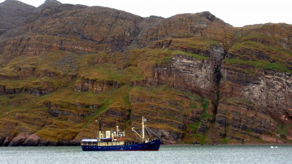
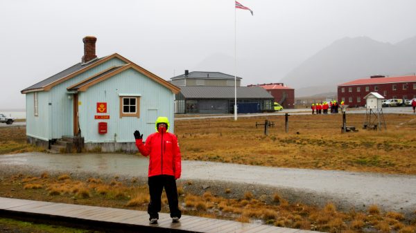
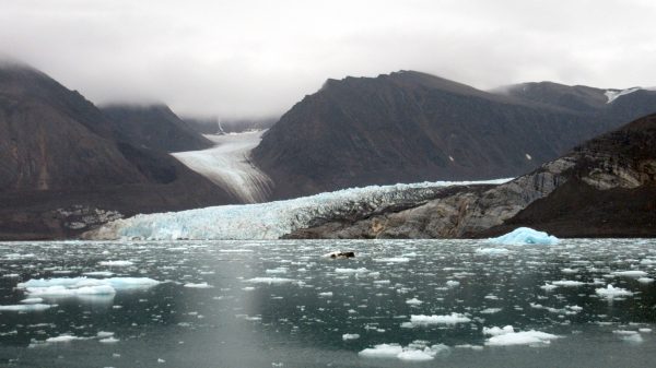
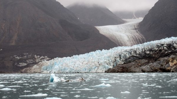
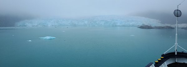
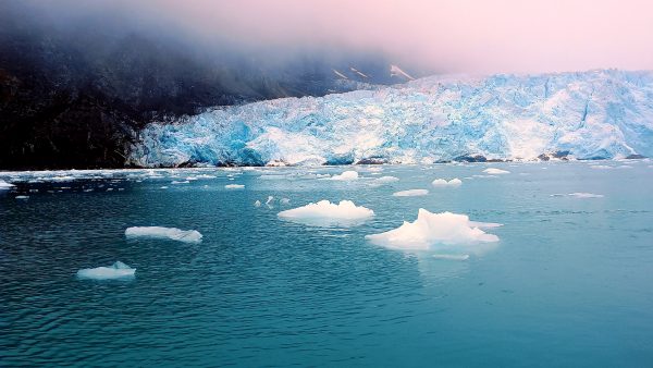
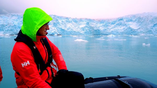
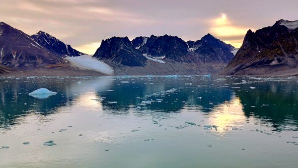
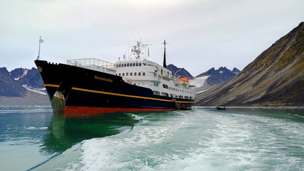
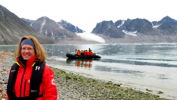
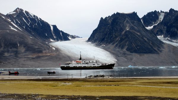
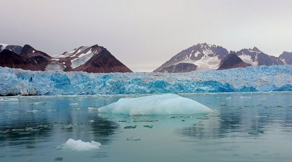
Another peaceful morning as we enter Kongsfjorden. However the weather is forecast to change so the ship can’t risk getting us all back safely from a shore excursion.So we get to spend our morning cruising Kongsfjorden looking for Icebergs!The fins and striations are really magnificent.as is the fun shape.and the intensity of the color.You could tell when we were getting near an active glacier calving with all the floating ice. KongsfjordenThis is a hillside which many birds nest. The other ship gives it some scale — and also kept us from getting closer. KongsfjordenA very rainy shore excursion to visit Ny-Alesund, but we still got to see the museum and monuments. This is the Worlds Most Northern Post Office.A memorial plaque in Ny-Alesund-for Amundsen-Ellsworh-Nobile Start of Transpolar Flight 1926. We had learned a lot about the details of this airship flight on our visit to the North Pole Expedition Museum in Longyearbyen.This is the mast that supported the airship Norge before it took off for its Transpolar Flight in 1926, landing in Alaska.The Kings glacier on Kings Fjord as the clouds close down on us, we are happy for some visibility!It has been a few days packed full of glaciers, smooth sailing, meeting new people over our meals while enjoying the views. Thank you to the guides for their enthusiasm and sharing the special places in Svalbard with us.
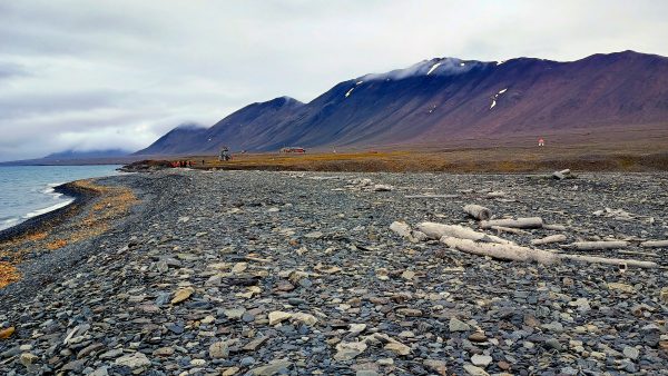
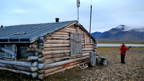
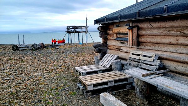
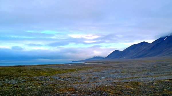
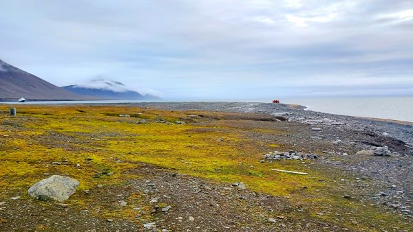
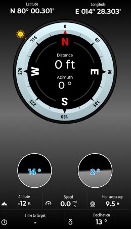
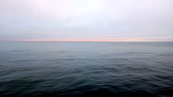
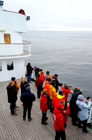
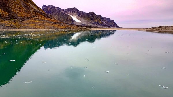
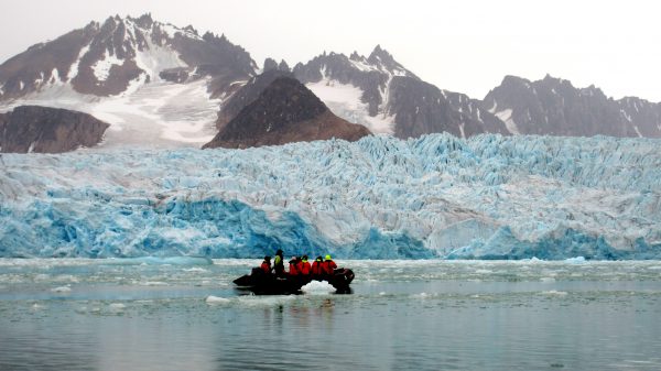
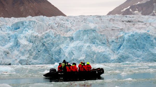
Early morning fog in Liefdefjorden (which means Love Fjord) at Monaco Glacier. It was so incredibly quiet and serene.After breakfast buffet, we went out exploring in the Rib Boats. Liefdefjorden, Monaco Glacier.Lots to study on the glacial edges while on a Rib Boat cruise — such interesting formations and layers of ice. Liefdefjorden, Monaco Glacier.On adjacent Woodfjorden, we had another shore expedition with our guides. Why is this called Wood Fjord when you see no forests? But see those logs on the beach……They were used to construct the Mushamna Cabin–a trapper cabin built more sturdy than most in around 1997. Trees logged in the Siberian Taiga are floated down rivers, but some get out of control and–instead of reaching their destination–end up in the Arctic Ocean. The ocean currents bring this drift wood to the coast of Svalbard where the storms wash them on shore.We liked the custom lounge chairs to catch some Midnight Sun! Beyond is the anti-bear storage on stilts and a Flintstone type of cart with wooden wheels. There’s also a sauna building, an outhouse, and a sled. Mushamna Cabin would be a nice place to hang out.And you have these views of Woodfjorden–lying beyond where we explored.And in the other direction is where we walked from our ship. Woodfjorden,Mushamna CabinNorth 80-degrees Crossing! GPS image from our Locus App. Download free map of region and use off line – we tracked the route as we sailed, as well as our on shore hikes.This is what the sea looked like at the North 80-degrees crossing. Can you believe how calm it is? Beautiful lighting – around 9PM in the evening. We’re only 690 miles (1,100 km) from the North Pole.We had a Champagne Celebration with everyone on deck. We were also very close to Moffen Island, where walrus could be watched with the binoculars.
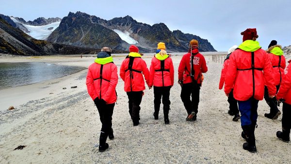
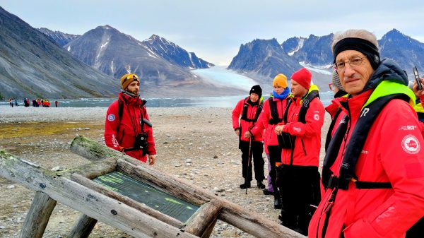
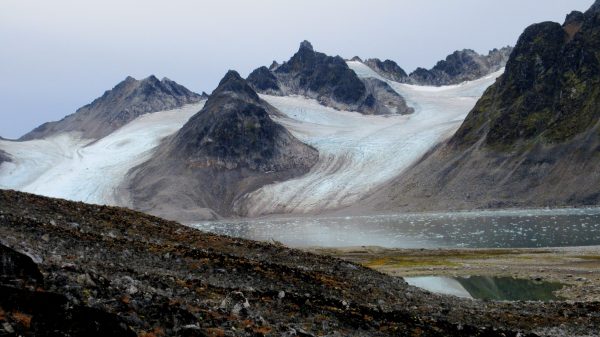
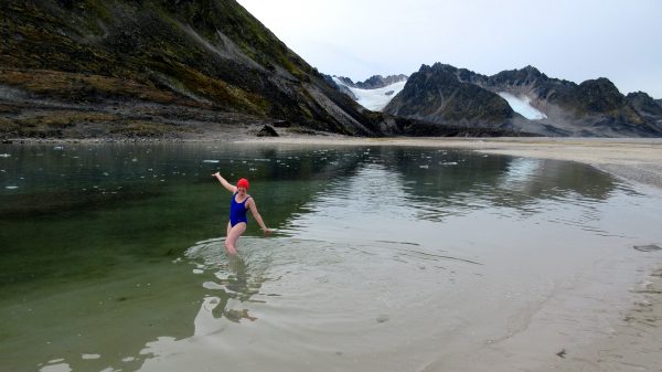
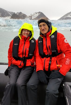
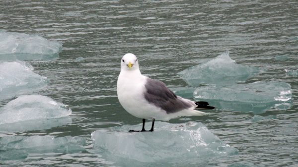
The serene beauty this morning of Magdalenefjorden!We are anchoring here in Trinty Harbor – picture postcard perfect!We are on the Rib Boat leaving our ship behind while we go on shore to explore.We are going to learn about the Whaling History in this region.We have to stay behind our guide and no more than 60′ away as part of polar bear awareness. In addition to our guides, there are several others stationed on watch.The Whaling Station Gravneset marker explains the remains of four blubber ovens or furnaces that have been found, as well as a graveyard containing about 130 graves dating from the 17th to the late 18th century.We walked as far as this overlook area to view this glacier and learn more about whaling.And then we got to take an Arctic Ocean Dip! The water was 4 degrees Celsius (that is about 39 Fahrenheit) so not freezing – technically. We received a certificate declaring us a real polar bear for braving the ice cold waves of the arctic sea – but you can see it was as calm as a bath.And the ship awaits with a warm shower.After lunch we had a Rib Boat Cruise to the Smeerenburgbreen. Massively huge glacier making all sorts of noises.The guides measure our distance from the glacier. We can’t get closer than 600 meters for safety. This face was about 100 meters (over 300 feet) in height measured by one of the other safety watch. SmeerenburgbreenVery fun to look at up close.On the Rid Boat you need to wear the special jackets as well as the life vests. We also have rubber boots so we are very warm and dry. This Krykkje black-leg Kittiwake was interested to check us out, floating on his own little ice berg –similar to a gull but different.