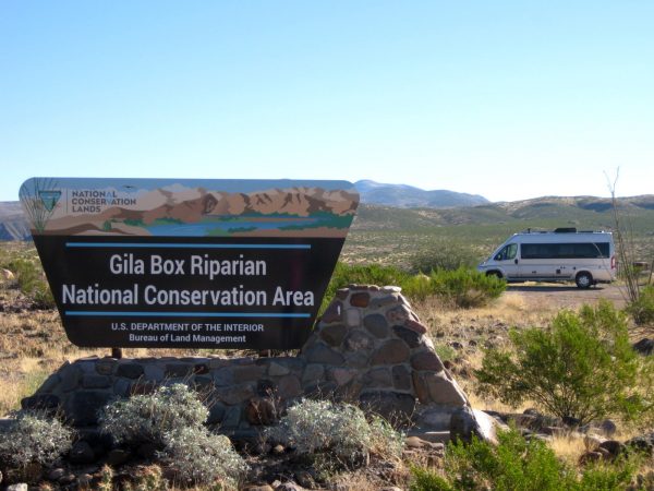
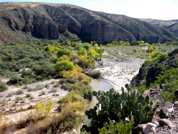
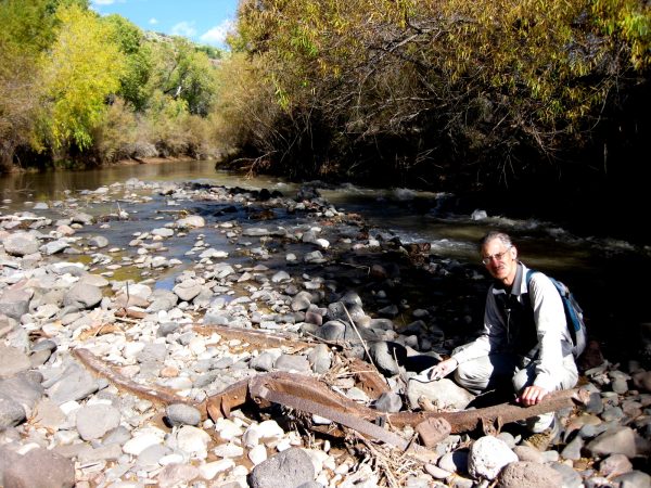
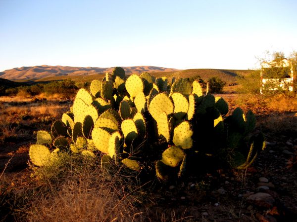
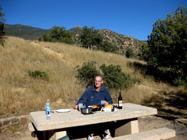
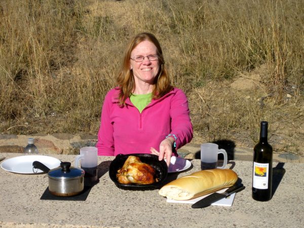
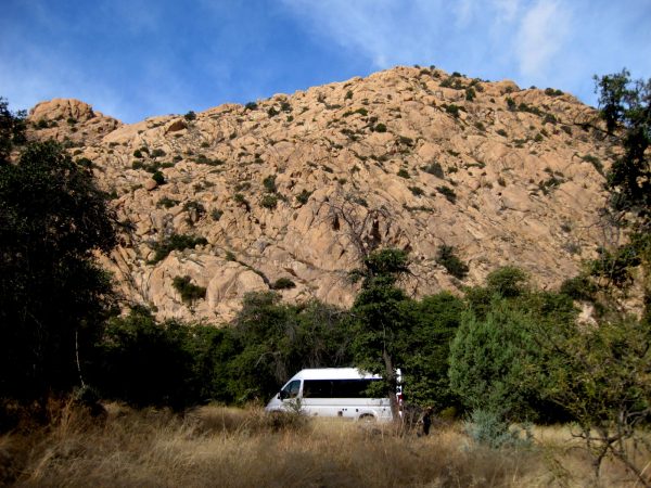
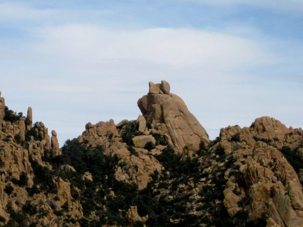
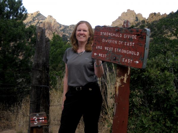
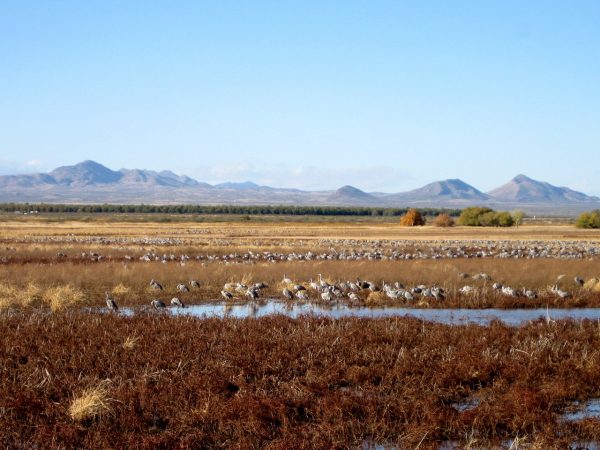
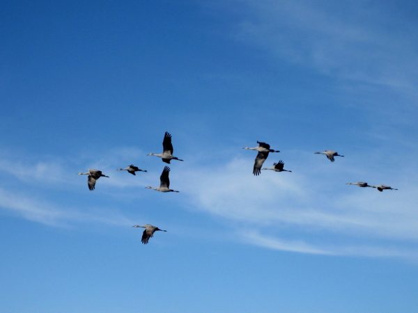
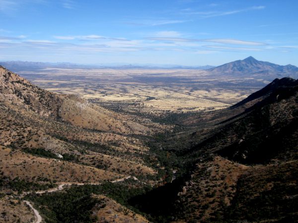
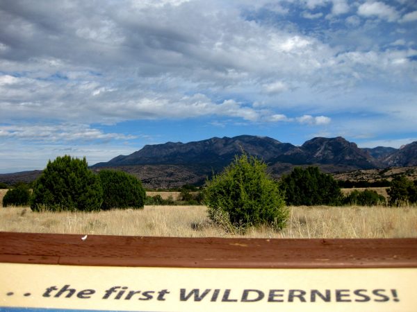
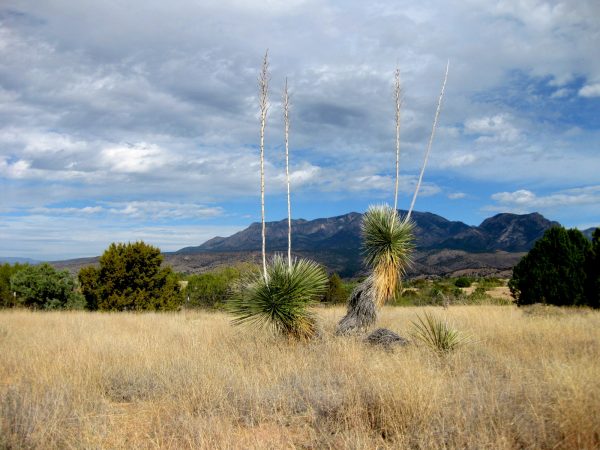
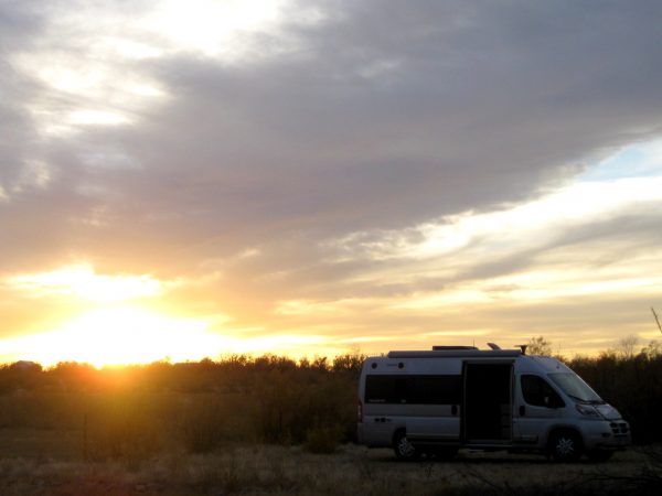
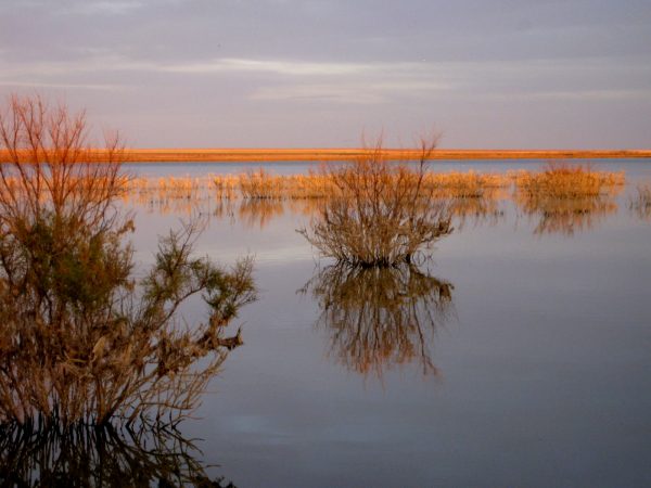
South Eastern Arizona in the San Simon Valley – we dispersed on BM land near the town of Safford. We did not get a storm but enjoyed the clouds playing with the sun.Gila Box was a very beautiful area! We stayed at a BLM managed campground which was excellent.View of the Gila river walking back to our camp site.We found the skeleton of an old Model T buried in the pebbles – Don’t you wonder what was the story behind how it got here?Sunset on another beautiful day.Our Thanksgiving Feast at Stockton Pass, south of Safford in the Penaleno Mountains. Pass is named after Stockton Clanton, father of the brothers known in Tombstone.It is roasted chicken but we have turkey gravy, fresh bread, and nice Colorado wine.Cochise Stronghold – our favorite dispersed campsite in the Dragoon Mountains of Coronado National Forest.Is Batman overlooking the grave of Cochise? That is one of the mysteries of this mountain range. Here is the link to photos from last year’s hike and camp http://tealsky.com/wp-admin/post.php?post=1691&action=editWe hiked again to the Stronghold Divide – much better weather than last year!Whitewater Draw Wildlife Area had a lot of cranes already here for the winter. This was amazing to see and hear so many of them.The cranes fly in to spend the night after feeding in the fields all day. They leave pre-dawn so we did not see any the next morning – we were too lazy to get out in the cold before our coffee.View of Mexico from Coronado National Monument – this was a challenging 3 mile drive to the top of the pass but great views. We spent a few nights near Sierra Vista in Miller Canyon and then Gardener Canyon.
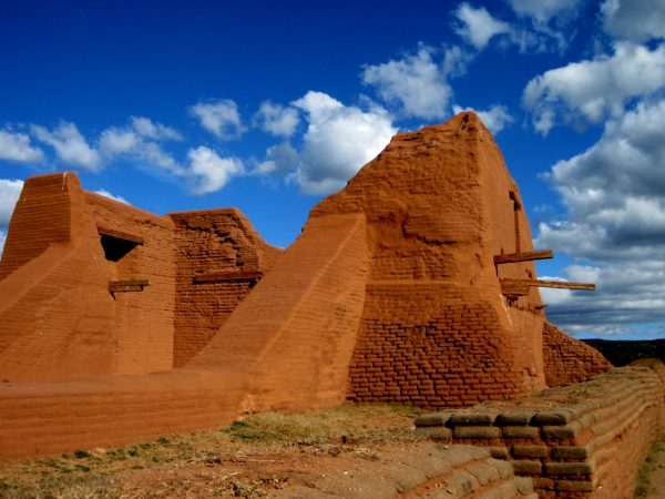
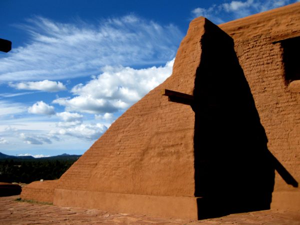
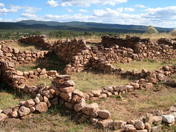
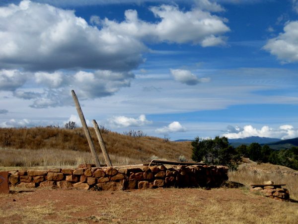
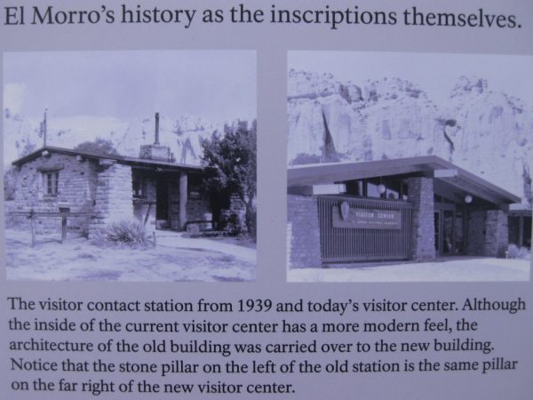
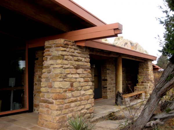
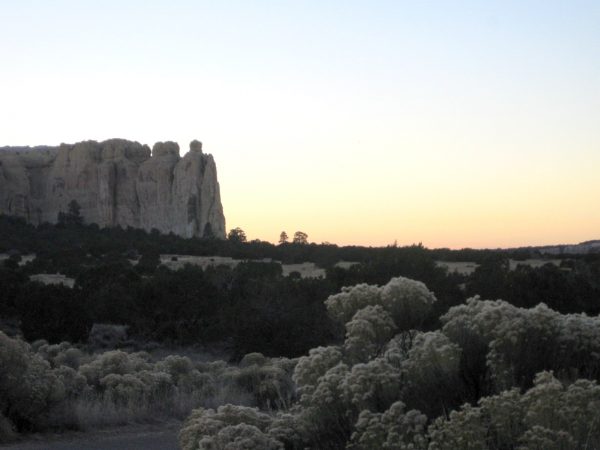
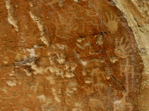
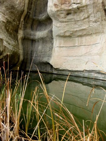
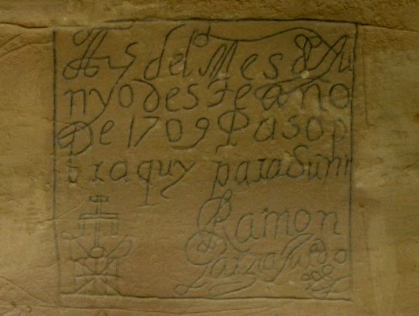
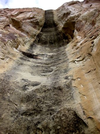
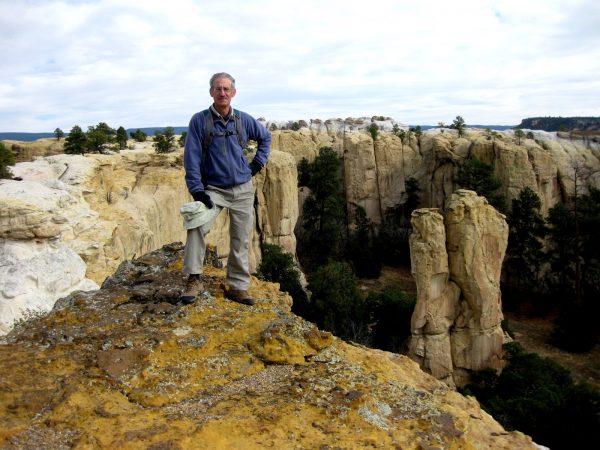
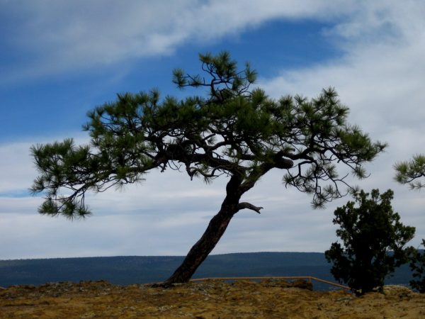
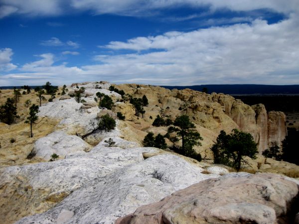
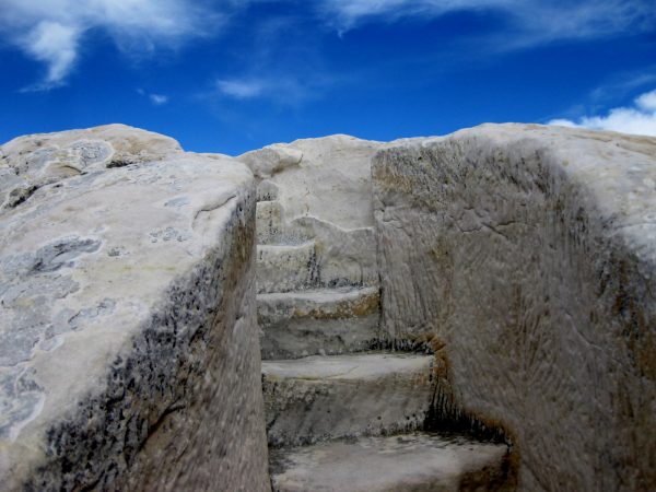
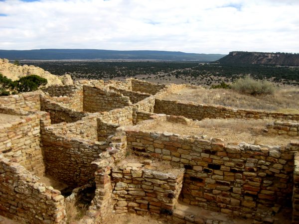
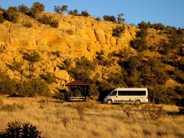
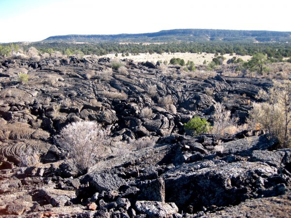
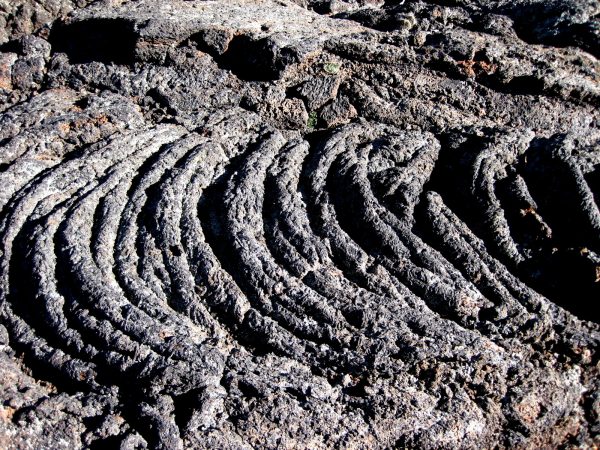
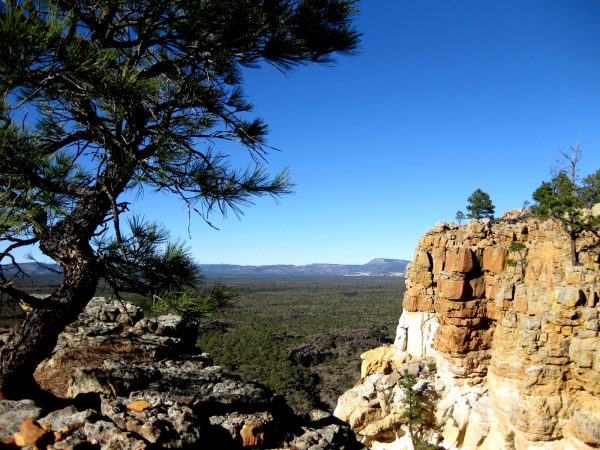
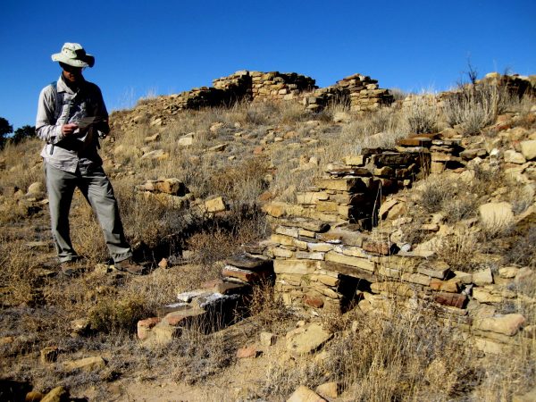
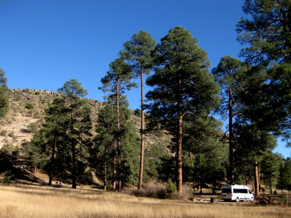
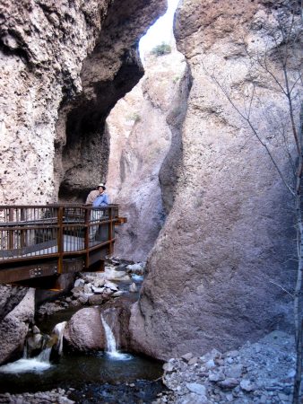
Pecos National Monument added to our knowledge of ancient cultures – especially with their fabulous pottery display.A gorgeous day to experience the plateau and structures.So many layers of historyFacsinating kivas. We also toured the civil war site as part of the monument and noted how the scenery was not exactly the same as today with all the farms having cleared the land.We appreciated the re-purposing of the existing building.A close up photo of the original building.El Morro means the headland and this is the landmark travelers aimed towards in their desert crossings.It became a place to leave your mark – to tell part of your story.Most were very anxious to reach this water supply – we enjoyed the reflection and serenity.Settlers, conquistadors, friars – so many passed this way and had remarkable stories to tell.We thought this looked like a bottle of wine!We walked to the top of the rock – this overlooks a box canyon with amazing goelogy.It was windy but we appreciated the sculpting effects like this amazing character pine.Contemplating all that have enjoyed this scene.CCC workers carved these stairs into the rock. We thought we had been transported to Greek Isles.Ruins on the top that have been stabilized and preserved.Near by El Malpais we found this great BLM campground which we stayed for a few nights.The lava flows are what makes it the badlands!Imagine walking over miles of this uneven surface.We took the Rims Narrow Trail to the arch overlook – gorgeous vistas for the entire walk.We are thinking bear print – we saw several of these but no bear. Lots of animal tracks.On the south side of the park are these unmarked ruins.We camped at Apache Creek, Gila National Forest – we had this entire campground to ourselves. In the morning we saw 4 javalinas walking up the hill.We stopped at Catwalk for this hike into the canyon. It was originally water lines to a mine. The CCC turned that into a walkway and it has been maintained ever since. Part up the canyon is still closed due to a fire/flash flood.What better spot to have lunch? Gila Wilderness.Thank you Aldo Leopold for loving this area so much, that you spent your life working to preserve areas as wilderness for all those that came after you. We really appreciate it and have so enjoyed this opportunity to explore so many wilderness areas as well as other public lands.
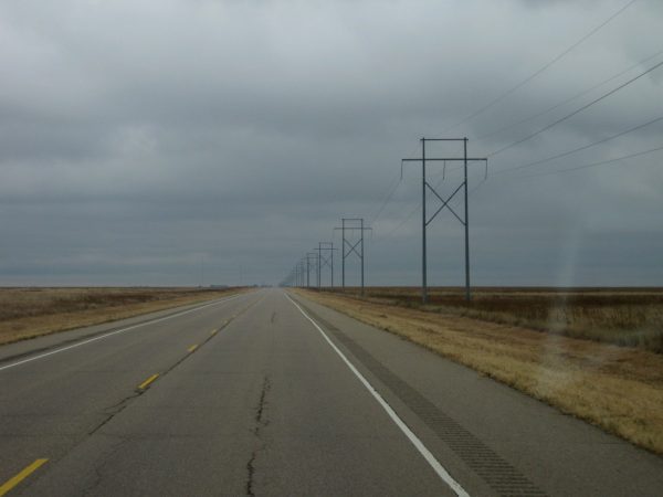
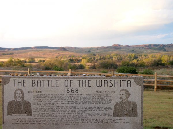
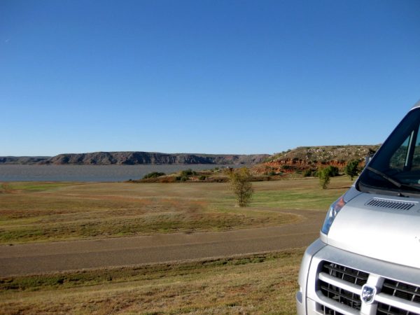
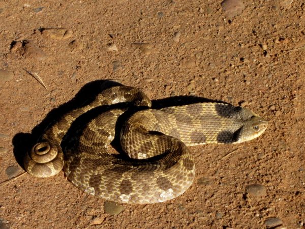
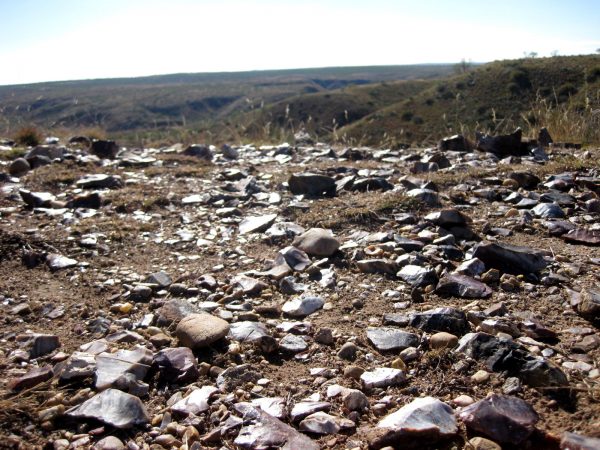
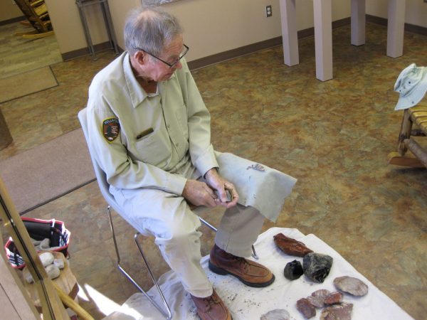
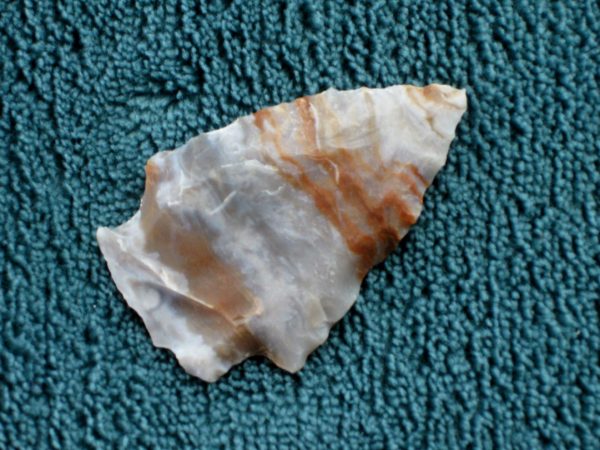
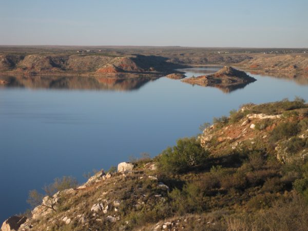
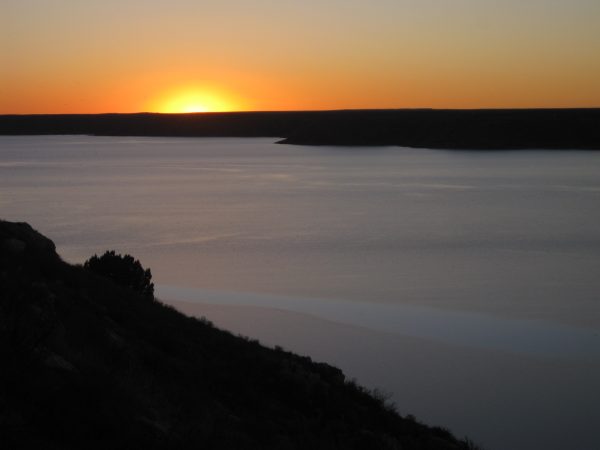
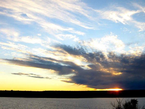
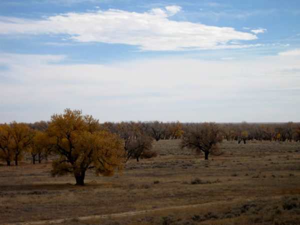
On the road again in the flat lands!Peace Chief Black Kettle survived Sand Creek Massacre but did not survive this massacre. We spent the night nearby in the Black Kettle Grasslands.Imagine those that escaped by hiding in these grasses. We enjoyed seeing it at sunset.Lake Meredith National Recreation Area in Texas was our next stop – we spent our first night here as it was quite windy.This bull snake was enjoying some sunshine. We had not seen them flatten their heads like this.At the Alibates Flint Quarry National Monument, we took a guided hike up to see these ancient quarries of the beautiful stones.At the visitor center, we watched Ed Dey, flint knapper, shape one of these stones into a small masterpiece. He also regaled us with some stories.This was the beautiful arrowhead he created that we were given as a souvenir. Nice! We really appreciated it.Our second night we spent higher on the bluffs – as you can see there was no wind!And enjoyed this gorgeous sunset – they are all nice but we like the lake view as well.Heading into New Mexico with a bit more wind at our back.A night at Ute Lake State Park in New Mexico as we head towards Santa Fe for the weekend.
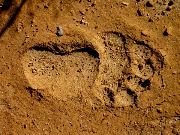
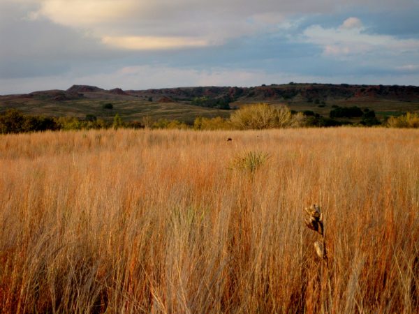
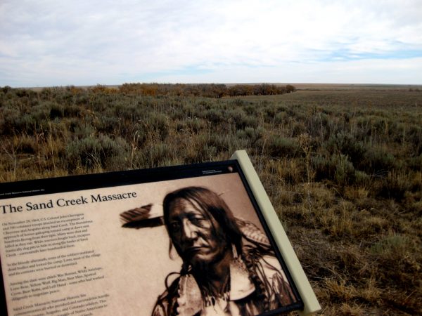
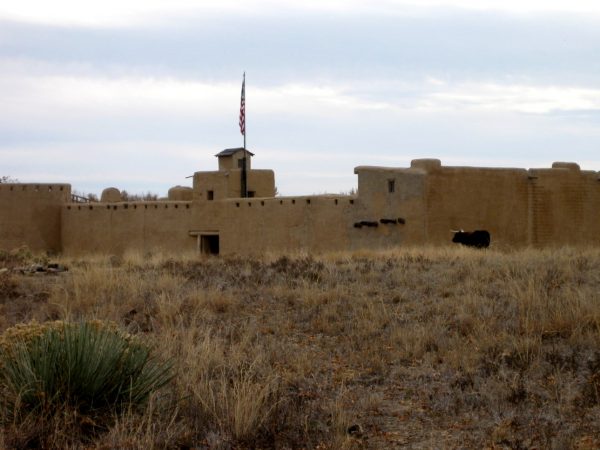
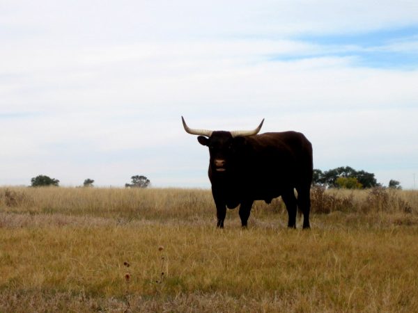
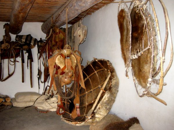
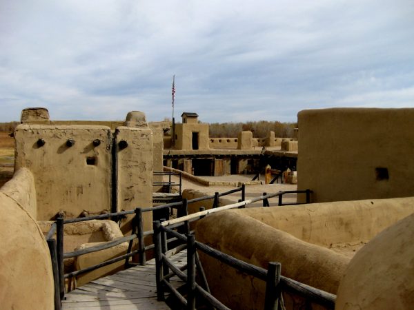
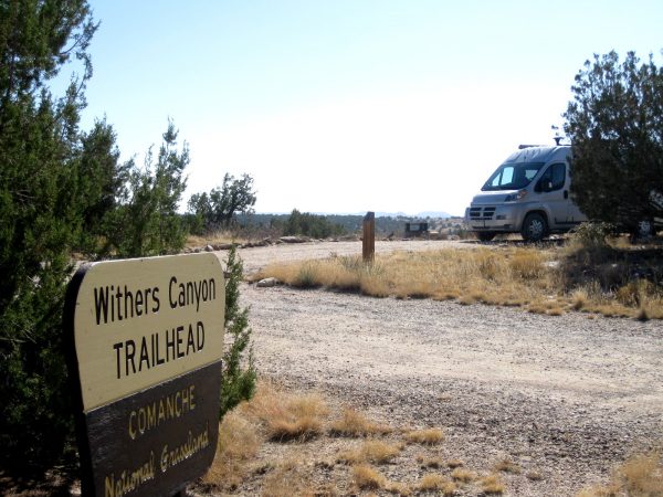
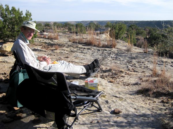
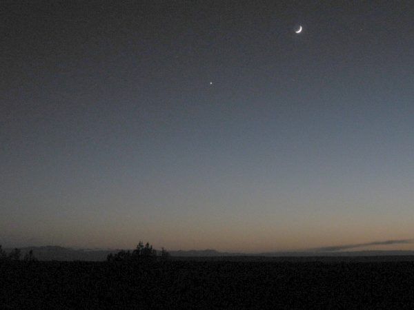
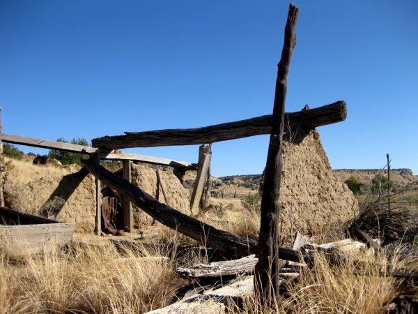
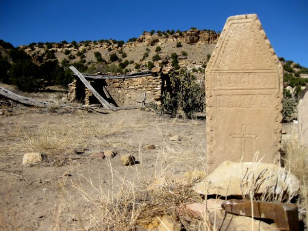
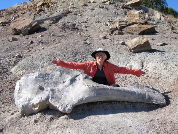
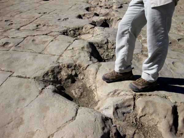
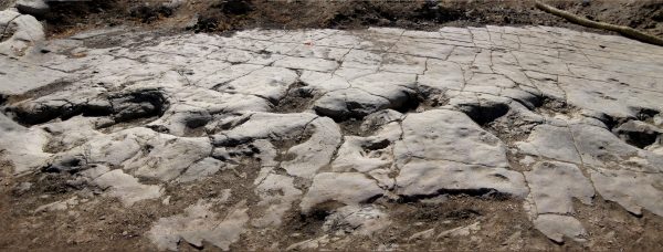
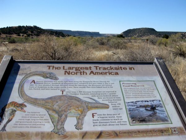
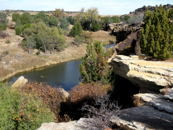
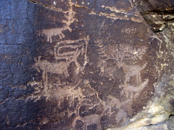
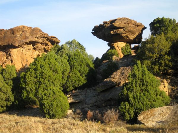
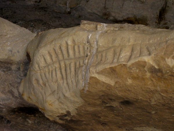
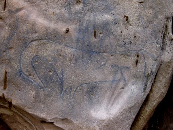
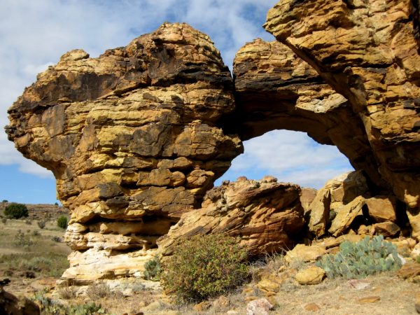
A National Historic Site, we had a ranger overview talk before our walk to the overlook of the massacre site.It is the last day of October – the massacre was the end of November – it surely wasn’t 87 degrees that day!We parked at Nee Noshee SWA for the late afternoon and evening, South of Eads, CO.This is the beautiful wildlife area – we saw a few ducks, raptors, and coots.Bent’s Old Fort NHS with a resident steer greeting us.Beautiful animal. I guess he gets to pull the wagon occasionally.This was a big fur trading area – mostly buffalo skins but here is a river boat made out of one as well as some beaver pelts.A nice piece of history that is recreated here on the Arkansas River.We headed South to Comanche National Grasslands for a few nightsPanoramic views to enjoy on our ‘back patio”. We are surprised at all the canyons in the grasslands.Peaceful sunset with Moon and planets. The Milky Way was awesome!Picket Wire Canyonlands hike first had this dust bowl ruin.On old chapel ruin and cemetery of another settlement.But dinosaurs are why we have chosen this trail – this is a thigh bone a tad larger than mine!And footprints a tad larger than ours!This is a panorama of Theropod dinosaur tracks. Well worth a 12 mile RT hike.Largest Tracksite in North AmericaWe stopped for lunch at Carrizo canyon.And did a short hike to these amazing petroglyphs of elk.We camped at Vogel canyon and enjoyed sunset on Balance Rock.This was the view from the Travato!We hiked to some more petroglyphs. This is a calendar that marks the solstice.And some amazing drawings. We were disturbed by recent graffiti and had many discussions of why someone would deface these treasures.We enjoyed our picnic lunch by this arch as we were in no hurry to get back to camp.